Alston Moor
| Alston Moor | |
|---|---|
 Alston | |
 Alston Moor Alston Moor shown within Cumbria | |
| Population | 2,088 (2011) |
| OS grid reference | NY7146 |
| Civil parish |
|
| District | |
| Shire county | |
| Region | |
| Country | England |
| Sovereign state | United Kingdom |
| Post town | ALSTON |
| Postcode district | CA9 |
| Dialling code | 01434 |
| Police | Cumbria |
| Fire | Cumbria |
| Ambulance | North West |
| EU Parliament | North West England |
| UK Parliament | |
| Alston with Garrigill | |
|---|---|
| History | |
| • Created | 1894 |
| • Abolished | 1974 |
| • Succeeded by | District of Eden |
| Status | Rural district |
| • HQ | Alston Town Hall |
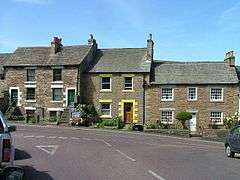
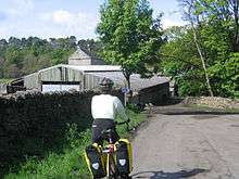
Alston Moor is a civil parish, also electoral ward in Cumbria, England, based around the small town of Alston. It is set in the moorlands of the North Pennines, mostly at an altitude of over 1000 feet. The parish/ward had a population of 2,088 at the 2011 census.[1] As well as the town of Alston, the parish includes the villages of Garrigill and Nenthead, along with the hamlets of Nenthall, Nentsberry, Galligill, Blagill, Ashgill, Leadgate, Bayles and Raise. Alston Moor is part of the North Pennines Area of Outstanding Natural Beauty (AONB), the second largest of the 40 AONBs in England and Wales.
Under the Local Government Act 1894, the parish, then known as Alston with Garrigill, which had previously been a rural sanitary district on its own, became one of the few single-parish rural districts. This remained in existence until 1974 when it became part of the Eden district. The parish is divided into the wards of Alston (which includes Leadgate), Garrgill and Nenthead.
The area is drained by the River South Tyne whose source is located in the fells above Garrigill and also by the Rivers Nent and Black Burn which, along with many other smaller streams, flow into the Tyne. The Rivers Tees and Wear also have their sources on the borders of the parish.
History
The manor of Alston or Alston Moor changed hands several times until the 17th century when it passed to the Radcliffe family who held the title Earl of Derwentwater, but after their part in the failed 1715 Jacobite rising their lands were confiscated by the Government, who assigned it to the Admiralty to support the Royal Hospital for Seamen at Greenwich in London.
Greenwich Hospital remained the principal landowner in the parish and owner of the extensive mineral rights up until the 1960s. The estate was then transferred to the Trustees for Catholic Purposes who a few years ago sold their remaining properties in Alston Moor.
The poet W. H. Auden was to travel a great deal in Britain and abroad, but it is the wild region between the River Tees and Hadrian's Wall which provides the backdrop to many of his poems and plays of the ‘20s and '30s, and echoes at intervals throughout his life. In America in 1947, an Ordnance Survey map of Alston Moor hung on the wall of Auden's chaotic shack on Fire Island.
According to his brother John, Auden came to love Alston Moor more than any other place. The poem entitled 'Alston Moor' dates from 1924, as does 'Allendale'.
Close to the River South Tyne, 2 miles north of Alston, lies Randalholme Hall, a 17th-century house incorporating a fourteenth-century pele tower.[2]
Mineral wealth
Alston Moor had some of the largest deposits of lead and zinc ores in Britain. Lead was probably mined in Roman times. The Romans built a fort at Whitley Castle, and pieces of lead ore and slag have been found there, though no other traces of their work remain. There are various references to the mines of the area between the 12th & 16th centuries. Most emphasise the value of the silver, which makes up a small (<1%) proportion of the lead ore. This made the mines of interest to the Crown, who charged rents on the silver production. When Sir Edward Radcliffe, Earl of Derwentwater bought the estate in 1629 for £2,500, the mines were believed to be virtually exhausted.
From the 18thC. Greenwich Hospital leased the rights to mine for lead and other minerals to a number of companies. The most significant of these was the London Lead Company, but other smaller companies and partnerships also took on leases, with varying degrees of success. The London Lead Company's work led to Alston Moor becoming one of the main lead producing areas in the country by the mid-19th C, especially around Nenthead. The population of the area rose to a peak of around 5,000 in this period. By the 1860s, cheaper imports were making the local lead industry unprofitable, and by 1896 the leases had passed to the Vieille Montagne company, who worked the mines for zinc, which had earlier been of little commercial value.[3]
The 20th C. saw a gradual decline in mining and the prosperity it had brought to the area. Little remained of the industry after World War II. Today the remains of the smelt mill at Nenthead Mines can be seen. A few of the old mines are accessible but must only be explored with expert guidance. The traces of hundreds of other small mines, shafts and spoil heaps are merging into the landscape.
Golf
Alston Moor is home to England's highest golf course. The Golf Club was founded in 1905 and has occupied numerous sites over the years. The first course was at Black House Farm, but the course is now located on the Hermitage Farm site. The official opening was on Easter Monday 1906, although there is evidence that a club was in existence for quite some time before this date.[4]
See also
References
- ↑ Alston Moor at ONS Neighbourhood Statistics
- ↑ Randalholme Hall at British Listed Buildings Online
- ↑ Fairbairn, Ray (2008). The Mines of Alston Moor – 2nd Ed. pp. 11–13. ISBN 978-0-9560522-0-9.
- ↑ "Archived copy". Archived from the original on 2010-12-28. Retrieved 2012-04-03.
Related websites
External links

Cumbria Portal | |
| Boroughs or districts | |
| Major settlements |
|
| Topics | |