Rockcliffe, Cumbria
| Rockcliffe | |
|---|---|
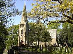 St. Mary's Church, Rockcliffe | |
 Rockcliffe Rockcliffe shown within Cumbria | |
| Population | 779 (2011)[1] |
| OS grid reference | NY3709160293 |
| Civil parish |
|
| District | |
| Shire county | |
| Region | |
| Country | England |
| Sovereign state | United Kingdom |
| Post town | CARLISLE |
| Postcode district | CA6 |
| Dialling code | 01228 |
| Police | Cumbria |
| Fire | Cumbria |
| Ambulance | North West |
| EU Parliament | North West England |
| UK Parliament | |
Rockcliffe is a village and civil parish in the City of Carlisle district of Cumbria, England.[2] Part of the parish is a marshy peninsula between the mouths of the rivers Esk and Eden. The parish includes the settlements of Rockcliffe, Rockcliffe Cross, Floristonrigg, Todhills, Low Harker and Harker.
Rockcliffe formerly had a railway station, on the Caledonian Railway Main Line, that closed in 1965. Another station was located nearby at Floriston that closed in 1950.
Place-name meaning
Rockcliffe does not mean 'cliff by rocks' or 'rocky cliff' as many might think. The name means 'red cliff', implying a sandstone cliff-face. The name is from Old Norse rauðr meaning "red" and Old English clif for "cliff", similar to Radcliffe in Greater Manchester.
Governance
Rockcliffe is the largest parish in the electoral ward of Longtown & Rockcliffe. The ward covers the two parishes and the area in between. The total ward population at the 2011 Census was 4,123.[3]

See also
References
- ↑ "Parish population 2011". Retrieved 24 June 2015.
- ↑ Philip's Motorist's Atlas: 2004, Octopus Publishing Group, London, England
- ↑ "Longtown & Rockcliffe ward population 2011". Retrieved 24 June 2015.
External links
| Wikimedia Commons has media related to Rockcliffe, Cumbria. |
- Map sources for Rockcliffe, Cumbria