Bewaldeth and Snittlegarth
| Bewaldeth and Snittlegarth | |
|---|---|
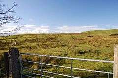 The site of Caer Mote Roman Fort | |
 Bewaldeth and Snittlegarth Bewaldeth and Snittlegarth shown within Cumbria | |
| OS grid reference | NY210348 |
| Civil parish |
|
| District | |
| Shire county | |
| Region | |
| Country | England |
| Sovereign state | United Kingdom |
| Post town | COCKERMOUTH |
| Postcode district | CA13 |
| Dialling code | 017687 |
| Police | Cumbria |
| Fire | Cumbria |
| Ambulance | North West |
| EU Parliament | North West England |
| UK Parliament | |
Bewaldeth and Snittlegarth is a civil parish in the Allerdale district [1] of Cumbria, England, on the edge of the Lake District. According to the 2001 census it had a population of 40 [2] who live in 1,534 acres (621 ha).[3] At the 2011 Census it was measured that the population was still less than 100. Details are maintained in the parish of Ireby and Uldale. It contains Bewaldeth at 54°42′06″N 3°13′30″W / 54.701572°N 3.225093°W, High Bewaldeth at 54°41′47″N 3°12′17″W / 54.696385°N 3.204759°W and Snittlegarth at 54°43′46″N 3°12′49″W / 54.729549°N 3.213514°W.
According to Bulmer's History & Directory Of Cumberland (1901), "Snittlegarth ... is supposed to have been formerly a village of considerable magnitude. The word "Snittlegarth" is thought to signify an enclosure."[4]
See also
References
External links
| Wikimedia Commons has media related to Bewaldeth and Snittlegarth. |