Whitwell and Selside
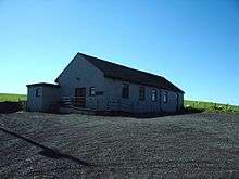
Selside Memorial Hall
Whitwell and Selside is a civil parish in South Lakeland, Cumbria, England. It does not have a parish council but a parish meeting.[1] The neighbouring parishes are Whinfell to the east, Skelsmergh and Strickland Roger to the south west, Kentmere and Longsleddale to the west and Shap Rural in Eden District to the north. The main settlement is the village of Selside.[2]
In the 2011 census it had a population of 296.[3]
There are 14 listed buildings or structures in the parish, including the grade II*, 14th-century, Selside Hall.[4][5]
See also
References
- ↑ "Whitwell & Selside Parish Meeting". South Lakeland District Council. Retrieved 6 March 2016.
- ↑ "Information on: Whitwell and Selside (Parish)". Neighbourhood Statistics. Office for National Statistics. Retrieved 6 March 2016.
- ↑ "Whitwell and Selside (Parish): key statistics". Neighbourhood Statistics. Office of National Statistics. Retrieved 6 March 2016.
- ↑ "Advanced search". National Heritage List for England. Historic England. Retrieved 6 March 2016. Enter parish name to search
- ↑ Historic England. "Selside Hall and attached outbuilding (1311671)". National Heritage List for England. Retrieved 6 March 2016.
Further reading
- Farrer, William; Curwen, John F (1924). "Selside and Whitwell". Records Relating To the Barony of Kendale: Volume 1. pp. 239–250.
External links
- "Whitwell and Selside Ch/CP/Tn". Vision of Britain.
- Selside: historical and genealogical information at GENUKI
Coordinates: 54°23′N 2°43′W / 54.38°N 2.72°W
Cumbria Portal | |
| Boroughs or districts | |
| Major settlements |
|
| Topics | |
This article is issued from
Wikipedia.
The text is licensed under Creative Commons - Attribution - Sharealike.
Additional terms may apply for the media files.