Lakes, Cumbria
| Lakes | |
|---|---|
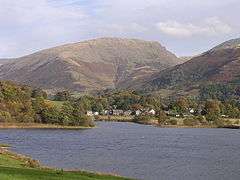 Grasmere | |
 Lakes Lakes shown within Cumbria | |
| Population | 4,420 (2011) |
| OS grid reference | NY3704 |
| Civil parish |
|
| District | |
| Shire county | |
| Region | |
| Country | England |
| Sovereign state | United Kingdom |
| Post town | AMBLESIDE |
| Postcode district | LA22 |
| Post town | WINDERMERE |
| Postcode district | LA23 |
| Dialling code | 01539 |
| Police | Cumbria |
| Fire | Cumbria |
| Ambulance | North West |
| EU Parliament | North West England |
| UK Parliament | |
Lakes is a large civil parish in the South Lakeland district of Cumbria, England, with a population of 5,127 according to the 2001 census,decreasing to 4,420 at the 2011 Census.[1] It covers the small town of Ambleside, and the villages and hamlets of Clappersgate, Rydal, Grasmere, Troutbeck, Chapel Stile, Elterwater, Little Langdale and Waterhead.
Lakes CP incorporates within its boundaries the wards of Ambleside, the Langdales, Rydal & Loughrigg, Grasmere and Troutbeck.[2]
The parish was formed in 1934 as an urban district, despite being largely rural, under a County Review Order, by a merger of Ambleside and Grasmere urban districts and parts of Windermere Urban District, South Westmorland Rural District and West Ward Rural District.[3]
The A591 road, a primary route, passes through the centre of the CP, it enters the parish from the South at the point where it crosses Trout Beck at Troutbeck Bridge village. After covering 16 km (10 mi) in road distance,(13.4km (8.5mi) as the crow flies) it leaves the parish at Dunmail Raise. The A592 road passes through the eastern area of the parish. The col of the Kirkstone Pass, at a point approximately 200 m north of the Kirkstone Inn, marks the northern boundary of Lakes CP.[4]
It is the area covered by the Kelsick Foundation,[5] an organisation that helps locals with the costs of extra-curricular activities for children.
The urban district had an area of 49,917 acres (202.01 km2).[6] or 202 km².
The urban district was abolished in 1974, with the Patterdale ward becoming a civil parish in the Eden district, and the rest becoming a civil parish in South Lakeland.[7]
See also
References
- ↑ "Parish population 2011". Retrieved 9 June 2015.
- ↑ http://www.amblesideonline.co.uk/parish-council/
- ↑ Lakes Urban District at Vision of Britain Archived 2007-10-01 at the Wayback Machine.. Accessed February 1, 2006.
- ↑ http://streetmap.co.uk/map.srf?x=337733&y=504125&z=120&sv=ambleside&st=3&tl=Map+of+Ambleside,+Cumbria+[Town]&searchp=ids.srf&mapp=map.srf
- ↑ http://www.kelsick.org.uk/
- ↑ Lakes Westmorland through time | Population Statistics | Area (acres)
- ↑ HMSO. S.I. 1972/2039
Cumbria Portal | |
| Boroughs or districts | |
| Major settlements |
|
| Topics | |