Dearham
| Dearham | |
|---|---|
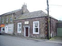 Dearham Village Hall | |
 Dearham Dearham shown within Cumbria | |
| Population | 2,151 (2011) |
| OS grid reference | NY075365 |
| Civil parish |
|
| District | |
| Shire county | |
| Region | |
| Country | England |
| Sovereign state | United Kingdom |
| Post town | Maryport |
| Postcode district | CA15 |
| Dialling code | 01900 |
| Police | Cumbria |
| Fire | Cumbria |
| Ambulance | North West |
| EU Parliament | North West England |
| UK Parliament | |
Dearham is a village and civil parish in the Allerdale district of Cumbria, England. Historically part of Cumberland, it lies about 2 miles (3.2 km) east of Maryport and 4 1⁄2 miles (7.2 km) west of Cockermouth. According to the 2001 census[1] it had a population of 2,028, increasing to 2,151 at the 2011 Census.[2] It is a large, strung-out village. The village has a small primary school with approximately 253 children on roll and a nursery with approximately 26 children on roll.[3]
The majority of young people in Dearham attend Netherhall School, Maryport or Cockermouth School for their secondary schooling.
Etymology
'Dearham' is "an Old Anglian compound of 'dēor' and 'hām'.[4] Old Anglian is Old English. 'Dēor' means 'deer', 'hām' is 'homestead' or 'village' or 'estate'.
History
Dearham is in the Workington division of the county, ward of Allerdale-below-Derwent, Derwent petty sessional division, Cockermouth union, county court district of Cockermouth and Workington, rural deanery of Maryport and archdeaconry and Diocese of Carlisle.
The church of St. Mungo, erected in the early 12th century, is a building of stone, with 13th-century chancel, nave, south porch and a 14th-century Pele tower. During restoration work carried out on the church in 1882, two stones were discovered: The first is the 4-foot-high (1.2 m) Adam Stone, which depicts the fall and redemption of man and dates from 900 AD; the second is the Kenneth Cross, which depicts the legend of the 6th-century hermit, St. Kenneth/Cenydd. (Photos of St. Mungo's church are available online).[5]
The village belongs to Cumberland's former coal mining industry.
See also
References
- ↑ 2001 census Archived 2008-09-25 at the Wayback Machine.
- ↑ "Civil Parish population 2011". Retrieved 26 January 2016.
- ↑ Dearham Primary School
- ↑ Armstrong, A. M.; Mawer, A.; Stenton, F. M.; Dickens, B. (1950). The place-names of Cumberland. English Place-Name Society, vol.xxi. Part 2. Cambridge: Cambridge University Press. p. 283.
- ↑ http://www.geog.port.ac.uk/webmap/thelakes/html/lgaz/lk11022.htm
External links
| Wikimedia Commons has media related to Dearham. |
- Cumbria County History Trust: Dearham (nb: provisional research only - see Talk page)
- GENUKI(tm) page