Langiden, Abra
| Langiden | |
|---|---|
| Municipality | |
| Municipality of Langiden | |
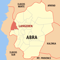 Map of Abra with Langiden highlighted | |
.svg.png) Langiden Location within the Philippines | |
| Coordinates: 17°35′N 120°34′E / 17.58°N 120.56°ECoordinates: 17°35′N 120°34′E / 17.58°N 120.56°E | |
| Country |
|
| Region | Cordillera Administrative Region (CAR) |
| Province | Abra |
| District | Lone District |
| Barangays | 6 (see Barangays) |
| Government [1] | |
| • Type | Sangguniang Bayan |
| • Mayor | Noel P. Castillo |
| • Electorate | 2,736 voters (2016) |
| Area [2] | |
| • Total | 116.29 km2 (44.90 sq mi) |
| Population (2015 census)[3] | |
| • Total | 3,198 |
| • Density | 28/km2 (71/sq mi) |
| Time zone | UTC+8 (PST) |
| ZIP code | 2807 |
| PSGC | 140112000 |
| IDD : area code | +63 (0)74 |
| Climate type | Tropical rainforest climate |
| Income class | 5th municipal income class |
| Revenue (₱) | 51,724,023.91 (2016) |
| Native languages |
Itneg language Ilocano Tagalog |
Langiden, officially the Municipality of Langiden, (Ilokano: Ili ti Langiden; Tagalog: Bayan ng Langiden), is a 5th class municipality in the province of Abra, Philippines. According to the 2015 census, it has a population of 3,198 people.[3]
Geography
Langiden is located at 17°35′N 120°34′E / 17.58°N 120.56°E.
According to the Philippine Statistics Authority, the municipality has a land area of 116.29 square kilometres (44.90 sq mi) [2] constituting 2.79% of the 4,165.25-square-kilometre- (1,608.21 sq mi) total area of Abra.
Barangays
Langiden is politically subdivided into 6 barangays.[4]
| PSGC | Barangay | Population | ±% p.a. | |||
|---|---|---|---|---|---|---|
| 2015[3] | 2010[5] | |||||
| 140112001 | Baac | 11.1% | 354 | 360 | −0.32% | |
| 140112004 | Dalayap (Nalaas) | 14.3% | 457 | 470 | −0.53% | |
| 140112005 | Mabungtot | 14.6% | 467 | 500 | −1.29% | |
| 140112006 | Malapaao | 22.6% | 723 | 707 | 0.43% | |
| 140112007 | Poblacion | 12.9% | 414 | 379 | 1.70% | |
| 140112008 | Quillat | 24.5% | 783 | 754 | 0.72% | |
| Total | 3,198 | 3,170 | 0.17% | |||
Demographics
| Population census of Langiden | ||
|---|---|---|
| Year | Pop. | ±% p.a. |
| 1918 | 1,598 | — |
| 1939 | 1,634 | +0.11% |
| 1948 | 1,297 | −2.53% |
| 1960 | 1,743 | +2.49% |
| 1970 | 2,558 | +3.91% |
| 1975 | 2,194 | −3.03% |
| 1980 | 2,256 | +0.56% |
| 1990 | 2,452 | +0.84% |
| 1995 | 2,729 | +2.03% |
| 2000 | 2,998 | +2.04% |
| 2007 | 3,242 | +1.09% |
| 2010 | 3,170 | −0.81% |
| 2015 | 3,198 | +0.17% |
| Source: Philippine Statistics Authority[3][5][6][7] | ||
In the 2015 census, Langiden had a population of 3,198.[3] The population density was 28 inhabitants per square kilometre (73/sq mi).
References
- ↑ "Municipality". Quezon City, Philippines: Department of the Interior and Local Government. Retrieved 31 May 2013.
- 1 2 "Province: Abra". PSGC Interactive. Quezon City, Philippines: Philippine Statistics Authority. Retrieved 12 November 2016.
- 1 2 3 4 5 Census of Population (2015). "Cordillera Administrative Region (CAR)". Total Population by Province, City, Municipality and Barangay. PSA. Retrieved 20 June 2016.
- ↑ "Municipal: Langiden, Abra". PSGC Interactive. Quezon City, Philippines: Philippine Statistics Authority. Retrieved 8 January 2016.
- 1 2 Census of Population and Housing (2010). "Cordillera Administrative Region (CAR)". Total Population by Province, City, Municipality and Barangay. NSO. Retrieved 29 June 2016.
- ↑ Censuses of Population (1903–2007). "Cordillera Administrative Region (CAR)". Table 1. Population Enumerated in Various Censuses by Province/Highly Urbanized City: 1903 to 2007. NSO.
- ↑ "Province of Abra". Municipality Population Data. Local Water Utilities Administration Research Division. Retrieved 17 December 2016.
External links
| Wikimedia Commons has media related to Langiden, Abra. |
Places adjacent to Langiden, Abra | |
|---|---|
Bangued (capital) | |
| Municipalities | |
| Barangays | |
This article is issued from
Wikipedia.
The text is licensed under Creative Commons - Attribution - Sharealike.
Additional terms may apply for the media files.