Magsingal
| Magsingal | ||
|---|---|---|
| Municipality | ||
| Municipality of Magsingal | ||
| ||
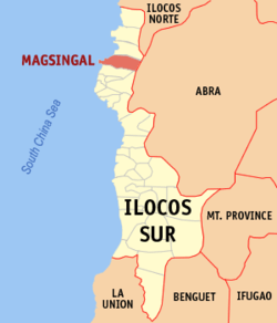 Map of Ilocos Sur with Magsingal highlighted | ||
.svg.png) Magsingal Location within the Philippines | ||
| Coordinates: 17°41′00″N 120°25′30″E / 17.6833°N 120.425°ECoordinates: 17°41′00″N 120°25′30″E / 17.6833°N 120.425°E | ||
| Country |
| |
| Region | Ilocos Region (Region I) | |
| Province | Ilocos Sur | |
| District | 1st District | |
| Barangays | 30 (see Barangays) | |
| Government [1] | ||
| • Type | Sangguniang Bayan | |
| • Mayor | Alrico Apostol Favis | |
| • Electorate | 16,993 voters (2016) | |
| Area [2] | ||
| • Total | 84.98 km2 (32.81 sq mi) | |
| Population (2015 census)[3] | ||
| • Total | 30,792 | |
| • Density | 360/km2 (940/sq mi) | |
| Time zone | UTC+8 (PST) | |
| ZIP code | 2730 | |
| PSGC | 012912000 | |
| IDD : area code | +63 (0)77 | |
| Climate type | Tropical monsoon climate | |
| Income class | 3rd municipal income class | |
| Revenue (₱) | 277,620,750.13 (2016) | |
| Native languages |
Ilocano Tagalog | |
| Website |
www | |

Magsingal, officially the Municipality of Magsingal, is a 3rd class municipality in the province of Ilocos Sur, Philippines. According to the 2015 census, it has a population of 30,792 people.[3]
Magsingal is 419 kilometres (260 mi) from Metro Manila and 14 kilometres (8.7 mi) from Vigan City, the provincial capital.
Barangays
Magsingal is politically subdivided into 30 barangays. [2]
- Alangan
- Bacar
- Barbarit
- Bungro
- Cabaroan
- Cadanglaan
- Caraisan
- Dacutan
- Labut
- Maas-asin
- Macatcatud
- Namalpalan
- Manzante
- Maratudo
- Miramar
- Napo
- Pagsanaan Norte
- Pagsanaan Sur
- Panay Norte
- Panay Sur
- Patong
- Puro (Puro Pinget)
- San Basilio (Poblacion)
- San Clemente (Poblacion)
- San Julian (Poblacion)
- San Lucas (Poblacion)
- San Ramon (Poblacion)
- San Vicente (Poblacion)
- Santa Monica
- Sarsaracat
History
The name of the municipality came from the term "Mayisingal," an Ilocano term which means "to be moved." It was applied when the belltower was moved from a previous location to its current site.
Captain Juan de Salcedo had a hand in founding the municipality. But before he reached the current site of the poblacion, he came to a village called Malongon, about one-half kilometer to the south. The leader of the village refused Salcedo's request to establish a municipality there, but suggested that he establish the town a half kilometer north of the village, and the belltower be moved to that site, hence the origin of the town's name.
Itnegs were the original inhabitants of the place when Salcedo arrived. He worked for the conversion of the people to Christianity, but not all accepted the new faith. Those who refused conversion fled the town and settled east of Bantay Bul-lagaw (Bul-lagaw Mountain).
Demographics
| Population census of Magsingal | ||
|---|---|---|
| Year | Pop. | ±% p.a. |
| 1903 | 7,134 | — |
| 1918 | 10,723 | +2.75% |
| 1939 | 11,193 | +0.20% |
| 1948 | 11,697 | +0.49% |
| 1960 | 13,437 | +1.16% |
| 1970 | 16,117 | +1.83% |
| 1975 | 17,341 | +1.48% |
| 1980 | 19,177 | +2.03% |
| 1990 | 22,271 | +1.51% |
| 1995 | 23,565 | +1.06% |
| 2000 | 25,580 | +1.77% |
| 2007 | 27,615 | +1.06% |
| 2010 | 28,302 | +0.90% |
| 2015 | 30,792 | +1.62% |
| Source: Philippine Statistics Authority[3][4][5][6] | ||
In the 2015 census, the population of Magsingal was 30,792 people,[3] with a density of 360 inhabitants per square kilometre or 930 inhabitants per square mile.
Major Schools in Magsingal
- Saint William's Institute - a privately funded educational institution run by the Sisters of Saint Paul of Chartres
- The Magsingal Institute - a private highschool
- Magsingal National High School- a public highschool
- Manzante National Highschool - a public high school
References
- ↑ "Municipality". Quezon City, Philippines: Department of the Interior and Local Government. Retrieved 31 May 2013.
- 1 2 "Province: Ilocos Sur". PSGC Interactive. Quezon City, Philippines: Philippine Statistics Authority. Retrieved 12 November 2016.
- 1 2 3 4 Census of Population (2015). "Region I (Ilocos Region)". Total Population by Province, City, Municipality and Barangay. PSA. Retrieved 20 June 2016.
- ↑ Census of Population and Housing (2010). "Region I (Ilocos Region)". Total Population by Province, City, Municipality and Barangay. NSO. Retrieved 29 June 2016.
- ↑ Censuses of Population (1903–2007). "Region I (Ilocos Region)". Table 1. Population Enumerated in Various Censuses by Province/Highly Urbanized City: 1903 to 2007. NSO.
- ↑ "Province of Ilocos Sur". Municipality Population Data. Local Water Utilities Administration Research Division. Retrieved 17 December 2016.
External links
- Philippine Standard Geographic Code
- Philippine Census Information
- Local Governance Performance Management System
Places adjacent to Magsingal | ||||||||||
|---|---|---|---|---|---|---|---|---|---|---|
| ||||||||||