Knoll Camp
 | |
 Shown within Hampshire | |
| Alternative name | Damerham Knoll |
|---|---|
| Location | Hampshire |
| Coordinates | 50°57′58″N 1°51′36″W / 50.9660°N 1.8599°WCoordinates: 50°57′58″N 1°51′36″W / 50.9660°N 1.8599°W |
| Area | 4 acres |
| History | |
| Periods | Iron Age |
| Site notes | |
| Public access | Yes |
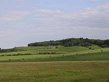
Knoll Camp, or Damerham Knoll, is the site of an Iron Age univallate hill fort located in Hampshire. The fort comprises a circular earthwork containing about four acres. There is a single ditch with inner rampart and traces of counter scarp bank.[1][2] The site is a scheduled ancient monument no.118. Grim's Ditch also runs throughout this area. The footpath/bridleway from the nearby long barrows of Grans Barrow and Knap Barrow runs southeast along the ridge through the centre of the hill fort, leaving through the original SE entrance,[3] and you could easily miss the ditch and bank as you cross it. The interior is thickly wooded and brambled.[4]
There is also a probable Iron Age Cross Ridge close-by, described as Damerham Knoll, 50m west of Knoll Camp and comprises a shallow ditch with fragmentary remains of a bank on the west side. grid reference SU098185[2]
Location
The site is located at grid reference SU099185, to the west of the village of Rockbourne in the county of Hampshire. The hill has a summit of 132m AOD.
References
- ↑ Field Archaeology in Hampshire, 1915, (Williams-Freeman), p.400.
- 1 2 http://www.hants.gov.uk/hampshiretreasures/vol05/page076.html Hampshire Treasures website
- ↑ http://www.megalithic.co.uk/article.php?x=409900&y=118500 The Megalithic Portal
- ↑ http://www.themodernantiquarian.com/site/4159/knoll_camp.html The Modern Antiquarian: Knoll Camp