Ringsbury Camp
 | |
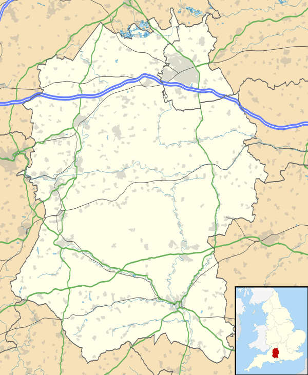 Shown within Wiltshire | |
| Alternative name | The Roman Camp |
|---|---|
| Location | Purton, Wiltshire |
| Region | South West England |
| Coordinates | 51°34′47″N 1°53′36″W / 51.5798°N 1.8932°W |
| Area | 8 acres |
| History | |
| Periods | Iron Age |
| Site notes | |
| Public access | yes, via rights of way |
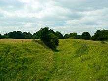
Ringsbury Camp is an Iron Age hill fort, thought to date from approximately the year 50BC. It is located in the civil parish of Purton in Wiltshire.
Structure
Ringsbury is a multivallate fort as it has a double-banked structure. In all about 8 acres (32,000 m2) are enclosed by the surrounding walls. The fort sits at the brow of a hill with excellent views of the surrounding areas, particularly to the south, west and north. There is less of an incline towards the east. It is believed that to ensure visibility was not impeded the builders cleared all areas, but certainly the land towards the west, from trees. The banks are made from limestone rubble 1. These are not local rocks, thus suggesting building material was transported to the camp from further afield. The stones from the banks are very light, and are known as 'blood stones'. A reason for the lightness of the rocks was apparently due to blood soaking into the stones when they were used as missiles during battles; however, nowadays chemical weathering - carbonation - of the limestone is thought to account for their light mass.
History
Historians have suggested that the fort may not have been used continually, but as an enclosure in times of unrest. Unrest was common in these times: the fort is situated on the boundary of two old British kingdoms; and there were two major Celtic invasions in the years around which the fort was constructed. The fort is also not part of the larger chain of hill forts along the Ridgeway, such as Barbury Castle, maybe suggesting Ringsbury was an 'outpost'. There are signs of earlier habitation of the site: Neolithic flint tools have been found in the area.
Today
Several rights of way make the fort accessible. Ringsbury Camp can be reached most easily by walking west through fields from Battlewell and Restrop Road in Purton. The site has a grid reference of SU 075 867. One Iron Age coin was discovered at the camp, and is currently displayed in Purton Museum. Some local people refer to Ringsbury as 'The Roman Camp', although this does not reflect its earlier Iron Age heritage. Today Ringsbury is in grassland pasture, with the southern and western banks wooded. The centre of the camp, at one time, was ploughed 1, which may have destroyed any further artefacts waiting to be unearthed. Ringsbury Camp is part of Restrop Farm, a biological Site of Special Scientific Interest.
See also
| Wikimedia Commons has media related to Ringsbury Camp. |
References
- 1Purton's Past, A. Robbins, 1991, Purton Historical Society.