Bury Walls
 Rampart of Bury Walls | |
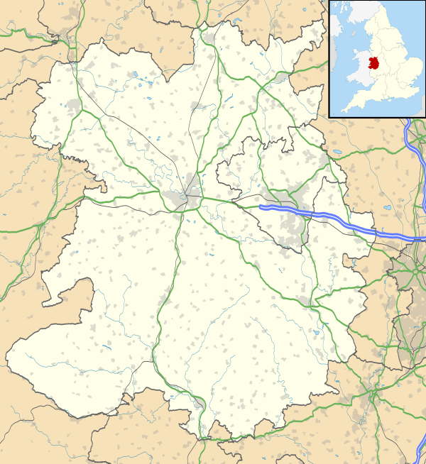 Shown within Shropshire | |
| Location |
Near Weston-under-Redcastle, Shropshire grid reference SJ 577 274 |
|---|---|
| Coordinates | 52°50′34″N 2°37′43″W / 52.84278°N 2.62861°WCoordinates: 52°50′34″N 2°37′43″W / 52.84278°N 2.62861°W |
| Altitude | 160 m (525 ft) |
| Type | Hillfort |
| Length | 520 metres (1,710 ft) |
| Width | 380 metres (1,250 ft) |
| Area | 8 hectares (20 acres) |
| History | |
| Periods | Iron Age |
| Identifiers | |
| Atlas of Hillforts | 0048 |
Bury Walls is an Iron Age hillfort about 1 mile (1.6 km) south-east of Weston-under-Redcastle, in Shropshire, England.
It has been a scheduled monument since 17 December 1929.[1]
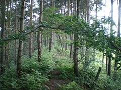
Description
The fort is on a promontory facing south-west, part of the southern escarpment of a sandstone ridge. The altitude is 160 metres (520 ft). The enclosure is about 520 metres (1,710 ft) north to south and 380 metres (1,250 ft) east to west; the area within is about 8 hectares (20 acres).[1][2]
There are steep slopes on all sides except the north, where there are two massive ramparts and ditches, the inner rampart being about 7.8 metres (26 ft) above the interior. Elsewhere there is a single rampart around the edge of the promontory, about 3.0 metres (10 ft) along the east side and up to 1.8 metres (5 ft 11 in) along the west side.[2]
From the enclosure there are extensive views to the south, and there is a natural spring within the enclosure. The main entrance is near the north-east corner: there is an inturned entrance about 5 metres (16 ft) wide.[1]
Excavation and surveys
In 1930 there was some excavation of the site by E. W. Bowcock. It was found that the bedrock at the entrance was cut by cart ruts. To the right of the entrance there were two areas of broken stone, perhaps indicating hearths, and a possible quern-stone. Near the centre of the interior, foundations of a building were discovered, thought at the time to be medieval, but more recently thought to be the remains of a Romano-Celtic temple.[2]
In 1999 and 2000 there were geophysical and topographical surveys. In the northern part of the interior, there was evidence of a series of large concentric terraces; the material taken during their creation was apparently used for the defences.[2]
See also
References
| Wikimedia Commons has media related to Bury Walls. |
- 1 2 3 Bury Walls: a large multivallate hillfort Historic England. Retrieved 24 November 2017.
- 1 2 3 4 Bury Walls PastScape. Historic England. Retrieved 24 November 2017.