Croft Ambrey
| Croft Ambrey | |
|---|---|
|
Northern Herefordshire Near Leominster in UK | |
 Croft Ambrey | |
| Area | 32 acres |
Croft Ambrey is a British Iron Age hill fort in northern Herefordshire, 10 kilometres (6 mi) north of Leominster close to the present day county border with South Shropshire.
Location
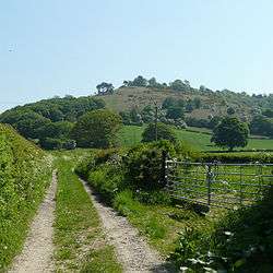
Croft Ambrey is located on high ground within the Croft Castle estate, the nearest villages are Yarpole, Aymestrey, Yatton and Mortimer's Cross. Leominster lies to the south and Leintwardine to the north.
The Mortimer Trail waymarked long distance footpath passes adjacent to the site.
Description

The monument includes a small multivallate hillfort with an annexe containing a Romano-Celtic temple and a medieval warren of up to five pillow mounds situated on the summit of a prominent steeply sloping spur overlooking Yatton Marsh and the valley of a tributary to Allcock’s Brook. The hillfort survives as a roughly triangular enclosure defined to the north by two scarps with a buried ditch – to the west by three rampart banks and a larger internal ditch and to the south by three rampart banks with two medial ditches and a wide internal ditch which may have been used to store water. There were two complex entrances which through time had 20 successive gateposts and were further enhanced with guardrooms, corridors and bridges of which the south western was the principal entrance and the north eastern was complex and inturned. The enclosure originally covered approximately 2.2ha, but this increased through time to 3.6ha and eventually a southern rectangular annexe was added. This is defined by two slighter concentric banks.
Excavations
The hillfort was excavated between 1960 and 1966 and was found to have been in use from the 6th century BC up to AD 48. It contained closely set rectangular buildings which had been rebuilt up to six times. The population of the hillfort was estimated at 500-900 individuals. Finds included metalwork such as iron tools, weapons, sickles, blades, nails and a spade, shale and glass objects, bone and antler artefacts, spindle whorls, loom and thatch weights, saddle querns and rotary querns, hammer stones and Iron Age pottery.
There are some notable parallels with the hillfort at Wapley Hill, which also was used for rabbit farming.
See also
Further reading
- Children, G; Nash, G (1994) Prehistoric Sites of Herefordshire Logaston Press ISBN 1-873827-09-1
External links
| Wikimedia Commons has media related to Croft Ambrey. |
- Croft Ambrey Monument Detail at Historic England
- Croft Ambrey on the Roman-Britain website
- Croft Ambrey on English Heritage
Coordinates: 52°17′42″N 2°48′54″W / 52.295°N 2.815°W