Shire of Kent
| Shire of Kent Western Australia | |||||||||||||||
|---|---|---|---|---|---|---|---|---|---|---|---|---|---|---|---|
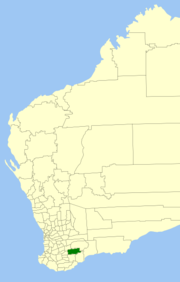 Location in Western Australia | |||||||||||||||
| Population | 528 (2013 est)[1] | ||||||||||||||
| • Density | 0.09372/km2 (0.24273/sq mi) | ||||||||||||||
| Established | 1922 | ||||||||||||||
| Area | 5,633.8 km2 (2,175.2 sq mi) | ||||||||||||||
| President | Alan Smith | ||||||||||||||
| Council seat | Nyabing | ||||||||||||||
| Region | Great Southern | ||||||||||||||
| State electorate(s) | Roe | ||||||||||||||
| Federal Division(s) | O'Connor | ||||||||||||||
|
| |||||||||||||||
| Website | Shire of Kent | ||||||||||||||
| |||||||||||||||
The Shire of Kent is a local government area in the Great Southern region of Western Australia, about 320 kilometres (200 mi) southeast of Perth, the state capital. The Shire covers an area of 5,634 square kilometres (2,175 sq mi) and its seat of government is the town of Nyabing. The area produces grains such as wheat, barley and legumes.
History
The Kent Road Board was formed and gazetted in 1922, and on 1 July 1961, it became a shire following changes to the Local Government Act. From 1955 until 1972, it was known as Nyabing-Pingrup.[2][3]
The name "Kent" comes from the commissariat officer of Dr T. Wilson’s expedition of 1829.
Wards
Following a redistribution in 2002, the Shire has been divided into four wards, each with two councillors:
- Holland Rock Ward
- Mindarabin Ward
- Nampup Ward
- Pingarnup Ward
Towns
References
- ↑ "3218.0 Regional Population Growth, Australia. Table 5. Estimated Resident Population, Local Government Areas, Western Australia". 3 April 2014. Retrieved 11 September 2014.
- ↑ WA Electoral Commission, Municipality Boundary Amendments Register (release 2.0), 31 May 2003.
- ↑ "Shire of Nyabing-Pingrup. Alteration of Name. Order in Council. (per L.G. 117/65)". Western Australia Government Gazette. 29 November 1972. p. 1972:4560.
External links
This article is issued from
Wikipedia.
The text is licensed under Creative Commons - Attribution - Sharealike.
Additional terms may apply for the media files.