Ilhéu de Sal Rei
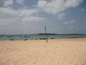 Ilhéu de Sal Rei seen from Sal Rei, Boa Vista | |
| Geography | |
|---|---|
| Location | Atlantic Ocean |
| Coordinates | 16°10′16″N 22°55′48″W / 16.171°N 22.930°WCoordinates: 16°10′16″N 22°55′48″W / 16.171°N 22.930°W |
| Area | 0.89 km2 (0.34 sq mi) |
| Highest elevation | 27 m (89 ft) |
| Administration | |
|
Cape Verde | |
| Municipality | Boa Vista |
| Demographics | |
| Population | 0 |
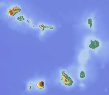
Ilhéu de Sal Rei is an uninhabited islet near the coast of Boa Vista Island, Cape Verde. It is located 1 km (0.6 miles) southwest of the island capital Sal Rei. Its area is 89 ha (0.34 sq mi)[1] and its highest point is 27 m (88.6 ft).[2]
The islet has exposed basaltic and limestone rock, and there are sandy beaches in sheltered areas. The entire islet is a natural monument.[2] The headland Ponta de Escuma is the islet's westernmost point. A narrow strait to its northeast separates it from Boa Vista island by 500 to 600 meters. On the southern tip of the island, the ruined Portuguese fort Duque de Bragança is situated.
Ponta da Escuma Lighthouse
|
| |
 Cape Verde | |
| Location |
Ponta da Escuma Ilhéu de Sal Rei Boa Vista Cape Verde |
|---|---|
| Coordinates | 16°10′21.37″N 22°55′55.48″W / 16.1726028°N 22.9320778°W |
| Year first constructed | 1888 (first) |
| Year first lit | n/a (current) |
| Foundation | concrete base |
| Construction | metal lamp post |
| Tower shape | cylindrical lamp post with light |
| Height | 7.9 metres (26 ft) |
| Focal height | 28 metres (92 ft) |
| Light source | solar power |
| Range | 11 nautical miles (20 km; 13 mi)[3] |
| Characteristic | Fl (5) W R 20s. |
| Admiralty number | D2918 |
| NGA number | 24192 |
| Cape Verde number | PT-2106[4] |
The island has a lighthouse named Ponta de Escuma, built in 1888, consisted of a concrete staircase 5 metres (16 ft) high with the light on the top. The current light is a cylindrical metal mast 7.9 metres (26 ft) high with balcony and lantern. According to the NGA the light is still active,[3] has a solar power unit and emits five flashes white or red depending from the direction in a twenty seconds period visible up to 11 nautical miles.[3]
Gallery
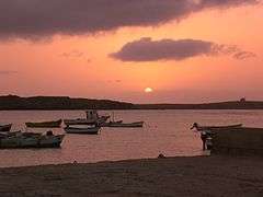 Sunset near the Sal Rei Islet
See also
References
- ↑ Resolução nº 36/2016, Estratégia e Plano Nacional de Negócios das Áreas Protegidas
- 1 2 Protected areas in the island of Boa Vista - Municipality of Boa Vista, March 2013 (in Portuguese)
- 1 2 3 List of Lights, Pub. 113: The West Coasts of Europe and Africa, the Mediterranean Sea, Black Sea and Azovskoye More (Sea of Azov) (PDF). List of Lights. United States National Geospatial-Intelligence Agency. 2015.
- ↑ Rowlett, Russ. "Lighthouses of Cape Verde". The Lighthouse Directory. University of North Carolina at Chapel Hill.
| Island groups | ||
|---|---|---|
| Islands | ||
| Islets | ||
The island of Boa Vista | ||
|---|---|---|
| Santa Isabel | 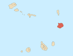 | |
| São João Baptista | ||
| Mountains | ||
| Islets | ||
| Beaches | ||
| Other geographical features | ||
| ||