Serra Negra, Cape Verde
| Serra Negra | |
|---|---|
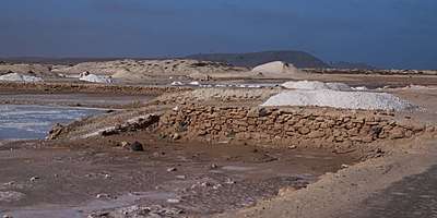 Serra Negra as seen from the Santa Maria Saltpans | |
| Highest point | |
| Elevation | 104 m (341 ft) |
| Coordinates | 16°39′31″N 22°53′9″W / 16.65861°N 22.88583°WCoordinates: 16°39′31″N 22°53′9″W / 16.65861°N 22.88583°W |
| Naming | |
| Translation | black mountain (Portuguese) |
| Pronunciation | Portuguese: [ˈsɛʁɐ ˈneɡɾɐ] |
| Geography | |
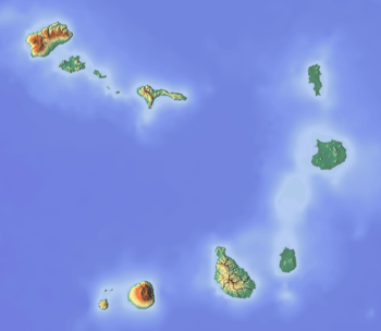 Serra Negra island of Sal, Cape Verde | |
Serra Negra is a hill in the southeastern part of the island of Sal in Cape Verde. Its maximum elevation is 104 m, the highest point in southern Sal.[1] It stretches for about 2.5 km along the east coast of the island, between the headland Ponta da Fragata in the south and the Ponta do Morrinho Vermelho in the north. The nearest settlement is Murdeira, to the west. The mountain forms part of a protected area as a nature reserve, important as nesting area for seabirds and turtles.[2] The nature reserve covers 3.31 km2 (1.28 sq mi) of land and 22.96 km2 (8.86 sq mi) of ocean.[3]
See also
References
- ↑ Cabo Verde Visor
- ↑ Reservas Naturais, Áreas protegidas Cabo Verde
- ↑ Resolução nº 36/2016, Estratégia e Plano Nacional de Negócios das Áreas Protegidas
The island of Sal, Cape Verde | ||
|---|---|---|
| Settlements | 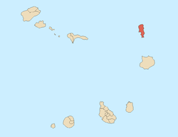 | |
| Mountains and hills | ||
| Points and promontories | ||
| Lighthouses | ||
| Other geographical features | ||
| Other topics | ||
This article is issued from
Wikipedia.
The text is licensed under Creative Commons - Attribution - Sharealike.
Additional terms may apply for the media files.