Monte Caçador and Pico Forcado Protected Countryside
| Monte Caçador Pico Forcado Mesa Cágado | |
|---|---|
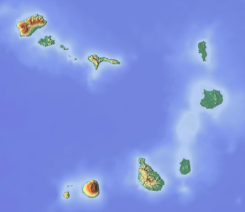 Monte Caçador Pico Forcado Mesa Cágado Location in Cape Verde | |
| Highest point | |
| Elevation | 364 m (1,194 ft) |
| Coordinates | 16°7′N 22°46′W / 16.117°N 22.767°WCoordinates: 16°7′N 22°46′W / 16.117°N 22.767°W |
| Geography | |
| Location | East central Boa Vista |
Monte Caçador and Pico Forcado Protected Countryside (Portuguese: Paisagem protegido de Monte Caçador e Pico Forcado) is a protected area covering 3,357 hectares (12.96 sq mi) of land[1][2][3] in the eastern part of the island of Boa Vista in Cape Verde. It is the most important mountain formation on the island, but not the highest.
The alignment of the peaks forms a tiny mountain range that consists Monte Caçador (355 metres [1,165 ft], Pico Forcado (364 metres [1,194 ft]) and the lower Mesa Cágado (297 metres [974 ft]). The rock formation consists of phonolitic deposits over the basaltic Fundo de Figueiras Formation.[4]
See also
References
- ↑ Paisagens protegidas, Cabo Verde (in Portuguese)
- ↑ Protected areas in the island of Boa Vista - Municipality of Boa Vista (in Portuguese)
- ↑ Resolução nº 36/2016, Estratégia e Plano Nacional de Negócios das Áreas Protegidas
- ↑ Ramalho, R. (2010). Tracers of uplift and subsidence in the Cape Verde Archipelago. p. 11.
External links
- Protected areas of Cape Verde (in Portuguese)
- Protected areas in the island of Boa Vista - Municipality of Boa Vista (in Portuguese)
The island of Boa Vista | ||
|---|---|---|
| Santa Isabel | 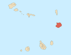 | |
| São João Baptista | ||
| Mountains | ||
| Islets | ||
| Beaches | ||
| Other geographical features | ||
| ||
This article is issued from
Wikipedia.
The text is licensed under Creative Commons - Attribution - Sharealike.
Additional terms may apply for the media files.