Ilhéu Rabo de Junco
| Geography | |
|---|---|
| Location | Atlantic Ocean |
| Coordinates | 16°42′00″N 22°59′35″W / 16.700°N 22.993°WCoordinates: 16°42′00″N 22°59′35″W / 16.700°N 22.993°W |
| Area | 0.02 km2 (0.0077 sq mi) |
| Length | 0.26 km (0.162 mi) |
| Width | 0.17 km (0.106 mi) |
| Highest elevation | 18 m (59 ft) |
| Administration | |
|
Cape Verde | |
| Municipality | Sal |
| Demographics | |
| Population | 0 |
Ilhéu Rabo de Junco is an uninhabited islet near the west coast of Sal Island, Cape Verde. It lies about 300 metres (980 feet) from the coast. It is 253 metres (830 feet) long and 165 metres (541 feet) wide, its shoreline is about 878 metres (2,881 feet) long.[1] It is the only islet near the island of Sal. Baía da Murdeira lies to the southeast of the islet. Further east is the highest point in southern Sal named Rabo de Junco, which has an elevation of 165 metres (541 feet). The islet is part of the marine nature reserve Baía da Murdeira.[2]
References
- ↑ MAHOT Cartography, 2012
- ↑ Reservas Naturais, Áreas protegidas Cabo Verde
The island of Sal, Cape Verde | ||
|---|---|---|
| Settlements | 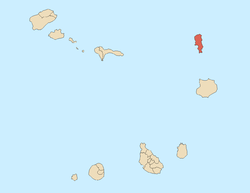 | |
| Mountains and hills | ||
| Points and promontories | ||
| Lighthouses | ||
| Other geographical features | ||
| Other topics | ||
| Island groups | ||
|---|---|---|
| Islands | ||
| Islets | ||
This article is issued from
Wikipedia.
The text is licensed under Creative Commons - Attribution - Sharealike.
Additional terms may apply for the media files.