Rabo de Junco
| Rabo de Junco | |
|---|---|
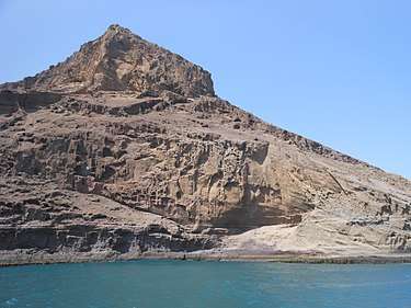 South face of Rabo de Junco | |
| Highest point | |
| Elevation | 165 m (541 ft) [1][2] |
| Listing | List of mountains in Cape Verde |
| Coordinates | 16°41′46″N 22°58′55″W / 16.696°N 22.982°WCoordinates: 16°41′46″N 22°58′55″W / 16.696°N 22.982°W [1] |
| Geography | |
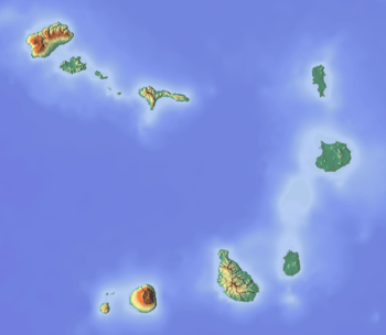 Rabo de Junco western Sal | |
Rabo de Junco (also: Monte Leão) is a hill on the west coast of the island of Sal in Cape Verde. It is situated at the northern end of the Baía da Murdeira, 8 km southwest of the island capital Espargos. Its steep eroded south face towards the bay is an important nesting area for birds. Rabo de Junco and the surrounding area (154 hectares) are protected as a nature reserve.[3][2] It was mentioned as Rabadyunk in the 1747 map by Jacques-Nicolas Bellin.[4] To its west lies the uninhabited islet Ilhéu Rabo de Junco.
See also
References
- 1 2 (in Portuguese) Cabo Verde Visor
- 1 2 Reservas Naturais, Áreas protegidas Cabo Verde
- ↑ Resolução nº 36/2016, Estratégia e Plano Nacional de Negócios das Áreas Protegidas
- ↑ Jacques-Nicolas Bellin (1747). "Carte des Isles du Cap Verd = Kaart van de Eilanden van Kabo Verde" (in French).
The island of Sal, Cape Verde | ||
|---|---|---|
| Settlements | 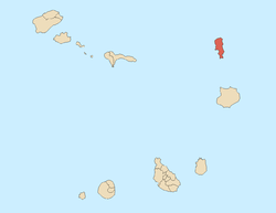 | |
| Mountains and hills | ||
| Points and promontories | ||
| Lighthouses | ||
| Other geographical features | ||
| Other topics | ||
This article is issued from
Wikipedia.
The text is licensed under Creative Commons - Attribution - Sharealike.
Additional terms may apply for the media files.