Monte Santo António
| Monte Santo António | |
|---|---|
 Monte Santo António | |
| Highest point | |
| Elevation | 379 m (1,243 ft) |
| Listing | List of mountains in Cape Verde |
| Coordinates | 16°03′50″N 22°53′02″W / 16.064°N 22.884°WCoordinates: 16°03′50″N 22°53′02″W / 16.064°N 22.884°W |
| Geography | |
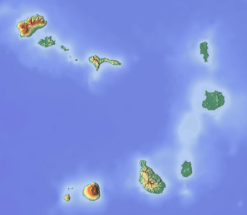 Monte Santo António southeastern Boa Vista | |
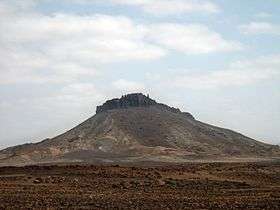
Monte Santo António is a mountain in the southwestern part of the island Boa Vista in Cape Verde. At 379 m (1,243 ft) elevation,[1] it is the island's second highest point. Like Rocha Estância and Monte Estância, it rises steeply from the surrounding plains. It is part of a protected natural area under the statute of natural monument,[2] covering 459 hectares (1,130 acres).[1][3]
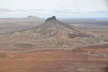
Aerial view of Monte Santo António with Rocha Estância in the background
See also
References
- 1 2 Protected areas in the island of Boa Vista - Municipality of Boa Vista, March 2013 (in Portuguese)
- ↑ Natural monuments of Cape Verde (in Portuguese)
- ↑ Resolução nº 36/2016, Estratégia e Plano Nacional de Negócios das Áreas Protegidas
External links
| Wikimedia Commons has media related to Pico do Santo António. |
The island of Boa Vista | ||
|---|---|---|
| Santa Isabel | 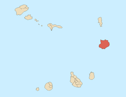 | |
| São João Baptista | ||
| Mountains | ||
| Islets | ||
| Beaches | ||
| Other geographical features | ||
| ||
This article is issued from
Wikipedia.
The text is licensed under Creative Commons - Attribution - Sharealike.
Additional terms may apply for the media files.