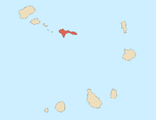
São Nicolau, Cape Verde
| Nickname: Ilha de Chiquinho | |
|---|---|
 | |
 São Nicolau | |
| Geography | |
| Location | Atlantic Ocean |
| Coordinates | 16°36′54″N 24°16′16″W / 16.615°N 24.271°W |
| Area | 343 km2 (132 sq mi) |
| Length | 44.5 km (27.65 mi) |
| Width | 22.0 km (13.67 mi) |
| Highest elevation | 1,312 m (4,304 ft) |
| Highest point | Monte Gordo |
| Administration | |
|
Cape Verde | |
| Concelhos (Municipalities) | Ribeira Brava, Tarrafal de São Nicolau |
| Largest settlement | Ribeira Brava |
| Demographics | |
| Population | 12,424[1]:36 (2015) |
| Pop. density | 36.2 /km2 (93.8 /sq mi) |

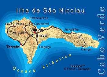
São Nicolau (Portuguese meaning Saint Nicholas) is one of the Barlavento (Windward) islands of Cape Verde. It is located between the islands of Santa Luzia and Sal. Its population is 12,424 (2015),[1]:36 with an area of 343 km².[1]:25 The main towns are Ribeira Brava and Tarrafal de São Nicolau.
History
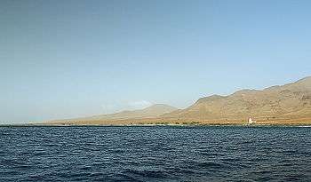
The island was discovered in 1461 or 1462 by Diogo Afonso, together with the islands of São Vicente and Santo Antão.[2]:73 It was first settled in the seventeenth century. The settlement Porto de Lapa was abandoned in 1653 due to pirate attacks, and the town Ribeira Brava was founded in the interior.[3]:16 It was the seat of the Roman Catholic Diocese of Santiago de Cabo Verde between 1786 and 1943.[3]:28 The roadstead of Tarrafal de São Nicolau became an anchorage for whaling ships in the 19th century. It is now the largest settlement of the island.[4]:14-16
Geography
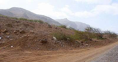
The mountainous island is mostly agricultural but is subject to droughts, especially in the lower lying areas. The highest point on the island is Monte Gordo (1,312 m), in the western half of the island.[4]:20 The eastern part is a chain of lower mountains, including Monte Bissau and Pico de Alberto.
Administrative divisions
The island is divided in two municipalities, which are subdivided into civil parishes:
Before 2005, the island was administrated as one municipality: São Nicolau.[5]
Demography
In the 1830s, São Nicolau had an estimated population of 5,000.[6]
| Population of São Nicolau, Cape Verde (1940—2015) | ||||||||
|---|---|---|---|---|---|---|---|---|
| 1940[7] | 1950[7] | 1960[7] | 1970[7] | 1980[7] | 1990[7] | 2000[7] | 2010[8] | 2015[1]:36 |
| 14,846 | 10,366 | 13,866 | 16,308 | 13,572 | 13,665 | 13,536 | 12,817 | 12,424 |
Transportation
The island has a domestic airport, São Nicolau Airport, located between Ribeira Brava and Preguiça. There is a port at Tarrafal de São Nicolau, with ferry connections to the islands of São Vicente (Mindelo) and Santiago (Praia).[9]
Notable residents
- Teofilo Chantre (b. 1964), musician
- Baltasar Lopes da Silva (1907 - 1989), writer
- José Lopes da Silva (pseudonym: Gabrial Mariano, (1928–2003), poet and essayist
- Antónia Pusich, Portuguese poet, journalist, pianist and compositor of Croatian origin, daughter of the colonial governor António Pusich
- António Maria de Bettencourt Rodrigues (1854-1933), doctor, diplomat and politician
References
- 1 2 3 4 Cabo Verde, Statistical Yearbook 2015, Instituto Nacional de Estatística
- ↑ Valor simbólico do centro histórico da Praia, Lourenço Conceição Gomes, Universidade Portucalense, 2008
- 1 2 Inventário dos recursos turísticos do município de Ribeira Brava de São Nicolau, Direcção Geral do Turismo
- 1 2 Inventário dos recursos turísticos do município do Tarrafal de São Nicolau, Direcção Geral do Turismo
- ↑ Lei nº 67/VI/2005, p. 61
- ↑ Roberts, Edmund (1837). Embassy to the Eastern Courts of Cochin-China, Siam, and Muscat. New York: Harper & Brothers. p. 14.
- 1 2 3 4 5 6 7 Source: Statoids
- ↑ 2010 Census Summary
- ↑ Cabo Verde Fast Ferry's website
External links
Coordinates: 16°36′54″N 24°16′16″W / 16.615°N 24.271°W
| Wikimedia Commons has media related to São Nicolau (Cape Verde). |
| Island groups | ||
|---|---|---|
| Islands | ||
| Islets | ||
The island of São Nicolau | ||||||
|---|---|---|---|---|---|---|
| Ribeira Brava |
|  | ||||
| Tarrafal de São Nicolau |
| |||||
| Mountains | ||||||
| Other topics | ||||||