Ponta Preta (Southern Sal)
| Ponta Preta | |
|---|---|
 Ponta Preta, its location is in the southwest of the island | |
 Ponta Preta | |
| Location | Southern Sal, Cape Verde |
| Coordinates | 16°36′21″N 22°55′47″W / 16.6057°N 22.9297°WCoordinates: 16°36′21″N 22°55′47″W / 16.6057°N 22.9297°W |
| Offshore water bodies | Atlantic Ocean |
Ponta Preta (Portuguese meaning "black tip") is a headland in the southwest of the island of Sal in Cape Verde. It is about 2 km west of the town Santa Maria and about 2 km of Ponta do Sinó, the southernmost point of the island. It lies within the nature reserve Ponta do Sinó, at the edge of a tourism development zone.[1]
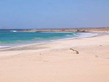
View of Ponta Preta and its beach in 2004
See also
References
- ↑ Reservas Naturais, Áreas protegidas Cabo Verde
| Wikimedia Commons has media related to Ponta Preta Beach. |
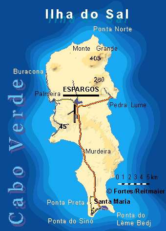
The island of Sal, Cape Verde | ||
|---|---|---|
| Settlements | 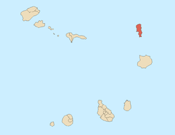 | |
| Mountains and hills | ||
| Points and promontories | ||
| Lighthouses | ||
| Other geographical features | ||
| Other topics | ||
This article is issued from
Wikipedia.
The text is licensed under Creative Commons - Attribution - Sharealike.
Additional terms may apply for the media files.