Interstate 75 in Florida
| |||||||
|---|---|---|---|---|---|---|---|
|
I-75 highlighted in red | |||||||
| Route information | |||||||
| Maintained by FDOT | |||||||
| Length | 470.808 mi[1] (757.692 km) | ||||||
| Existed | 1955 – present | ||||||
| Major junctions | |||||||
| South end |
| ||||||
| North end |
| ||||||
| Location | |||||||
| Counties | Miami-Dade, Broward, Collier, Lee, Charlotte, DeSoto, Sarasota, Manatee, Hillsborough, Pasco, Hernando, Sumter, Marion, Alachua, Columbia | ||||||
| Highway system | |||||||
| |||||||

Interstate 75 (I-75) is a part of the Interstate Highway System and runs from the Hialeah–Miami Lakes border, a few miles northwest of Miami, to Sault Ste. Marie in the Upper Peninsula of Michigan. I-75 begins its national northward journey near Miami, running along the western parts of the Miami metropolitan area before traveling westward across Alligator Alley (also known as Everglades Parkway[2]), resuming its northward direction in Naples, running along Florida's Gulf Coast, passing the cities of Fort Myers, Punta Gorda, Venice, Sarasota, and the Tampa Bay Area, before turning inward towards Ocala, Gainesville, and Lake City before leaving the state and entering Georgia. I-75 runs for 471 miles (758 km) in Florida, making it the longest interstate in any state east of the Mississippi River. The interstate maintains a speed limit of 70 mph (110 km/h) for its entire length in Florida.
The portion of I-75 from Tampa northward was a part of the original 1955 Interstate Highway plans, with I-75's southern terminus at I-4's current western terminus. Planning to extend the interstate south to Miami began in 1968 after massive growth in Southwest Florida, which resulted in I-75 being realigned to travel on the eastern fringes of the Tampa Bay area, and the last portion of the highway was opened in 1993.
For FDOT inventory purposes, it is designated as State Road 93 (SR 93) for most of its length in Florida (with exception to the Tampa Bay area, where SR 93 follows I-275, while SR 93A travels with I-75 in the latter's bypass of the area).
Route description
South Florida
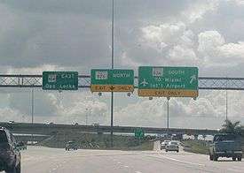
I-75 begins its northward journey at an interchange with SR 826 (Palmetto Expressway) and SR 924 (Gratigny Parkway) on the Hialeah–Miami Lakes border, near Miami.[3]
As it curves around the border of Miami Lakes, I-75 serves some of the western fringes of South Florida as an eight-lane highway. After an exit with SR 860, I-75 has a southbound interchange with the Homestead Extension of Florida's Turnpike before crossing into Broward County. There, it continues through the western suburbs of Pembroke Pines, Weston, Miramar, Davie, and Southwest Ranches.
At the junction of SR 869 (Sawgrass Expressway) and I-595, I-75 (while maintaining its south–north status) enters a west–east trajectory as it crosses the Everglades by way of Alligator Alley, a toll road that runs from the Collier Boulevard (Exit 101) toll plaza to the US-27 toll plaza (Exit 23). It was originally constructed as a two-lane highway before it was converted to a four-lane highway meeting Interstate Highway standards. At this point, I-75 loses a lane in each direction, heading west, losing another lane west of the U.S. Route 27 (US 27) interchange.
The Everglades and Southwest Florida
The Alligator Alley section west of Fort Lauderdale, Florida and east of Naples is due west–east and is one of only two sections of I-75 that are tolled (the other is the Mackinac Bridge). There are only two interchanges along the 75 mile tolled portion of Alligator Alley in addition to two rest areas and a number of scenic outlook points as it crosses the Florida Everglades. I-75 enters Collier County along Alligator Alley just west of the Snake Road exit (exit 49) and passes through the Big Cypress National Preserve between the Collier County border and State Road 29 (exit 80). There are a number of small bridges along Alligator Alley to allow wildlife to pass under the freeway especially along the Florida Panther National Wildlife Refuge east of SR 29. Extensive fencing also prevents wildlife from crossing traffic.[4]
Once near Naples at County Road 951 (Exit 101), I-75 makes a sharp turn north resuming its south–north trajectory and gains a third lane each way as it parallels Florida's west coast. At this point, Alligator Alley ends and I-75 is toll free for the rest of its length in Florida. As it continues north, I-75 passes near Bonita Springs, Fort Myers, Punta Gorda, Port Charlotte, Venice, Sarasota, and Bradenton, before reaching the Tampa Bay Area metropolis consisting of Tampa and St. Petersburg.
Tampa Bay area
North of Ellenton, I-275 splits from I-75 to serve St. Petersburg and Pinellas County via the Sunshine Skyway Bridge and Tampa via the Howard Frankland Bridge. I-75 parallels the eastern shore of Tampa Bay as a bypass route of the Tampa Bay Area, as it passes by the communities of Brandon, Temple Terrace, and New Tampa. Two expressways access downtown Tampa from I-75: the Lee Roy Selmon Expressway (SR 618) and I-4. Within the Tampa Bay Metropolitan Area, many interchanges are far more complex than mere diamond, cloverleaf, or even SPUI interchanges. Aside from the large turbine interchange with I-4 (Exit 261), there are interchanges with Fowler Avenue (Exit 265) and Fletcher Avenue/Morris Bridge Road (Exit 266) that contain both loops and flyovers. A flyover ramp was built from southbound Bruce B. Downs Boulevard (Exit 270) to southbound I-75.[5]
Northern Florida

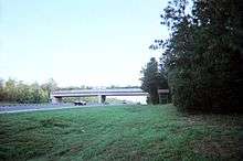
At the Hillsborough–Pasco county line (south of SR 56 (Exit 275)), I-275 rejoins I-75 (at Exit 274, southbound only) and I-75 changes into a southwest–northeast trajectory as it passes through Pasco, Hernando, and Sumter Counties where it runs through parts of the Withlacoochee State Forest on its way to the junction with Florida's Turnpike. Widened median segments exist in Northern Pasco County, Hernando County, and in Sumter County north of County Road 476-B (Exit 309). Some of these median segments are actually considered part of the Withlacoochee State Forest itself. The Withlacoochee State Trail runs beneath I-75 between US 98/SR 50 (Exit 301) and the Hernando–Sumter County line, where it also crosses over the Withlacoochee River. All of Interstate 75 from the Georgia border to Tampa, Florida is three lanes, unless closed for construction. This is to accommodate for the immense number of tourists and vacationers that come to Florida.
After Florida's Turnpike (accessible from southbound I-75 only), I-75 changes into a general southeast–northwest trajectory, which is sustained to the Georgia state line and beyond. I-75 passes beneath the Cross Florida Greenway, which contains a land bridge built across the highway in 2001 between Exits 341 and 350,[6] before entering the City of Ocala, and passing by the cities of Gainesville and Lake City and crosses I-10 at an interchange before entering the state of Georgia, near Valdosta.
I-75 runs closest to US 41 except between Tampa and High Springs. It runs closer to US 301 between Ellenton and Temple Terrace, and again from Dade City to Sparr. From Belleview to Lake City it runs closest to US 441.[7]
History

Original route to Tampa
Original plans for I-75 called for its southern terminus to be in to Tampa, where it would terminate at I-4 (at the current interchange between I-4 and I-275, with I-4, which was completed in the Bay area by 1962, continuing west along what is now I-275 over the Howard Frankland Bridge into St. Petersburg). Plans for I-75 from Tampa to Sault Ste. Marie, Michigan were authorized as part of the Federal Aid Highway Act of 1956, signed into law by President Dwight D. Eisenhower, which created the Interstate Highway System.[8]
Construction of the original route from the Georgia border to Tampa via Gainesville and Ocala lasted through most of the 1960s. The first segment of I-75 to open in Florida was from the Georgia border to State Road 6 just south of Jennings, which opened in 1963. It would reach U.S. 90 in Lake City later that year. By mid-1964, I-75 opened from Lake City to the newly completed Florida Turnpike (known then as the Sunshine State Parkway) in Wildwood. Segments of the original route that are now part of I-275 near Tampa would begin opening in 1966, and construction of the full route would be completed by 1969.[8]
Extension to Miami
Due to major growth in Southwest Florida (particularly Fort Myers and Naples), it was becoming clear that this part of the state would soon need a freeway. Florida's state government first proposed to build a West Coast Turnpike in 1964 from the Tampa Bay area south to Naples.[9] Plans for the West Coast Turnpike (which would have been tolled) were cancelled in 1968, when it was announced that U.S. Secretary of Transportation Alan Boyd had approved an extension of I-75 south to Naples and then east to Miami. The Federal Government would pay for 90% of the extension using funds allocated by the Federal-Aid Highway Act of 1968, which was signed into law by President Lyndon B. Johnson.[10][11]
In preparation for the extension, I-75's designation was extended along the pre-existing route of I-4 over the Howard Frankland Bridge into St. Petersburg by the end of 1969 (I-4's designation would be truncated to its current terminus at this time). From St. Petersburg, I-75 was proposed to continue south over the Sunshine Skyway Bridge and continue south along a new freeway roughly parallel to the Tamiami Trail (U.S. 41) along the lower Gulf Coast to Naples.
.svg.png)
As the extension was planned in 1968, plans were also made for a freeway bypassing Tampa Bay to the east. The bypass was initially planned to be designated I-75E, and was to split from I-75 near Wesley Chapel and rejoin it just north of Ellenton. However, in 1972, it was determined that maintaining the main route of I-75 through Downtown Tampa would eventually require major improvements to the existing infrastructure to handle through traffic. As a result, it was decided that I-75 would instead follow the bypass route, with the original route through downtown Tampa and St. Petersburg becoming I-275. I-75 reached as far south as 38th Avenue North in St. Petersburg when the designations were switched. Despite the designation switch, both freeway's hidden designations still reflect the originally planned routing, with I-75's SR 93 designation following I-275, and the current route of I-75 on the bypass being designated SR 93A.[12] Construction on the bypass segment of I-75 began in 1979.[8]
The initially favored proposal for I-75 to reach Miami from Naples was to have I-75 run along the Tamiami Trail (U.S. 41) across the Everglades to just east of the Palmetto Expressway where it would continue along SR 836 (Dolphin Expressway) and terminate at I-95 and I-395 in Downtown Miami.[12]
Due to environmental concerns of upgrading the Tamiami Trail (which runs along the northern border of Everglades National Park) and the fact that the Dolphin Expressway was not built to Interstate standards, the decision was made in 1973 to shift I-75's proposed route to cross the Everglades along Alligator Alley. By using this route, I-75 would run along the alley to the proposed Port Everglades Expressway, where it would turn south along a new freeway through the western suburbs of Weston and Pembroke Pines to Miami. It was still planned to continue east to I-95, but due to local opposition, I-75 was not built past its current terminus at SR 826 (Palmetto Expressway) in Hialeah. With this new route, the Port Everglades Expressway was then planned to be built as an interstate highway designated I-595 to provide an interstate connection between I-75 and I-95.
The first piece of the south extension of I-75 to open was a short segment just east of Fort Myers from SR 78 south to Corkscrew Road in 1979. This piece would extend north to Tucker's Grade just south of Punta Gorda in early 1980 and south to Immokalee Road in North Naples by 1981. Also in 1981, the segment from U.S. 301 in Manatee County south to River Road near Venice opened, which would be completed south to the southern segment in Punta Gorda later that year. It would reach Alligator Alley in Naples by 1984. The route from Tampa to Naples would be complete by 1986 as segments of the Tampa bypass were opened from 1982 to 1986. In the Miami area, I-75 was opened from U.S. 27 to its terminus at the Palmetto Expressway in 1986.[8]
The Florida Department of Transportation transitioned existing interchange exit numbers on all Interstate highways from sequential exits to mileage-based exits in January 2002.[13]
Alligator Alley
The Alligator Alley segment (from Naples to just west of Fort Lauderdale) previously existed as a two-lane tollway connecting the two coasts of Florida. Initially known as Everglades Parkway (State Road 84), it opened for traffic on February 11, 1968, after four years of construction. Built by H. L. Mills Construction Company, it had been called the most controversial roadway ever built in Florida during its initial construction.[14] The name "Alligator Alley" was given by the American Automobile Association while it was planned since they believed it would be useless to cars, merely an "alley for alligators". However, as alligators often frequent the waterways beside the road, and occasionally the road itself, the nickname has developed a somewhat literal meaning. The state would officially adopt the Alligator Alley name in 1966.[14]
As a two-lane road, Alligator Alley suffered from poor construction and environmental planning. It was also notorious for high-speed accidents with both head-on collisions and collisions with wildlife. The need to improve it was one of the factors in the decision to reroute I-75 onto the alley, which was rebuilt as a four-lane interstate highway between 1986 and 1992. Many bridges and culverts designed to let water and wildlife pass underneath and permit the natural water flow of the Everglades were built as part of the upgrade.[15] This helped to reduce the environmental impact of the highway somewhat, especially upon the severely endangered Florida panther. The completion of the converted Alligator Alley was the final link of the I-75 extension. The segment was signed Interstate 75 on November 25, 1992, fully completing the highway from Miami to Sault Ste. Marie, Michigan.[16]
In January 2000, the west end toll plaza of Alligator Alley was dedicated to the memory of Edward J. Beck, a toll taker who was murdered while on the job on January 30, 1974.[17]
A state effort to privatize Alligator Alley failed in May 2009 when no bids were received for the highway that met the required terms.[18]
Future
Construction began in September 2016 to redesign the interchanges with the north end of Florida's Turnpike (Exit 328) and SR 44 (Exit 329), connecting them with collective-distributor roads, and eliminating left-hand access to Florida's Turnpike from the main southbound lane. This is a joint effort between the Florida's Turnpike Enterprise and Florida Department of Transportation and the project is anticipated to be complete in winter 2019.[19]
Another interchange is planned for Overpass Road north of State Road 54, connecting to County Road 530.[20][21]
Many widening projects are underway on I-75 to eventually bring it to at least six lanes from Naples to the Georgia state line.[22][23][24]
FDOT is implementing express lanes along 28 miles (45 km) of the I-75 and SR 826 (Palmetto Expressway) corridors, from just south of the SR 836 (Dolphin Expressway), in Miami-Dade County, to I-595 in Broward County. This project will complete another section of the South Florida managed lanes network for all motorists and will improve mobility, relieve congestion, provide additional travel options and accommodate future growth in the area. The 75 Express Lanes project extends 15 miles (24 km) along I-75 from Northwest 170 Street, in Miami-Dade County, to I-595, in Broward County. Work will be completed in four segments to minimize affects to the public. Construction began early 2014 and is scheduled to be completed by mid-2019. The total project is estimated to cost $481 million.[25]
Services
Several rest area facilities exist along I-75 throughout the state. In addition, there are separate facilities for each direction of the Interstate in Hamilton and Suwannee counties, southbound and northbound, respectively, and a welcome center south of the state line. Exit 131 has a single facility accessible from both travel directions on I-75, as well as the intersecting highway. Exit 161 had a rest stop at the interchange's southeast quadrant but it closed in 2015 because of low usage.[26] Each rest area has rest rooms, vending machines, picnic tables, dog walk areas, and nighttime security. The welcome center also has travel information and free orange juice, the state's official state beverage.[27]
Motorist-aid call boxes were installed starting in 1973, initially from the Georgia line to Lake City,[28] eventually being installed on both outside shoulders of the road every one mile (1.6 km) to allow drivers to indicate the need for gasoline, repair (tire or engine), or emergency services (police, ambulance, or fire). The majority of the call boxes were removed in late 2013 because of the rising maintenance cost and the availability of newer technology.[29]
Intelligent transportation systems (ITS) are used throughout the Interstate. ITS is a fiber optic system of traffic cameras, overhead message signs, microwave vehicle detectors, travel time sensors, road and weather information sensors, and highway advisory radios.[29] FDOT has a data-share agreement with Waze which provides real-time information for the state's 5-1-1 service, ITS, and to Waze users.[30]
The Everglades Radio Network is a network of two low-power FM travelers information radio stations serving the Collier County segment of Alligator Alley in the Everglades region and based at Florida Gulf Coast University in Fort Myers.
Exit list
| County | Location | mi[1] | km | Old exit | New exit | Destinations | Notes | |
|---|---|---|---|---|---|---|---|---|
| Miami-Dade | Miami Lakes | 0.000 | 0.000 | Continuation beyond SR 826 | ||||
| 0.038 | 0.061 | 1 | 1 | Signed as exits 1A (SR 826 north, former 1B) and 1B (SR 826 south, former 1A) | ||||
| Hialeah | 1.470 | 2.366 | 2 | 2 | Northwest 138th Street / Graham Dairy Road | |||
| 4.454 | 7.168 | 3A | 4 | |||||
| Miami-Dade–Broward county line | Hialeah–Miramar line | 4.923 | 7.923 | 3B | 5 | Southbound exit and northbound entrance; Turnpike exit 39 | ||
| Broward | Miramar | 6.966 | 11.211 | 4 | 7 | Signed as exits 7A (east) and 7B (west); access to Memorial Hospital Miramar | ||
| Pembroke Pines | 9.204 | 14.812 | 5 | 9 | Signed as exits 9A (east) and 9B (west); access to Memorial Hospital West | |||
| Pembroke Pines–Davie city line | 10.867 | 17.489 | 6 | 11 | Access to Memorial Hospital West | |||
| Davie–Weston line | 13.166 | 21.189 | 7 | 13 | Griffin Road (CR 818) | Signed as exits 13A (east) and 13B (west); to SR 818 | ||
| 14.997 | 24.135 | 8 | 15 | Access to Cleveland Clinic Florida | ||||
| Sunrise–Weston– Davie tripoint | 17.379 | 27.969 | 10 | 19 | ||||
| Weston | 21.119 | 33.988 | 11 | 21 | Northbound exit and southbound entrance (exit 22 provides full access) | |||
| 22.064 | 35.509 | 12 | 22 | |||||
| 23.494 | 37.810 | 13 | 23 | |||||
| Everglades Wildlife Management Area | 25 | 40 | ||||||
| 35.3[31] | 56.8 | Recreational and rest areas | ||||||
| Miccosukee Reservation | 49.428 | 79.547 | 14 | 49 | ||||
| Collier | Big Cypress National Preserve | 63.0 | 101.4 | |||||
| Miles City | 80.048 | 128.825 | 14A | 80 | ||||
| | 100[31] | 160 | West Toll Plaza (southbound) | |||||
| | 101.284 | 163.001 | 15 | 101 | Access to Physicians Regional Medical Center-Collier Boulevard | |||
| | 104.552 | 168.260 | -- | 105 | ||||
| | 107.134 | 172.415 | 16 | 107 | Access to Physicians Regional Medical Center-Pine Ridge | |||
| | 111.401 | 179.283 | 17 | 111 | ||||
| Lee | Bonita Springs | 115.385 | 185.694 | 18 | 116 | |||
| Estero | 122.748 | 197.544 | 19 | 123 | ||||
| | 127.068 | 204.496 | 20 | 128 | ||||
| | 130.808 | 210.515 | 21 | 131 | Rest area on northeast corner of interchange; access to Gulf Coast Medical Center | |||
| Fort Myers | 135.426 | 217.947 | 22 | 136 | Access to Lee Memorial Hospital | |||
| 136.985 | 220.456 | 23 | 138 | |||||
| | 138.494 | 222.884 | 24 | 139 | ||||
| | 140.416 | 225.978 | 25 | 141 | ||||
| | 140.926– 141.666 | 226.798– 227.989 | Bridge over Caloosahatchee River | |||||
| Bayshore | 142.777 | 229.777 | 26 | 143 | ||||
| Charlotte | | 157.004 | 252.673 | 27 | 158 | |||
| | 158.8[31] | 255.6 | Weigh station | |||||
| | 160.270 | 257.930 | 28 | 161 | ||||
| Punta Gorda | 163.611 | 263.306 | 29 | 164 | Access to Bayfront Health Punta Gorda | |||
| | 164.304– 165.832[31] | 264.422– 266.881 | Bridge over Peace River | |||||
| | 166.395 | 267.787 | 30 | 167 | ||||
| | 169.573 | 272.901 | 31 | 170 | ||||
| DeSoto |
No major junctions | |||||||
| Sarasota | North Port | 178.559 | 287.363 | 32 | 179 | |||
| 181.505 | 292.104 | 33 | 182 | |||||
| | 190.580 | 306.709 | 34 | 191 | ||||
| | 192.821 | 310.315 | 35 | 193 | ||||
| Venice | 195.120 | 314.015 | 35A | 195 | ||||
| | 199.319 | 320.773 | 36 | 200 | Southbound exit and northbound entrance; former I-75 south; access to Venice Regional Bayfront Health | |||
| | 204.884 | 329.729 | 37 | 205 | ||||
| | 206.906 | 332.983 | 38 | 207 | Access to Doctors Hospital | |||
| Fruitville | 209.622 | 337.354 | 39 | 210 | ||||
| Sarasota–Manatee county line | | 213.139 | 343.014 | 40 | 213 | Diverging diamond interchange (DDI) flow implemented May 21, 2017. First DDI completed in the state.[32] | ||
| Manatee | | 216.826 | 348.948 | 41 | 217 | Signed as exits 217A (east) and 217B (west) northbound | ||
| | 220.425 | 354.740 | 42 | 220 | Access to Manatee Memorial Hospital | |||
| | 223.498– 224.226[31] | 359.685– 360.857 | Bridge over Manatee River | |||||
| | 224.103 | 360.659 | 43 | 224 | ||||
| | 227.874 | 366.728 | 44 | 228 | Northern end of SR 93 overlap; southern end of SR 93A overlap | |||
| | 229.290 | 369.006 | 45 | 229 | ||||
| Hillsborough | | 237.2[31] | 381.7 | Rest area | ||||
| | 240.126 | 386.445 | 46 | 240 | Signed as exits 240A (east) and 240B (west) southbound; access to South Bay Hospital | |||
| | 245.966 | 395.844 | 47 | 246 | ||||
| | 250.158 | 402.590 | 48 | 250 | Gibsonton, Riverview (Gibsonton Drive) | |||
| | 253.741 | 408.357 | 49 | 254 | ||||
| | 255.587 | 411.327 | 50 | 256 | Exit 15 on SR 618 | |||
| Brandon | 256.559 | 412.892 | 51 | 257 | Access to Brandon Regional Hospital | |||
| Mango | 259.307 | 417.314 | 52 | 260 | Signed as exits 260A (east) and 260B (west) northbound | |||
| | 260.729 | 419.603 | 53 | 261 | I-4 exit 9 | |||
| Temple Terrace | 264.803 | 426.159 | 54 | 265 | ||||
| | 265.814 | 427.786 | 55 | 266 | Access to Florida Hospital Tampa | |||
| Tampa (New Tampa) | 269.849 | 434.280 | 56 | 270 | ||||
| Pasco | | 273.708 | 440.490 | 57 | 274 | Southbound exit and northbound entrance; north end of SR 93A overlap; south end of SR 93 overlap | ||
| Wesley Chapel | 275.200 | 442.891 | 57A | 275 | ||||
| 277.0[31] | 445.8 | Rest area | ||||||
| 278.670 | 448.476 | 58 | 279 | |||||
| Pasco | 285.295 | 459.138 | 59 | 285 | Access to Bayfront Health Dade City | |||
| | 292.620 | 470.926 | 60 | 293 | ||||
| Hernando | | 300.969 | 484.363 | 61 | 301 | Access to Bayfront Health Brooksville | ||
| Sumter | Withlacoochee State Forest | 306.0[31] | 492.5 | Rest area | ||||
| 307.125 | 494.270 | 62 | 309 | |||||
| | 313.036 | 503.783 | 63 | 314 | ||||
| Lake Panasoffkee | 319.468 | 514.134 | 64 | 321 | ||||
| | 326.797 | 525.929 | 65 | 328 | Southbound exit and northbound entrance | |||
| | 328.004 | 527.871 | 66 | 329 | ||||
| Marion | | 337.1[31] | 542.5 | Weigh station | ||||
| | 339.357 | 546.142 | 67 | 341 | ||||
| | 344.6[31] | 554.6 | Rest area | |||||
| Ocala | 348.340 | 560.599 | 68 | 350 | Access to Florida Hospital Ocala (formerly Munroe Regional Medical Center) and Ocala Regional Medical Center | |||
| 350.816 | 564.584 | 69 | 352 | |||||
| 352.195 | 566.803 | 70 | 354 | |||||
| | 356.478 | 573.696 | 71 | 358 | ||||
| Irvine | 366.723 | 590.183 | 72 | 368 | ||||
| Alachua | | 373.650 | 601.331 | 73 | 374 | |||
| | 381.5[31] | 614.0 | Rest area | |||||
| Gainesville | 382.390 | 615.397 | 74 | 382 | ||||
| 383.694 | 617.496 | 75 | 384 | Access to UF Health Shands Hospital | ||||
| 387.218 | 623.167 | 76 | 387 | Access to North Florida Regional Medical Center | ||||
| | 389.815 | 627.346 | 77 | 390 | Access to Gainesville Regional Airport | |||
| Alachua | 398.854 | 641.893 | 78 | 399 | ||||
| Traxler | 404.225 | 650.537 | 79 | 404 | ||||
| Columbia | | 411.8[31] | 662.7 | Rest area | ||||
| Ellisville | 413.709 | 665.800 | 80 | 414 | ||||
| | 422.632 | 680.160 | 81 | 423 | ||||
| Lake City | 427.351 | 687.755 | 82 | 427 | Access to Lake City Medical Center | |||
| | 434.702 | 699.585 | 83 | 435 | I-10 exit 296 | |||
| Suwannee | | 439.386 | 707.123 | 84 | 439 | |||
| Hamilton | | 445.4[31] | 716.8 | Inspection station | ||||
| | 448.5[31] | 721.8 | Weigh station | |||||
| | 451.262 | 726.236 | 85 | 451 | ||||
| | 460.350 | 740.862 | 86 | 460 | ||||
| Jennings | 466.825 | 751.282 | 87 | 467 | ||||
| | 469.0[31] | 754.8 | Florida Welcome Center (southbound only) | |||||
| | 470.808 | 757.692 | Georgia state line | |||||
1.000 mi = 1.609 km; 1.000 km = 0.621 mi
| ||||||||
In literature
In John D. MacDonald's novel, The Long Lavender Look, part of his series about fictional detective Travis McGee, the story takes place on Alligator Alley and in nearby towns accessible from it.
See also
References
- 1 2 Staff. "FDOT Interchange Report" (PDF). Florida Department of Transportation. Retrieved February 28, 2018.
- ↑ Burghard, August (1969). Alligator Alley: Florida's Most Controversial Highway. Washington, DC: Lanman. pp. 3–29. Excerpted in "Alligator Alley Story". naples.net. Archived from the original on February 6, 2012. Retrieved June 25, 2012.
- ↑ FIHS System Map (Map). Florida Department of Transportation. January 1, 2006. Archived from the original on December 22, 2007. Retrieved February 9, 2008.
- ↑ Kernicky, Kathleen (March 7, 1993). "Alligator Alley Now A Memory". Orlando Sentinel. Retrieved August 6, 2014.
- ↑ "Bruce B. Downs Bridge to Southbound I-75 is now Open" (Press release). Florida Department of Transportation. July 24, 2008. Retrieved July 24, 2001.
- ↑ Staff (May 31, 2011). "Cross Florida Greenway Land Bridge". Florida Department of Environmental Protection. Retrieved July 24, 2011.
- ↑ Google (April 26, 2010). "Overview Map of I-75 in Florida" (Map). Google Maps. Google. Retrieved April 26, 2010.
- 1 2 3 4 "Interstate 75". AA Roads. Retrieved July 28, 2016.
- ↑ "West Coast Turnpike Study Ordered By Kirk". St. Petersburg Times. April 20, 1967. p. 1B.
- ↑ Stafford, Charles (December 14, 1968). "Boyd Approved I-75 Extension to Miami". St. Petersburg Times. Retrieved August 2, 2016.
- ↑ "I-75 Extension Should Kill Toll Road: Cramer". Daytona Beach Morning Journal. August 16, 1968. p. 16.
- 1 2 "Interstate 75". Interstate-Guide. Retrieved August 6, 2014.
- ↑ Kern, Arlene. "Florida's New Interstate Exit Numbers for I-75". State Traffic Engineering and Operations Office, Florida Department of Transportation. Retrieved July 24, 2011.
- 1 2 Sullivan-Hartung, Maureen. "Alligator Alley: 45 years of connecting east and west". Florida Weekly. Archived from the original on August 8, 2014. Retrieved August 6, 2014.
- ↑ "It Will Be 7 Years Before Highway Network Is A Reality". Sarasota Herald-Tribune. April 2, 1973. p. 9A.
- ↑ Staff. "Previous Interstate Facts of the Day". Celebrating the Eisenhower Interstate Highway System. Federal Highway Administration. Retrieved May 11, 2010.
- ↑ http://archive.naplesnews.com/news/letter-honoring-my-dad-ep-313150829-341485401.html/
- ↑ Wayne, Leslie (June 5, 2009). "Politics and the Financial Crisis Slow the Drive to Privatize". The New York Times. Retrieved June 4, 2009.
- ↑ "Interchange improvement project begins at I-75 and Florida's Turnpike in Wildwood" (PDF) (Press release). FDOT and Florida's Turnpike Enterprise. August 18, 2016. Retrieved March 2, 2018.
- ↑ "Project Information". Overpass Road from Old Pasco Road to US 301. Pasco County Department of Planning. Retrieved April 24, 2014.
- ↑ Mamdooh, Sally (April 23, 2014). "New Interchange to Connect I-75 to US 301 in Pasco". St. Peterburg, FL: Bay News 9. Retrieved April 24, 2014.
- ↑ "I-75 On the Go". I-75 On the Go. Florida Department of Transportation. Retrieved August 6, 2014.
- ↑ "Construction Projects: I-75". MyTBI. Florida Department of Transportation. Retrieved August 6, 2014.
- ↑ "Interstate 75 Current Construction Projects". Florida Department of Transportation. Retrieved April 6, 2016.
- ↑ "75 Express". Florida Department of Transportation. Retrieved September 1, 2014.
- ↑ Braun, Michael. "Jones Loop rest area in Charlotte County closes after Easter 2015". The News-Press. Retrieved July 20, 2018.
- ↑ "State Beverage". Florida Department of State. Retrieved July 20, 2018.
- ↑ "Motorist-aid call boxes still needed". Ocala Star-Banner. May 28, 2002. Retrieved September 22, 2015.
- 1 2 Turner, Jim (October 19, 2013). "DOT Removing 'Antiquated' Highway Motorist Call Boxes". Naples Daily News. Retrieved July 20, 2018.
- ↑ Glotzbach, Gene (August 2014). "The Waze Connection" (PDF). Traffic Engineering and Operations Office. SunGuide Disseminator. Florida Department of Transportation. Retrieved July 20, 2018.
- 1 2 3 4 5 6 7 8 9 10 11 12 13 14 15 Staff. "Straight Line Diagrams". Florida Department of Transportation. Retrieved February 28, 2018.
- ↑ Becnel, Thomas (May 21, 2017). "Diverging Diamond makes its University Parkway debut". Herald-Tribune. Sarasota, Florida. Retrieved July 11, 2017.
External links
Route map:
| Wikimedia Commons has media related to Interstate 75 in Florida. |
- Interstate 75 Index: Florida at AARoads
- I-275 Florida has information tangential to its parent I-75 in the Tampa Bay area
| Previous state: Terminus |
Florida | Next state: Georgia |