Bonita Springs, Florida
| Bonita Springs, Florida | ||
|---|---|---|
| City | ||
 Bonita Beach | ||
| ||
| Etymology: Spanish: bonita (beautiful), English: beautiful springs | ||
| Nickname(s): Gateway to the Gulf | ||
| Motto(s): "Small Town Charm Big Bright Future" | ||
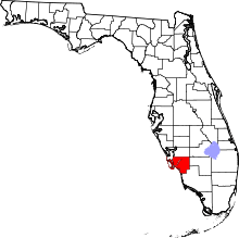
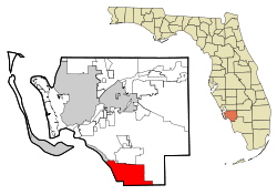 Location in Lee County and the U.S. state of Florida | ||
| Coordinates: 26°20′59″N 81°47′27″W / 26.34972°N 81.79083°WCoordinates: 26°20′59″N 81°47′27″W / 26.34972°N 81.79083°W | ||
| Country | United States | |
| State | Florida | |
| County | Lee | |
| Established | December 31, 1999 | |
| Government | ||
| • Type | Council-Manager | |
| • Mayor | Peter Simmons | |
| • City Manager | Carl Schwing | |
| Area[1] | ||
| • Total | 46.60 sq mi (120.70 km2) | |
| • Land | 38.75 sq mi (100.35 km2) | |
| • Water | 7.86 sq mi (20.34 km2) 13.95% | |
| Elevation | 10 ft (3 m) | |
| Population (2010) | ||
| • Total | 43,914 | |
| • Estimate (2017)[2] | 56,088 | |
| • Density | 1,447.54/sq mi (558.90/km2) | |
| Time zone | UTC-5 (Eastern (EST)) | |
| • Summer (DST) | UTC-4 (EDT) | |
| ZIP codes | 34133-34136 | |
| Area code(s) | 239 | |
| FIPS code | 12-07525 | |
| FIPS code | 12-07525[3] | |
| GNIS feature ID | 0279207[4] | |
| Website | Official website | |

Bonita Springs is a city in Lee County, Florida, United States. The population was 43,914 at the 2010 census.[5] It is part of the Cape Coral-Fort Myers, Florida Metropolitan Statistical Area. The city is located on the southwest coast of the state.
Geography
According to the United States Census Bureau, the city has a total area of 41.0 square miles (106 km2), of which 35.3 square miles (91 km2) is land and 5.7 square miles (15 km2) (13.95%) is water.
The city is located on both Estero Bay and the Gulf of Mexico. The area referred to as Bonita Beach is located on a road-accessible barrier island (Little Hickory Island) that lies between the Gulf of Mexico and Estero Bay. The Imperial River flows through the downtown district of the city and empties out into Estero Bay.
Climate
The city lies in the tropical climate zone, having a mean January temperature of 65 °F (18 °C). Hurricane Charley made landfall north of Bonita Springs on August 13, 2004. Hurricane Wilma made landfall south of Bonita Springs on October 24, 2005. On September 9–10, 2017, Hurricane Irma, at the time a slow moving Category 3 storm, passed over the southwest coast of Florida. The eyewall / eye passed overhead in Bonita Springs. Many structures were damaged or destroyed and the city experienced significant flooding.
Demographics
| Historical population | |||
|---|---|---|---|
| Census | Pop. | %± | |
| 1940 | 356 | — | |
| 1970 | 1,932 | — | |
| 1980 | 5,435 | 181.3% | |
| 1990 | 13,600 | 150.2% | |
| 2000 | 32,797 | 141.2% | |
| 2010 | 43,914 | 33.9% | |
| Est. 2017 | 56,088 | [2] | 27.7% |
| source:[6][7] | |||
As of the census[3] of 2010, there were 43,914 people residing in the city. Household data and density data have not yet been released, but as of the 2009 census estimate, there are 19,233 households, and 12,974 families residing in the city.[8] The population density in 2000 was 929.4 inhabitants per square mile (358.8/km²). There were 31,716 housing units at an average density of 661.1 per square mile (255.2/km²). The 2010 racial makeup of the city was 88.8% White, 0.8% African American, 0.5% Native American, 1% Asian, 0.1% Pacific Islander, 7.3% from other races, and 1.4% from two or more races. Hispanic or Latino of any race were 22.5% of the population.

There were 19,233 households in 2009 out of which 16.7% had children under the age of 18 living with them, 61.2% were married couples living together, 4.1% had a female householder with no husband present, and 32.5% were non-families. 27.1% of all households were made up of individuals and 11.6% had someone living alone who was 65 years of age or older. The average household size was 2.15 and the average family size was 2.55.
In 2000, the city the population was spread out with 13.9% under the age of 18, 5.9% from 18 to 24, 19.8% from 25 to 44, 28.8% from 45 to 64, and 31.7% who were 65 years of age or older. The median age was 54 years. For every 100 females, there were 104.6 males. For every 100 females age 18 and over, there were 103.9 males.
The 2009 estimated median income for a household in the city was $53,452, and the median income for a family was $53,436. Males had a median income of $31,227 versus $25,358 for females. The per capita income for the city was $37,958. About 6.2% of families and 10% of the population were below the poverty line, including 20.2% of those under age 18 and 5.2% of those age 65 or over.
Points of interest
- Center for the Arts of Bonita Springs - an arts organization that hosts local, regional and national traveling art exhibitions; a year long Performance Series featuring jazz, classical and rock music, dance and theater; arts classes in all disciplines and multiple community events. The organization has two campuses, the 10-acre Center for Visual Arts with galleries, studios, classrooms, art library and offices; and 1.8 miles south, the 4-acre Center for Performing Arts that features two auditoriums, black box theater, film center, music rooms and studios for study of performing arts. The organization's Bonita Springs National Art Festivals, ranked high in US are held January, February and March in downtown Historic Bonita Springs.
- Bonita Beach Park - a 2.5-acre (10,000 m2) beachfront park that features a boardwalk and swimming area. Sand dunes and coastal vegetation surround a gazebo and 8 picnic shelters.
- Barefoot Beach Preserve Park - is 342 acres (1.38 km2) of natural land and one of the last undeveloped barrier islands on Florida's southwest coast. It is located on the border of Collier and Lee Counties and accessible by Bonita Beach Road. In 2013, Forbes ranked the park's beach as the sixth best in the United States.[9]
- Little Hickory Island Beach Park.
- There are also 10 beach accesses with public parking located up and down Bonita Beach.
- Bonita Springs is located west of Corkscrew Swamp Sanctuary, a significant Bald Cypress reserve under management of the National Audubon Society.
- Lover's Key State Park, a 1,616-acre (6.54 km2) park made up of four barrier islands, is located within the city and just north of Bonita Beach. The park features nature trails for hiking and bicycling, a canoe launch, kayak and canoe rentals, acres of unspoiled mangroves and miles of pristine beaches. A haven for wildlife, the islands and their waters are home to West Indian Manatees, bottlenose dolphins, roseate spoonbills, marsh rabbits and bald eagles.[10]
- The Everglades Wonder Gardens features a large collection of Florida wildlife including exotic birds, panthers, alligators, flamingos and bears. The facility, originally opened in 1936 as both a wildlife exhibition and a refuge for injured animals, also boasts a botanical garden and a natural history museum.
- The Naples-Fort Myers Greyhound Track is located in Bonita Springs.
- Situated on Big Hickory Island is the Bonita Springs Water Tower. Built in 1982, the water tower stands at 156 feet (48 m). The water tower is best viewed during the day; at night the water tower is illuminated only by a blinking red beacon.
Education
Bonita Springs is served by the Lee County School District.
Transportation
Airports
- Southwest Florida International Airport in nearby South Fort Myers serves over 8 million passengers annually.
- Naples Municipal Airport in Naples is a smaller airport primarily for private aviation
Major highways


Mass transportation
Fixed-route bus and trolley service is provided by the Lee County Transit Department, operated as LeeTran.
Rail
Seminole Gulf Railway owns and operates a line which passes through the city. The company offers freight service and local, daytime excursions.
Media
Newspapers
Bonita Springs is served by local editions of the Fort Myers News-Press and Naples Daily News.
Radio
The metropolitan area is home to 36 radio stations. With an Arbitron-assigned 879,600 listening area population, the metropolitan area of which Bonita Springs is one part ranks 61/274 for the fall of 2013. Arbitron Standard Radio Market: Ft. Myers-Naples-Marco Island.[11]
Television
Nielsen Media Research designated market area: Ft. Myers-Naples.[12]
2013 - 2014 estimate U.S. rank: 62/210 (517,920 TV Homes)
Sister city
References
- ↑ "2017 U.S. Gazetteer Files". United States Census Bureau. Retrieved Sep 20, 2018.
- 1 2 "Population and Housing Unit Estimates". Retrieved March 24, 2018.
- 1 2 "American FactFinder". United States Census Bureau. Archived from the original on September 11, 2013. Retrieved January 31, 2008.
- ↑ "US Board on Geographic Names". United States Geological Survey. October 25, 2007. Retrieved January 31, 2008.
- ↑ "Race, Hispanic or Latino, Age, and Housing Occupancy: 2010 more information 2010 Census Redistricting Data (Public Law 94-171) Summary File". Factfinder2.census.gov. Archived from the original (PDF) on May 20, 2011. Retrieved November 3, 2015.
- ↑ "CENSUS OF POPULATION AND HOUSING (1790-2000)". U.S. Census Bureau. Retrieved July 31, 2010.
- ↑ Census figures enumerated from 1970 to 1990 were prior to incorporation as Bonita Springs CDP.
- ↑
- ↑ Bender, Andrew (May 24, 2013). "America's Top 10 Beaches of 2013". Forbes.com.
- ↑ "DEP confirmation that Lover's Key lies in city limits" (PDF). Dep.state.fl.us. Retrieved November 3, 2015.
- ↑ "Market Survey Schedule & Population Rankings" (PDF). Wargod.arbitron.com. Retrieved November 3, 2015.
- ↑ "Local Television Market Universe Estimates : Comparisons of 2012-13 and 2013-14 Market Ranks" (PDF). Nielsen.com. Retrieved November 3, 2015.
External links
| Wikimedia Commons has media related to Bonita Springs, Florida. |