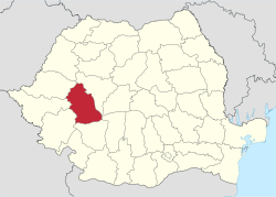
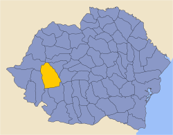
Hunedoara County
| Hunedoara County Județul Hunedoara | ||
|---|---|---|
| County | ||
| ||
 | ||
| Coordinates: 45°47′N 22°56′E / 45.78°N 22.93°ECoordinates: 45°47′N 22°56′E / 45.78°N 22.93°E | ||
| Country | Romania | |
| Development region | Vest | |
| Historical region | Transylvania | |
| Area | ||
| • Total | 7,063 km2 (2,727 sq mi) | |
| Area rank | 9th | |
| Population (2011) | ||
| • Total | 396,253[1] | |
| • Rank | 20th | |
| Telephone code | (+40) 254 or (+40) 354[2] | |
| ISO 3166 code | RO-HD | |
| Website |
County Council Prefecture | |
Hunedoara County (Romanian pronunciation: [huneˈdo̯ara] (![]()
Name
In Hungarian, it is known as Hunyad megye, in German as Kreis Hunedoara, and in Slovak as Hunedoara.
Demographics
In 2011, the county had a population of 396,253 and the population density was 56.1/km².
- Romanians - 93.31%[3]
- Hungarians - 4.09%
- Romani - 1.9%
- Germans (Transylvanian Saxons) - 0.25%
Hunedoara's Jiu River Valley is traditionally a coal-mining region, and its high level of industrialisation drew many people from other regions of Romania in the period before the fall of the communist regime.
| Year | County population[4] |
|---|---|
| 1948 | 306,955 |
| 1956 | |
| 1966 | |
| 1977 | |
| 1992 | |
| 2002 | |
| 2011 |
Geography
This county has a total area of 7,063 km².
Mainly, the relief is made up of mountains, divided by the Mureș River valley which crosses the county from East to West. To the North side there are the Apuseni Mountains and to the South side there are mountains from the Southern Carpathians group, Parâng Mountains group and Retezat-Godeanu Mountains group: Orastie and Surianu Mountains (South-East), Retezat Mountains (South), Poiana Ruscai Mountains (South-West).
Except from the Mureș River with its tributaries Strei, Râul Mare and Cerna which forms wide valleys, in the North side Crișul Alb River also forms a valley in the Apuseni Mountains - Zarand region. In the South side along the Jiu River with its two branches Jiul de Vest and Jiul de Est, there is a large depression, and an accessible route towards Southern Romania - Oltenia..
Neighbours
- Alba County in the East and North.
- Arad County, Timiș County and Caraș-Severin County in the West.
- Gorj County in the South.
Economy
Hunedoara County was one of the most industrialised areas during the communist period, and was very negatively affected when the industry collapsed after the fall of the communist regime.[5]
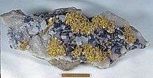
The industry in the Hunedoara county is linked with the mining activity in the region. In the mountains, from ancient times, metals and coal have been exploited. Nowadays, there is one large industrial complex at Hunedoara owned by Mittal Steel. Also energy related enterprises are located in the county - one of the biggest thermoelectric plant is located at Mintia.
The Jiu Valley, located in the south of the country, has been a major mining area throughout the second half of the 19th century and the 20th century, but many mines were closed down in the years following the collapse of the communist regime.
The city of Hunedoara has also suffered significantly from the 1990s onwards - under communism it contained the largest steel works in Romania (until Galați took the lead), but activity gradually diminished after the fall of communism due to the loss of the market. This was a blow to the overall prosperity of the town, which is now recovering through new investments.
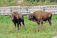
Agricultural activities also take place in Hunedoara county, which include livestock raising, and fruit and cereal cultivation. The county also has touristic potential, especially through the Dacian Fortresses of the Orăștie Mountains and the Corvin Castle.
The predominant industries in the county are:
- Metallurgy.
- Construction materials.
- Textile industry.
- Mining equipment.
- Food industry.
In the 1990s, a large amount of mines were closed down, leaving Hunedoara county with the highest unemployment rate in Romania, of 9.6%, in comparison to the national average of 5.5%.
Tourism

Retezat National Park and other picturesque regions makes it one of the most beautiful counties in Romania. Also there can be found Dacian and Roman complexes in the Orăştie Mountains.
The main tourist attractions in the county are:
- The Dacian Fortresses of the Orăștie Mountains - nowadays part of UNESCO World Heritage.
- Colonia Augusta Ulpia Traiana Dacica Sarmizegetusa - the capital of the Roman province of Dacia.
- The medieval edifices of Densuș, Deva, Hunedoara, Santămaria-Orlea, Strei.
- The Medieval Castle from Hunedoara
- The Medieval Guard Tower from Crivadia
Politics
The Hunedoara County Council, elected at the 2016 local government elections, is made up of 33 counselors, with the following party composition:[6]
| Party | Seats | Current County Council | ||||||||||||||||||
|---|---|---|---|---|---|---|---|---|---|---|---|---|---|---|---|---|---|---|---|---|
| Social Democratic Party | 18 | |||||||||||||||||||
| National Liberal Party | 15 | |||||||||||||||||||
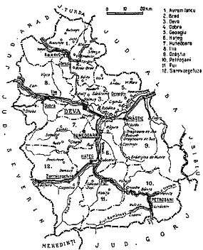
Administrative divisions
Hunedoara County has 7 municipalities, 7 towns and 55 communes. Although Hunedoara County is the most urbanized county in Romania (75% of the population is urban - in 2011)[7] it does not contain any city of more than 100.000 people. Also, following the de-industrialization after the communism fall, the major urban centres in the county, particularly Hunedoara and Petroșani, suffered significant population decline.
- Municipalities
- Brad - population: 13,909 (as of 2011)
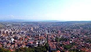
- Deva - capital city; population: 56,647 (as of 2011)
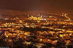
- Hunedoara - population: 55,384 (as of 2011)
- Lupeni - population: 21,986 (as of 2011)
- Orăștie - population: 17,255 (as of 2011)
- Petroșani - population: 34,331 (as of 2011)
- Vulcan - population: 22,906 (as of 2011)
- Towns
- Communes
- Baia de Criș
- Balșa
- Bănița
- Baru
- Băcia
- Băița
- Bătrâna
- Beriu
- Blăjeni
- Boșorod
- Brănișca
- Bretea Română
- Buceș
- Bucureșci
- Bulzeștii de Sus
- Bunila
- Burjuc
- Cerbăl
- Certeju de Sus
- Cârjiți
- Crișcior
- Densuș
- Dobra
- General Berthelot
- Ghelari
- Gurasada
- Hărău
- Ilia
- Lăpugiu de Jos
- Lelese
- Lunca Cernii de Jos
- Luncoiu de Jos
- Mărtinești
- Orăștioara de Sus
- Pestișu Mic
- Pui
- Rapoltu Mare
- Răchitova
- Ribița
- Râu de Mori
- Romos
- Sarmizegetusa
- Sălașu de Sus
- Sântămăria-Orlea
- Șoimuș
- Teliucu Inferior
- Tomești
- Toplița
- Totești
- Turdaș
- Vața de Jos
- Vălișoara
- Vețel
- Vorța
- Zam
Historical county
| Județul Hunedoara | ||
|---|---|---|
| County (Județ) | ||
 The Hunedoara County Prefecture building of the interwar period, currently serving the same function. | ||
| ||
 | ||
| Country |
| |
| Historic region | Transylvania | |
| Capital city (Reședință de județ) | Deva | |
| Established | 1925 | |
| Area | ||
| • Total | 7,695 km2 (2,971 sq mi) | |
| Population (1930) | ||
| • Total | 332,118 | |
| • Density | 43/km2 (110/sq mi) | |
| Time zone | UTC+2 (EET) | |
| • Summer (DST) | UTC+3 (EEST) | |
Historically, the county was located in the central-western part of Greater Romania, in the southwestern part of Transylvania. It included a large part of the present Hunedoara County.
After the administrative unification law in 1925, the name of county remained as it was, but the territory was reorganized. It was bordered on the west by the counties of Severin and Arad, to the north by Turda County, to the east by the counties of Sibiu and Alba, and to the south by the counties of Gorj and Mehedinți.
Administration
The county originally consisted of ten districts (plăṣi):[8]
- Plasa Avram Iancu, headquartered at Avram Iancu
- Plasa Brad, headquartered at Brad
- Plasa Deva, headquartered at Deva
- Plasa Geoagiu, headquartered at Geoagiu
- Plasa Hațeg, headquartered at Hațeg
- Plasa Hunedoara, headquartered at Hunedoara
- Plasa Ilia, headquartered at Ilia
- Plasa Orăștie, headquartered at Orăștie
- Plasa Petroșani, headquartered at Petroșani
- Plasa Pui, headquartered at Pui
Subsequently, two other districts were established:
- Plasa Dobra, headquartered at Dobra
- Plasa Sarmizegetusa, headquartered at Sarmizegetusa
Population
According to the census data of 1930, the county's population was 332,118, of which 82.0% were Romanians, 11.3% Hungarians, 2.5% Germans, 1.5% Romanies, 1.4% Jews, as well as other minorities. In the religious aspect, the population consisted of 64.2% Eastern Orthodox, 18.5% Greek Catholic, 9.1% Roman Catholic, 4.5% Reformed, as well as other minorities.[9]
Urban population
In 1930, the urban population of the county was 41,234, of which 52.8% were Romanians, 30.4% Hungarians, 6.7% Germans, 6.6% Jews, 1.6% Romanies, as well as other minorities. From the religious point of view, the urban population was made up of 42.0% Eastern Orthodox, 25.7% Roman Catholic, 10.5% Greek Catholic, 9.9% Reformed, 6.9% Jewish, 3.5% Lutheran, 1.0% Unitarian, as well as other minorities.[9]
References
| Wikimedia Commons has media related to Hunedoara County. |
- ↑ "POPULAŢIA REŞEDINŢĂ DE JUDEŢ DIN TOTAL POPULAŢIE JUDET" (PDF). Brasov.insse.ro. Retrieved 8 October 2017.
- ↑ The number used depends on the numbering system employed by the phone companies on the market.
- ↑ National Institute of Statistics, "Populația după etnie" Archived August 16, 2009, at the Wayback Machine.
- ↑ National Institute of Statistics, "Populația la recensămintele din anii 1948, 1956, 1966, 1977, 1992 și 2002" Archived September 22, 2006, at the Wayback Machine.
- ↑ "Mărirea şi declinul industriei în Hunedoara. Ce soartă au avut după 1990 cele mai mari întreprinderi din judeţ". Adevural.ro. Retrieved 8 October 2017.
- ↑ "Mandate de CJ pe judete si competitori" (in Romanian). Biroul Electoral Central. 10 June 2016. Retrieved 16 June 2016.
- ↑ "Rezultate definitive ale Recensământului Populaţiei şi al Locuinţelor – 2011" (PDF). Recensamantromania.ro. Retrieved 8 October 2017.
- ↑ Portretul României Interbelice - Județul Hunedoara
- 1 2 Recensământul general al populației României din 29 decemvrie 1930, Vol. II, pag. 633-639