Haripal
| Haripal | |
|---|---|
| Village | |
 Haripal Location in West Bengal, India  Haripal Haripal (India) | |
| Coordinates: 22°49′53″N 88°7′7″E / 22.83139°N 88.11861°ECoordinates: 22°49′53″N 88°7′7″E / 22.83139°N 88.11861°E | |
| Country |
|
| State | West Bengal |
| District | Hooghly |
| Government | |
| • Type | Panchayati raj (India) |
| • Body | Gram panchayat |
| Population (2011) | |
| • Total | 3,395 |
| Languages | |
| • Official | Bengali, English |
| Time zone | UTC+5:30 (IST) |
| ISO 3166 code | IN-WB |
| Vehicle registration | WB |
| Website |
wb |
Haripal is a village in Haripal CD Block in Chandannagore subdivision of Hooghly district in the Indian state of West Bengal.
Geography
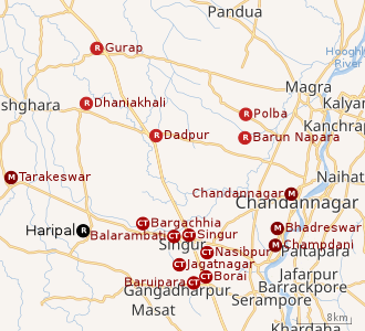 |
| Cities and towns in the Chandannagore subdivision and Polba Dadpur and Dhaniakhali CD Blocks of Chinsurah subdivision in Hooghly district M: municipal corporation/ municipal city/ town, CT: census town, R: rural/ urban centre, Owing to space constraints in the small map, the actual locations in a larger map may vary slightly |
Location
Haripal is located at 22°49′53″N 88°7′7″E / 22.83139°N 88.11861°E.[1]
Police station
Haripal police station has jurisdiction over Haripal CD Block.[2][3]
CD Block HQ
The headquarters of Haripal CD Block are located at Khamarchandi.[4]
Demographics
As per 2011 Census of India Haripal had a total population of 3,395 of which 1,717 (51%) were males and 1,678 (49%) were females. Population below 6 years was 294. The total number of literates in Haripal was 2,704 (87.20% of the population over 6 years).[5]
There are certain villages (2011 census figures in brackets) such as Chandinagar (1,601), Raghubati (1,047), Aminpur (1,454), Khamar Chandi (3,320) and Gopinagar (4,512), with independent identity in census records, adjacent to Haripal and have practically become part of Haripal.[5]
Economy
Around a total of 32 lakh people from all around the city commute to Kolkata daily for work. In the Howrah-Tarakeswar section there are 48 trains that carry commuters from 21 railway stations.[6]
Education
Vivekananda Mahavidyalaya, Haripal, a general degree college, was established at Haripal in 1966. It is affiliated to the University of Burdwan and offers honours courses in Bengali, English, Sanskrit, history, political science, philosophy, geography, education. mathematics, physics, computer science, nutrition, zoology, botany and accountancy.[7][8]
References
- ↑ "Haripal station, Hooghly". Hooghly district. Wikimapia. Retrieved 12 June 2016.
- ↑ "District Statistical Handbook 2014 Hooghly". Tables 2.1, 2.2,. Department of Statistics and Programme Implementation, Government of West Bengal. Retrieved 3 October 2018.
- ↑ "Hooghly District Police". West Bengal Police. Retrieved 20 June 2017.
- ↑ "District Census Handbook: Hugli, Series-20, Part XIIA" (PDF). Map of Hooghly district with CD Block HQs and Police Stations (on the fifth page). Directorate of Census Operations, West Bengal, 2011. Retrieved 20 June 2017.
- 1 2 "C.D. Block Wise Primary Census Abstract Data(PCA)". 2011 census: West Bengal – District-wise CD Blocks. Registrar General and Census Commissioner, India. Retrieved 10 June 2016.
- ↑ Dey, Teesta. "The Suburban Railway Network of Kolkata: A Geographical Apprisal" (PDF). eTraverse, the Indian journal of spatial science, 2012. Retrieved 8 October 2018.
- ↑ "Vivekananda Mahavidyalaya, Haripal". VMH. Retrieved 30 June 2017.
- ↑ "Vivekananda Mahavidyalaya". College Admission. Retrieved 30 June 2017.