Balagarh
| Balagarh | |
|---|---|
| Village | |
 Balagarh Location in West Bengal, India  Balagarh Balagarh (India) | |
| Coordinates: 23°07′21″N 88°27′48″E / 23.122444°N 88.463278°ECoordinates: 23°07′21″N 88°27′48″E / 23.122444°N 88.463278°E | |
| Country |
|
| State | West Bengal |
| District | Hooghly |
| Elevation | 15 m (49 ft) |
| Population (2011) | |
| • Total | 2,365 |
| Languages | |
| • Official | Bengali, English |
| Time zone | UTC+5:30 (IST) |
| PIN | 712501 (Balagarh) |
| Telephone/STD code | 03454 |
| Lok Sabha constituency | Hooghly |
| Vidhan Sabha constituency | Balagarh |
| Website |
hooghly |
Balagarh is a village in Balagarh CD Block in Chinsurah subdivision of Hooghly district in the state of West Bengal, India.
Geography
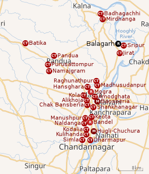 |
| Cities and towns in the Chinsurah subdivision (except Polba Dadpur and Dhaniakhali CD Blocks) in Hooghly district M: municipal city/ town, CT: census town, R: rural/ urban centre, Owing to space constraints in the small map, the actual locations in a larger map may vary slightly |
Location
Balagarh is located at 23°07′21″N 88°27′48″E / 23.122444°N 88.463278°E.
The Balagarh CD Block is mosty part of the Hooghly Flats, one of the three natural regions in the district composed of the flat alluvial plains that form a part of the Gangetic Delta. The region is a narrow strip of land along the 80 km long stretch of the Hooghly River, that forms the eastern boundary of the district.[1]
Police station
Balagarh police station has jurisdiction over Balagarh CD Block.[2][3]
Urbanisation
There are 13 statutory towns and 64 census towns in Hooghly district. The right bank of the Hooghly River has been industrialised over a long period. With foreigners dominating the area’s industry, trade and commerce for over two centuries, it is amongst the leading industrialised districts in the state. At the same time the land is fertile and agricultural production is significant.[4]
In Chinsurah subdivision 68.63% of the population is rural and the urban population is 31.37%. It has 2 statutory and 23 census towns.[5]In Chinsurah Mogra CD Block 64.87% of the population is urban and 35.13% is rural. Amongst the four remaining CD Blocks in the subdivision two were overwhelmingly rural and two were wholly rural.[6]
The map above shows a portion of Chinsurah subdivision. All places marked in the map are linked in the larger full screen map.
Demographics
As per the 2011 Census of India, Balagarh had a total population of 2,365 of which 1,213 (51%) were males and 1,152 (49%) were females. Population below 6 years was 188. The total number of literates in Balagarh was 1,968 (90.40% of the population over 6 years).[6]
Transport
Balagarh is a station on the Bandel-Katwa Branch Line. It is part of the Kolkata Suburban Railway network.[7]
The State Highway 6 (West Bengal), running from Rajnagar (in Birbhum district) to Alampur (in Howrah district) passes through Balagarh.[8]
Education
Balagarh Bijoy Krishna Mahavidyalaya, a general degree college, was established in Jirat, near Balagarh in 1985. It is affiliated with the University of Burdwan and offers honours courses in Bengali, English, political science, history, mathematics and accountancy.[9][10]
Balagarh High School is an another school in Balagarh Block.
References
- ↑ "District Census Handbook: Hugli, Series-20, Part XIIA" (PDF). Physiography, Page 17. Directorate of Census Operations, West Bengal, 2011. Retrieved 27 September 2018.
- ↑ "District Statistical Handbook 2014 Hooghly". Tables 2.1, 2.2,. Department of Statistics and Programme Implementation, Government of West Bengal. Retrieved 20 June 2017.
- ↑ "Hooghly District Police". West Bengal Police. Retrieved 20 June 2017.
- ↑ "District Census Handbook: Hugli, Series-20, Part XIIA" (PDF). Physical features: pages 20, 24. Directorate of Census Operations, West Bengal, 2011. Retrieved 27 September 2018.
- ↑ "District Statistical Handbook 2014 Hooghly". Table 2.1, 2.2, 2.4(a). Department of Statistics and Programme Implementation, Government of West Bengal. Retrieved 27 September 2018.
- 1 2 "C.D. Block Wise Primary Census Abstract Data(PCA)". 2011 census: West Bengal – District-wise CD Blocks. Registrar General and Census Commissioner, India. Retrieved 27 September 2018.
- ↑ "37911 Howrah Katwa Local". Indiarailinfo. Retrieved 4 June 2017.
- ↑ "List of State Highways in West Bengal". West Bengal Traffic Police. Retrieved 20 June 2017.
- ↑ "Balagarh Bijoy Krishna Mahavidyalaya". BBKM. Retrieved 30 June 2017.
- ↑ "Balagarh Bejoy Krishna Mahavidyala". College Admission. Retrieved 30 June 2017.