Hansghara
| Hansghara | |
|---|---|
| Census Town | |
 Hansghara Location in West Bengal, India  Hansghara Hansghara (India) | |
| Coordinates: 23°00′00″N 88°22′23″E / 23.00003°N 88.372969°ECoordinates: 23°00′00″N 88°22′23″E / 23.00003°N 88.372969°E | |
| Country |
|
| State | West Bengal |
| District | Hooghly |
| Population (2011) | |
| • Total | 7,665 |
| Languages | |
| • Official | Bengali, English |
| Time zone | UTC+5:30 (IST) |
| Telephone code | 91 3454 |
| Lok Sabha constituency | Hooghly |
| Vidhan Sabha constituency | Balagarh |
| Website |
hooghly |
Hansghara is a census town in Chinsurah Mogra CD Block in Chinsurah subdivision of Hooghly district in the Indian state of West Bengal.
Geography
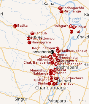 |
| Cities and towns in the Chinsurah subdivision (except Polba Dadpur and Dhaniakhali CD Blocks) in Hooghly district M: municipal city/ town, CT: census town, R: rural/ urban centre, Owing to space constraints in the small map, the actual locations in a larger map may vary slightly |
Location
Hansghara is located at 23°00′00″N 88°22′23″E / 23.00003°N 88.372969°E.[1]
Hansghara, Kola, Alikhoja, Amodghata, Shankhanagar and Chak Bansberia form a cluster of census towns on the eastern side of Bansberia and includes Mogra and Bara Khejuria (outgrowth).[1]
The area is composed of flat alluvial plains that form a part of the Gangetic Delta. The high west bank of the tidal Hooghly River is highly industrialised.[2]
Urbanisation
There are 13 statutory towns and 64 census towns in Hooghly district. The right bank of the Hooghly River has been industrialised over a long period. With the leading European powers dominating the area’s industry, trade and commerce for over two centuries, it is amongst the leading industrialised areas in the state. At the same time the land is fertile and agricultural production is significant.[3]
In Chinsurah subdivision 68.63% of the population is rural and the urban population is 31.37%. It has 2 statutory and 23 census towns.[4]In Chinsurah Mogra CD Block 64.87% of the population is urban and 35.13% is rural. Amongst the four remaining CD Blocks in the subdivision two were overwhelmingly rural and two were wholly rural.[5]
The map alongside shows a portion of Chinsurah subdivision. All places marked in the map are linked in the larger full screen map.
Demographics
As per 2011 Census of India Hansghara had a total population of 7,665 of which 3,936 (51%) were males and 3,729 (49%) were females. Population below 6 years was 760. The total number of literates in Hansghara was 5,795 (83.92% of the population over 6 years).[5]
References
- 1 2 "Census of India 2011, West Bengal: District Census Handbook, Hooghly" (PDF). Map of Chinsurah-Magra CD Block, page 469. Directorate of Census Operations, West Bengal. Retrieved 26 September 2018.
- ↑ "District Census Handbook: Hugli, Series-20, Part XIIA" (PDF). Physiography, Page 17-24. Directorate of Census Operations, West Bengal, 2011. Retrieved 28 September 2018.
- ↑ "District Census Handbook: Hugli, Series-20, Part XIIA" (PDF). Physical features: pages 20, 24. Directorate of Census Operations, West Bengal, 2011. Retrieved 27 September 2018.
- ↑ "District Statistical Handbook 2014 Hooghly". Table 2.1, 2.2, 2.4(a). Department of Statistics and Programme Implementation, Government of West Bengal. Retrieved 27 September 2018.
- 1 2 "C.D. Block Wise Primary Census Abstract Data(PCA)". 2011 census: West Bengal – District-wise CD Blocks. Registrar General and Census Commissioner, India. Retrieved 27 September 2018.