GOES-17
_(cropped).jpg) Processing of GOES-S at Astrotech | |||||||||||||||
| Names | GOES-S | ||||||||||||||
|---|---|---|---|---|---|---|---|---|---|---|---|---|---|---|---|
| Mission type | Meteorology | ||||||||||||||
| Operator | NOAA / NASA | ||||||||||||||
| COSPAR ID | 2018-022A | ||||||||||||||
| SATCAT no. | 43226 | ||||||||||||||
| Website |
goes-r | ||||||||||||||
| Mission duration |
Planned: 15 years Elapsed: 7 months, 16 days | ||||||||||||||
| Spacecraft properties | |||||||||||||||
| Bus | A2100A | ||||||||||||||
| Manufacturer | Lockheed Martin | ||||||||||||||
| Launch mass | 5,192 kg (11,446 lb) | ||||||||||||||
| Dry mass | 2,857 kg (6,299 lb) | ||||||||||||||
| Dimensions | 6.1 × 5.6 × 3.9 m (20 × 18 × 13 ft) | ||||||||||||||
| Power | 4 kW | ||||||||||||||
| Start of mission | |||||||||||||||
| Launch date | 1 March 2018, 22:02 UTC[1] | ||||||||||||||
| Rocket | Atlas V 541 (AV-077)[2] | ||||||||||||||
| Launch site | Cape Canaveral SLC-41 | ||||||||||||||
| Contractor | United Launch Alliance | ||||||||||||||
| Entered service | Planned: September 2018 | ||||||||||||||
| Orbital parameters | |||||||||||||||
| Reference system | Geocentric | ||||||||||||||
| Regime | Geostationary | ||||||||||||||
| Longitude | 137° West[3] | ||||||||||||||
| Slot | GOES-West | ||||||||||||||
| Semi-major axis | 42,064.6 km (26,137.7 mi) | ||||||||||||||
| Eccentricity | 0.0002373 | ||||||||||||||
| Perigee | 35,676.5 km (22,168.3 mi) | ||||||||||||||
| Apogee | 35,696.5 km (22,180.8 mi) | ||||||||||||||
| Inclination | 0.0687 deg | ||||||||||||||
| Period | 1,436.1 minutes | ||||||||||||||
| Epoch | 17 March 2018, 07:55:29 UTC[4] | ||||||||||||||
| |||||||||||||||
|
| |||||||||||||||
GOES-17 (formerly GOES-S) is the second of the current generation of weather satellites operated by the National Oceanic and Atmospheric Administration (NOAA). The four satellites of the series (GOES-16, -17, -T, and -U) will extend the availability of the GOES (Geostationary Operational Environmental Satellite system) until 2036 for weather forecast and meteorology research. The satellite was built by Lockheed Martin, was based on the A2100A platform, and will have an expected useful life of 15 years (10 years operational after five years of standby as an on-orbit replacement).[5] The satellite was launched on 1 March 2018[1] and reached geostationary orbit on 12 March 2018.[6] In May 2018, during the satellite's testing phase after launch, a problem was discovered with its primary instrument, the Advanced Baseline Imager.[7][8]
Launch
.jpg)
The satellite was launched into space on 1 March 2018 by an Atlas V (541) vehicle from Cape Canaveral Air Force Station, Florida.[1] It had a launch mass of 5,192 kg (11,446 lb).[1][9] On 12 March, GOES-17 joined GOES-16 (launched in 2016) in geosynchronous orbit at 22,200 mi (35,700 km) above Earth. GOES-17 will become the GOES-West operational satellite in late 2018.[6]
Objectives
NOAA's GOES-R series of satellites is designed to improve the forecasts of weather, ocean, and environment by providing faster and more detailed data, real-time images of lightning, and advanced monitoring of solar activities and space weather. GOES-17 can collect three times more data at four times image resolution, and scan the planet five times faster than previous probes.
GOES-17 has the same instruments and capabilities as GOES-16 (currently serving as GOES-East), and will complement its work by scanning a different area of the world. GOES-17 will become GOES-West when it moves to 137 degrees west longitude and cover the west coast of the continental US, Alaska, Hawaii, and much of the Pacific Ocean. These two satellites are expected to monitor most of the Western Hemisphere and detect natural phenomena and hazards in almost real time.[6][10]
Its capabilities will allow better:[10]
- fire track and intensity estimation
- detection of low cloud/fog
- tropical cyclone track and intensity forecasts
- monitoring of smoke and dust
- air quality warnings and alerts
- transportation safety and aviation route planning
- advanced monitoring of atmospheric river events that can cause flooding and mudslides
Instruments
The instrument suite of GOES-17 is identical to that of GOES-16. It includes:[11]
Earth sensing
.jpg)
Advanced Baseline Imager
The Advanced Baseline Imager (ABI) was built by Harris Corporation[12] Space and Intelligence Systems (formerly ITT/Exelis) for the GOES-R line of satellites for imaging Earth's weather, climate and environment. Key subcontractors for the ABI instrument included BAE Systems, Babcock Incorporated, BEI Technologies, DRS Technologies, L-3 Communications SSG-Tinsley and Northrop Grumman Space Technology.[13] The imaging capabilities of the ABI is superior to previous imagers in several ways.
Spectral resolution
.gif)
This instrument has 16 bands (11 more than the last GOES imager[14]):
2 Visible Bands:
4 Near IR Bands:
10 other Infrared Bands:
Temporal resolution
This changes depending on the type of image.
- Imaging of entire western hemisphere occurs every 5 to 15 minutes, while previously this was a scheduled event, with at most three photos per hour.[14]
- Imaging of the continental United States once every 5 minutes, compared to one every 15 minutes in previous satellites
- One detailed image over some 1000 by 1000 km box every thirty seconds, a capability previous imagers did not have
Spatial resolution
Spatial resolution will be dependent on what band is being used - band 2 is the highest resolution out of all channels, with a resolution of 500 m (1,600 ft). Channels 1, 3, and 5 will have a resolution of 1 km (0.62 mi), while all other bands in NIR/IR will have a resolution of 2 km (1.2 mi).[15]
Geostationary Lightning Mapper
The Geostationary Lightning Mapper (GLM) is used for measuring lightning (in-cloud and cloud-to-ground) activity. To do this, it considers a single channel in the NIR (777.4 nm) constantly, even during the day, to catch flashes from lightning.
The sensor has a 1372 by 1300 pixel CCD, with an 8-14 km spatial resolution (with the resolution decreasing near the edges of the FOV). The GLM has a frame rate of 2 milliseconds, meaning it considers the entire study area 500 times every second.[16]
Sun imaging
.jpg)
- Solar Ultraviolet Imager (SUVI) for observing coronal holes, solar flares and coronal mass ejection source regions
- Extreme Ultraviolet and X-Ray Irradiance Sensors (EXIS) for monitoring solar irradiance in the upper atmosphere
Space environment measuring
.png)
- Space Environment In-Situ Suite (SEISS) for monitoring proton, electron and heavy ion fluxes at geosynchronous orbit
- Magnetometer (MAG) for the space environment magnetic field that controls charged particle dynamics in the outer region of the magnetosphere
Transponders
- The Geostationary Search and Rescue (GEOS&R) for relaying distress signals from users in difficulty to search and rescue centers
- Data Collection and Interrogation Service (DCIS) for data collection from in-situ Data Collection Platforms
Malfunction
On 23 May 2018 NOAA announced that there were problems with the cooling system of the ABI.[7][8] Due to the cooling failure, infrared and near-infrared imaging was only possible 12 hours per day. The issue affects 13 of the infrared and near-infrared channels on the instrument. No other sensors of the satellite are affected.
During a media conference call on 24 July 2018,[17] the problem component was identified as the loop heat pipe, which transports heat from the cryocooler and ABI to radiators.[18] The degraded performance of this component means the ABI gets hotter than intended, which lowers the sensitivity of the infrared sensors. The GOES-R System Program Director, Pam Sullivan,[19] said on the conference call that preliminary projections suggested that via thermal mitigation measures such as changing the spacecraft alignment, ABI performance could be significantly improved, depending on the season. The orbit of the spacecraft brings the ABI into full sunlight more often around the equinoxes, resulting in more solar radiation being absorbed by the ABI and degrading the performance of the infrared channels, with projections indicating that 10 of the 16 channels will be available 24 hours a day, with the other six channels available for "most of the day, to varying degrees, depending on their wavelength.[17]" Around the solstices, the orbit alignment is such that the ABI receives less direct sunlight, and it is projected that 13 of the 16 channels will be available 24 hours a day with the other three channels available 20 or more hours per day.
The loop heat pipe was manufactured by Orbital ATK (now owned by Northrop Grumman). NOAA is working with Northrop Grumman to identify exactly what caused the loop heat pipe to fail, using engineering-grade copies of the spacecraft components for testing.[17] Possible causes mentioned in the conference call included debris or foreign objects inside the heat pipe, or an improper amount of propylene coolant. If a redesign of the loop heat pipe proves to be necessary, the launch of the next two units of the GOES-R series, GOES-T and GOES-U, may be delayed as a result.[17] Despite the problem with the ABI, NOAA's intention is to transition GOES-17 into operational status as originally scheduled in September 2018.
References
- 1 2 3 4 Graham, William (1 March 2018). "ULA Atlas V successfully launches with GOES-S". NASASpaceFlight.com. Retrieved 1 March 2018.
- ↑ "AV-077". Spaceflight Now. Archived from the original on 4 March 2018. Retrieved 7 March 2017.
- ↑ "Satellite: GOES-S". OSCAR. World Meteorological Organization. 2 March 2018. Retrieved 4 March 2018.
- ↑ "GOES S - Orbit". Heavens-Above. 17 March 2018. Retrieved 18 March 2018.
- ↑ "Mission Overview". GOES-R.gov. NOAA. Retrieved 1 August 2016.
- 1 2 3 "GOES-S Reaches Geostationary Orbit". NOAA. 12 March 2018. Retrieved 18 March 2018.
- 1 2 "Scientists Investigate GOES-17 Advanced Baseline Imager Performance Issue". NOAA: Satellite and Information Service. NOAA. Retrieved 23 May 2018.
- 1 2 Johnson, Scott (23 May 2018). "Newest NOAA weather satellite suffers critical malfunction". Ars Technica. Retrieved 23 May 2018.
- ↑ Ray, Justin (22 August 2016). "Sophisticated new U.S. weather observatory being readied for launch". Spaceflight Now. Retrieved 19 October 2016.
- 1 2 "GOES-R Series Mission". NOAA. Retrieved 16 March 2018.
- ↑ "GOES-R Series Satellites Spacecraft and Instruments". NASA. Retrieved 16 March 2018.
- ↑ https://www.harris.com/content/goes-r-advanced-baseline-imager
- ↑ "ITT Passes Review for GOES-R Advanced Baseline Imager". GIM international (Press release). Geomares Publishing. 27 February 2007. Retrieved 17 September 2018.
- 1 2 https://www.goes-r.gov/spacesegment/abi.html
- ↑ https://journals.ametsoc.org/doi/pdf/10.1175/BAMS-D-15-00230.1
- ↑ http://gpm.cptec.inpe.br/portal/pdf/relatorios/anexo14_2013.pdf
- 1 2 3 4 "GOES-17 ABI Media Call recording" (audio). NOAA NESDIS. 24 July 2018. Retrieved 25 July 2018.
- ↑ "GOES-17 Loop Heat Pipe Fact Sheet" (PDF). NOAA NESDIS. 24 July 2018. Retrieved 25 July 2018.
- ↑ "Program Team - GOES-R Series". GOES-R.gov. Retrieved 26 July 2018.
External links
| Wikimedia Commons has media related to GOES S. |
- Official website
- GOES-R Series by NOAA/NESDIS
| SMS (predecessor) | 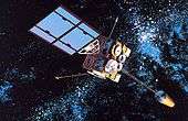 | |
|---|---|---|
| SMS derived | ||
| 1st generation | ||
| 2nd generation | ||
| 3rd generation | ||
| 4th generation | ||