ICESat
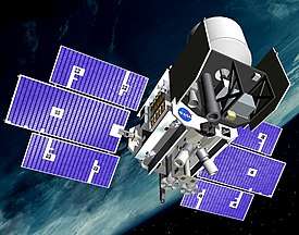 Artist's impression of ICESat in orbit | |
| Mission type | Remote sensing |
|---|---|
| Operator | NASA |
| COSPAR ID | 2003-002A |
| SATCAT no. | 27642 |
| Website |
icesat |
| Mission duration | Final: 7 years, 1 month |
| Spacecraft properties | |
| Bus | BCP-2000[1] |
| Manufacturer | Ball Aerospace[1] |
| Launch mass | 970 kg (2,140 lb) |
| Dimensions | 2 × 2 × 3.1 m (6.6 × 6.6 × 10.2 ft) |
| Power | 640 W |
| Start of mission | |
| Launch date | 13 January 2003, 00:45 UTC[2] |
| Rocket | Delta II 7320-10 D294 |
| Launch site | Vandenberg SLC-2W |
| End of mission | |
| Declared | February 2010[3] |
| Deactivated | 14 August 2010, 17:37 UTC[3] |
| Decay date |
30 August 2010, 08:49 UTC[4] 71°N 37°E / 71°N 37°E |
| Orbital parameters | |
| Reference system | Geocentric |
| Regime | Low Earth |
| Perigee | 586 kilometers (364 mi)[1] |
| Apogee | 594 kilometers (369 mi)[1] |
| Inclination | 94.0 degrees[1] |
| Period | 96.6 minutes |
|
Mission logo | |
ICESat (Ice, Cloud, and land Elevation Satellite) was a satellite mission for measuring ice sheet mass balance, cloud and aerosol heights, as well as land topography and vegetation characteristics. It operated as part of NASA's Earth Observing System. ICESat was launched 13 January 2003 on a Delta II rocket from Vandenberg Air Force Base in California into a near-circular, near-polar orbit with an altitude of approximately 600 km. It operated for seven years before being retired in February 2010, after its scientific payload shut down and scientists were unable to restart it.[5]
The ICESat mission was designed to provide elevation data needed to determine ice sheet mass balance as well as cloud property information, especially for stratospheric clouds common over polar areas. It provides topography and vegetation data around the globe, in addition to the polar-specific coverage over the Greenland and Antarctic ice sheets. The satellite was found useful in assessing important forest characteristics, including tree density.[6]
Satellite instruments
The sole instrument on ICESat was the Geoscience Laser Altimeter System (GLAS), a space-based LIDAR. GLAS combined a precision surface LIDAR with a sensitive dual-wavelength cloud and aerosol LIDAR. The GLAS lasers emit infrared and visible laser pulses at 1064 and 532 nm wavelengths. As ICESat orbited, GLAS produces a series of approximately 70 m diameter laser spots that are separated by nearly 170 m along the spacecraft's ground track. During the commissioning phase of the mission, the ICESat was placed into an orbit which allowed the ground track to repeat every 8 days. During August and September 2004, the satellite was maneuvered into a 91-day repeating ground track for the main portion of the mission.
Operational history
ICESat was designed to operate for three to five years. Testing indicated that each GLAS laser should last for two years, requiring GLAS to carry three lasers in order to fulfil the nominal mission length. During the initial on orbit test operation, a pump diode module on the first GLAS laser failed prematurely on 29 March 2003. A subsequent investigation indicated that a corrosive degradation of the pump diodes, due to an unexpected but known reaction between indium solder and gold bonding wires,[7] had possibly reduced the reliability of the lasers. Consequentially, the total operational life for the GLAS instrument was expected to be as little as less than a year as a result. After the two months of full operation in the fall of 2003, the operational plan for GLAS was changed, and it was operated for one-month periods out of every three to six months in order to extend the time series of measurements, particularly for the ice sheets.[8] The last laser failed on 11 October 2009, and following attempts to restart it, the satellite was retired in February 2010.[5] Between 23 June and 14 July, the spacecraft was manoeuvred into a lower orbit in order to speed up orbital decay. On 14 August 2010 it was decommissioned,[9] and at 08:49 UTC on 30 August 2010 it reentered the atmosphere.[4][10]
Follow-on satellite
A follow-on mission, ICESat-2, was developed by NASA to continue studying polar ice changes, and the biomass and carbon in vegetation.[11] The satellite was launched on 15 September 2018 aboard a Delta II rocket.[12] For the period of time in between the two satellites, NASA's Operation IceBridge used a Douglas DC-8 aircraft as a stopgap to measure ice thickness and collect other data.[13]
References
- 1 2 3 4 5 Krebs, Gunter. "ICESAT (EOS-LAM)". Gunter's Space Page. Retrieved 31 August 2010.
- ↑ McDowell, Jonathan. "Launch Log". Jonathan's Space Report. Retrieved 31 August 2010.
- 1 2 "ICESat Mission Status Report". NASA/Goddard Space Flight Center. 17 August 2010. Archived from the original on 16 September 2018.
- 1 2 "Decay Data: IceSat". Space-Track. 30 August 2010. Retrieved 18 September 2018.
- 1 2 Clark, Stephen (25 February 2010). "ICESat mission complete after seven years in orbit". Spaceflight Now. Retrieved 25 February 2010.
- ↑ "Space laser spies for woodpeckers". BBC News. 17 December 2010.
- ↑ "Laser Diode Pump Assembly". NASA. Archived from the original on 14 March 2004.
- ↑ Schutz, B. E.; Zwally, H. J.; Shuman, C. A.; Hancock, D.; DiMarzio, J. P. (2005). "Overview of the ICESat Mission" (PDF). Geophys. Res. Lett. 32: L21S01. Bibcode:2005GeoRL..3221S01S. doi:10.1029/2005GL024009.
- ↑ "NASA's Successful Ice Cloud and Land Elevation Mission Comes to an End". NASA. 27 August 2010. Retrieved 31 August 2010.
- ↑ Clark, Stephen (30 August 2010). "ICESat takes a plunge to conclude successful mission". Spaceflight Now. Retrieved 31 August 2010.
- ↑ "ICESat-2". NASA Goddard Space Flight Center. 26 October 2011. Retrieved 5 November 2011.
- ↑ Foust, Jeff (15 September 2018). "Final Delta 2 launches ICESat-2". SpaceNews. Retrieved 5 October 2018.
- ↑ Deamer, Kacey (19 May 2017). "NASA's IceBridge Mission Ends Its 'Best Year Ever'". Space.com. Retrieved 5 October 2018.
External links
| Wikimedia Commons has media related to ICESat. |
- ICESat by NASA's Goddard Space Flight Center
- ICESat/GLAS by the Center for Space Research, University of Texas
Further reading
- Webb, Charles E.; et al. (June 2013). "The Ice, Cloud and land Elevation Satellite (ICESat): Summary Mission Timeline and Performance Relative to Pre-Launch Mission Success Criteria" (PDF). NASA. TM-2013-217512.