Sentinel-1
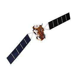 Model of a Sentinel 1 (radar antenna missing) | |||
| Manufacturer |
| ||
|---|---|---|---|
| Operator | European Space Agency | ||
| Applications | Land and sea monitoring, natural disasters mapping, sea ice observations, ships detection | ||
| Specifications | |||
| Spacecraft type | Satellite | ||
| Constellation | 2 | ||
| Design life | 7 years | ||
| Launch mass | 2,300 kg (5,100 lb) | ||
| Dry mass | 2,170 kg (4,780 lb) | ||
| Dimensions | 3.9 m × 2.6 m × 2.5 m (13 ft × 8.5 ft × 8.2 ft) | ||
| Power | 5.9 kilowatts (5,900 W)[2] | ||
| Batteries | 324 Ah | ||
| Production | |||
| Status | Active | ||
| Built | 1 | ||
| On order | 2 | ||
| Launched | 2 | ||
| Operational | 1 | ||
| First launch | Sentinel-1A (3 April 2014)[3] | ||
| Last launch | Sentinel-1D (TBD) | ||
| Related spacecraft | |||
| Subsatellite of | Copernicus Programme | ||
| |||
Sentinel-1 is the first of the Copernicus Programme satellite constellation conducted by the European Space Agency.[4] This space mission is composed of two satellites, Sentinel-1A and Sentinel-1B, that carry a C-band synthetic-aperture radar instrument which provides a collection of data in all-weather, day or night.
On 12 March 2010, the European Space Agency and Thales Alenia Space signed a contract worth €270 million to build the second satellite of the Sentinel-1 pair.
The first satellite, Sentinel-1A, launched on 3 April 2014, and Sentinel-1B was launched on 25 April 2016. Both satellites lifted off from the same location in Kourou, French Guiana, and each on a Soyuz rocket.[5] Sentinel-1C and 1D are in development with launch dates to be determined.
There are a wide range of applications for the data collected via the Sentinel-1 mission. A few of these uses include sea and land monitoring, emergency response due to environmental disasters, and economic applications.
Instruments
Sentinel-1 spacecraft are designed to carry the following instruments:[6]
- A single C-band synthetic-aperture radar (C-SAR) with its electronics. This instrument provides 1 dB radiometric accuracy with a central frequency at 5.405 GHz.[7]
- An SDRAM-based Data Storage and Handling Assembly (DSHA), with an active data storage capacity of about 1,443 Gbit (168 GiB), receiving data streams from SAR-SES over two independent links gathering SAR_H and SAR_V polarization, with a variable data rate up to 640 Mbit/s on each link, and providing 520 Mbit/s X-band fixed-user data-downlink capability over two independent channels towards ground.
Characteristics
Specifications of the Sentinel-1 satellites:[7]
- 7 year lifetime (12 years for consumables)
- Launcher: Soyuz
- Near-polar (98.18°) Sun-synchronous orbit
- 693 km (431 mi) altitude
- 12-day repeat cycle
- 175 revolutions per cycle
- 98.6 minute orbital period
- 3-axis altitude stabilization
- 2,300 kg (5,100 lb) launch mass
- 3.9 m × 2.6 m × 2.5 m (12.8 ft × 8.5 ft × 8.2 ft) dimensions
Operational/acquisition modes
Sentinel-1 has four operational modes:[7][8][9]
- Strip Map (SM) Mode features 5-by-5-metre (16 by 16 ft) spatial resolution and an 80 km (50 mi) swath.
- The sole uses of SM are to monitor small islands as well as emergency management for extraordinary events upon request
- Offers data products in single (HH or VV) or double (HH + HV or VV + VH) polarization
- Interferometric Wide Swath (IW) Mode features 5-by-20-metre (16 by 66 ft) spatial resolution and a 250 km (160 mi) swath.
- IW is the main operational mode over land
- IW accomplishes interferometry through burst synchronization
- Offers data products in single (HH or VV) or double (HH + HV or VV + VH) polarization
- Extra Wide Swath (EW) Mode features 25-by-100-metre (82 by 328 ft) spatial resolution and a 400 km (250 mi) swath.
- EW is used mainly to monitor wide coastal areas for phenomena such as shipping traffic and potential environmental hazards like oil spills or changes in sea ice.
- Offers data products in single (HH or VV) or double (HH + HV or VV + VH) polarization
- Wave (WV) Mode features 5-by-20-metre (16 by 66 ft) resolution and a low data rate. It produces 20 by 20 km (12 by 12 mi) sample images along the orbit at intervals of 100 km (62 mi).[7]
- This is the main operational mode over open ocean.
- Offers data products only in single (HH or VV) polarization
Data products
Sentinel-1 has four types of data products:[8]
- Raw Level 0 data
- Processed Level 1 Single Look Complex (SLC) data:
- Complex images with phase and amplitude of specified areas
- Ground Range Detected (GRD) Level 1 data:
- Only systematically distributed multi-looked intensity
- Level 2 Ocean (OCN) data:
- Systematically distributed data of ocean's geophysical parameters
Applications
Sentinel-1 will provide continuity of data from the ERS and Envisat missions, with further enhancements in terms of revisit, coverage, timeliness and reliability of service.
A summary of the main applications of Sentinel-1 include:[10]
- Marine monitoring
- Sea-ice levels and conditions
- Ocean oil spills
- Ship activity
- Marine winds
- Land monitoring
- Agriculture
- Forestry
- Emergency response
- Flooding
- Landslide and volcanic
- Earthquakes
- Shortly after the August 2014 South Napa earthquake, data collected by Sentinel-1A was used to develop an interferometric synthetic-aperture radar, or InSAR, image of the affected region. The Sentinel-1 satellites are expected to make analysis of earthquakes using InSAR techniques quicker and simpler.[11]
Industrial
The prime contractor of the mission is Thales Alenia Space Italy, with whole system integration and also with production of platform Spacecraft Management Unit (SMU) and payload Data Storage and Handling Assembly (DSHA). Sentinel-1A was constructed in Rome, Italy. Other technologies such as the T/R modules, the C-band synthetic-aperture radar antenna, the advanced data management and transmission subsystems, and the on-board computer, were developed in L'Aquila and Milan.[12] The C-SAR instrument is the responsibility of Astrium Gmbh.
The ground segment prime contractor is Astrium with subcontractors Telespazio, WERUM, Advanced Computer Systems and Aresys. Final test verification of the satellite was completed at Thales Alenia Space's clean rooms in Rome and Cannes.[12]
Spacecraft
- Sentinel-1A – launched on 3 April 2014[3]
- Sentinel-1B – launched on 25 April 2016[3]
- Sentinel-1C – development contract signed with Thales Alenia Space of Italy in December 2015, launch date TBD[13]
- Sentinel-1D – development contract signed with Thales Alenia Space of Italy in December 2015, launch date TBD[13]
Gallery
Examples of images produced from Sentinel-1 data.
 Thunderstorms over Estonia. False colour RGB image of VV-, VH- and VV+VH-polarisation backscatter.
 Lake Success region, California. False colour RGB image of scans from two different dates.
 Ice movement in Alert, Canada. False colour RGB image of scans from three different months.
 Interferometry reveals a crack in the Larsen Ice Shelf, Antarctica.
References
- ↑ "Sentinel 1". Earth Online. European Space Agency. Retrieved 17 August 2014.
- ↑ "Sentinel 1 Datasheet" (PDF). ESA. August 2013. Retrieved 17 August 2014.
- 1 2 3 "Earth Online – Sentinel 1". European Space Agnecy. Retrieved 3 April 2014.
- ↑ "Sentinel-1". Sentinel Online. European Space Agency. Retrieved 21 March 2018.
- ↑ "Soyuz overview". Arianespace. Retrieved 21 March 2018.
- ↑ "Sentinel-1: Instrument Payload". Sentinel Online. European Space Agency. Retrieved 7 March 2017.
- 1 2 3 4 Attema, Evert; et al. (August 2007). "Sentinel-1: The Radar Mission for GMES Operational Land and Sea Services" (PDF). Bulletin. European Space Agency. 131: 10–17.
- 1 2 "User Guides - Sentinel-1 SAR - Acquisition Modes". Sentinel Online. European Space Agency. Retrieved 12 March 2018.
- ↑ "Sentinel 1 Data Access and Products". European Space Agency. March 2015. Retrieved 11 March 2018.
- ↑ "User Guides - Sentinel-1 SAR - Applications". Sentinel Online. European Space Agency. Retrieved 22 March 2018.
- ↑ Amos, Jonathan (2 September 2014). "Sentinel system pictures Napa quake". BBC News. Retrieved 2 September 2014.
- 1 2 "Sentinel-1A Arrives at Launch Site in French Guiana". Thales Group. 24 February 2014. Retrieved 15 March 2018.
- 1 2 "Decolla la space economy italiana" [Take off of the Italian space economy] (in Italian). Airpress. Retrieved 15 December 2015.
External links
| Wikimedia Commons has media related to Sentinel-1. |
- Sentinel-1 at ESA's Sentinel Online
- Sentinel-1 at ESA's Earth Online
- Sentinel-1 at ESA's Observing the Earth
- Sentinel-1 Scientific Data Hub by ESA
- Sentinel-1 fact sheet by the European Union
- Copernicus Programme
| Sentinel satellites |
| | |||||||
|---|---|---|---|---|---|---|---|---|---|
| Contributing missions |
| ||||||||
| |||||||||||||||
| |||||||||||||||
| Telecommunications |
| ||||||||||||||
Technology demonstrators | |||||||||||||||
| Cancelled and proposed | |||||||||||||||
| Failed | |||||||||||||||