HaiYang
HaiYang (Chinese: 海洋; "ocean"), abbreviated HY, is a series of marine remote sensing satellites developed and operated by China since 2002. As of September 2018, four satellites were launched and four more are planned.[1][2] The HaiYang series is operated by NSOAS (National Satellite Ocean Application Service), a subordinate agency of the State Oceanic Administration.

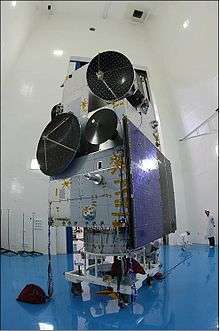
HY-2A Launching Time
Alternate view of the HY-2A spacecraft
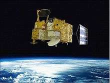
Artist's view of the deployed HY-2A spacecraft
Current and previous satellites
| Launch date | Satellites | Vehicle | Orbit | In use | Sensors |
|---|---|---|---|---|---|
| 2002-05-15 | HY-1A | CZ-4B | SSO | No | COCTS (Chinese Ocean Color and Temperature Scanner), CZI (Coastal Zone Imager) |
| 2007-04-11 | HY-1B | CZ-2C | SSO | Yes | COCTS (Chinese Ocean Color and Temperature Scanner), CZI (Coastal Zone Imager) |
| 2011-08-16 | HY-2A | CZ-4B | SSO | Yes | MWRI (Microwave Radiometer Imager), RA (Radar Altimeter), Ku-RFSCAT (Ku-Band Rotational Fan-beam Scatterometer) |
| 2018-09-06 | HY-1C | CZ-2C | SSO | Yes | Detection of chlorophyll, sediment concentrations and dissolved organic matter. Surface temperature measurements.[3] |
Data Applications
See also
References
- ↑ Krebs, Gunter. "HY 1A, 1B, 1C, 1D". Gunter's Space Page. Retrieved 9 September 2018.
- ↑ Krebs, Gunter. "HY 2A, 2B, 2C, 2D". Gunter's Space Page. Retrieved 9 September 2018.
- ↑ IANS (7 September 2018). "China launches new marine satellite HY-1C on Long March-2C rocket". Financial Express. Retrieved 9 September 2018.
- ↑ HaiYang Satellite Products
- ↑ AVISO+ current missions HY-2
External links
- Haiyang satellite programme (in Chinese)
This article is issued from
Wikipedia.
The text is licensed under Creative Commons - Attribution - Sharealike.
Additional terms may apply for the media files.