McPherson Square station
McPherson Square | |||||||||||||||||||||
|---|---|---|---|---|---|---|---|---|---|---|---|---|---|---|---|---|---|---|---|---|---|
|
| |||||||||||||||||||||
 | |||||||||||||||||||||
| Location |
1400 I Street, Northwest Washington, D.C. 20005 | ||||||||||||||||||||
| Owned by | Washington Metropolitan Area Transit Authority | ||||||||||||||||||||
| Line(s) |
| ||||||||||||||||||||
| Platforms | 2 side platforms | ||||||||||||||||||||
| Tracks | 2 | ||||||||||||||||||||
| Connections |
| ||||||||||||||||||||
| Construction | |||||||||||||||||||||
| Structure type | Underground | ||||||||||||||||||||
| Bicycle facilities | 1 rack | ||||||||||||||||||||
| Disabled access | Yes | ||||||||||||||||||||
| Other information | |||||||||||||||||||||
| Station code | C02 | ||||||||||||||||||||
| History | |||||||||||||||||||||
| Opened | July 1, 1977 | ||||||||||||||||||||
| Traffic | |||||||||||||||||||||
| Passengers (2017) |
13,247 daily [1] | ||||||||||||||||||||
| Services | |||||||||||||||||||||
| |||||||||||||||||||||
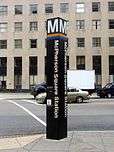
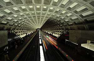
McPherson Square is a side platformed Washington Metro station in Downtown Washington, D.C., United States. The station is operated by the Washington Metropolitan Area Transit Authority (WMATA). Providing service for the Blue, Silver, and Orange Lines, the station is located between McPherson Square and Franklin Square, with two entrances on I Street at Vermont Avenue and 14th Street NW. This is the main station to access the White House, and the Vermont Avenue exit is directly underneath the Department of Veterans Affairs building.
The station opened on July 1, 1977.[2] Its opening coincided with the completion of 11.8 miles (19.0 km)[3] of rail between National Airport and RFK Stadium and the opening of the Arlington Cemetery, Capitol South, Crystal City, Eastern Market, Farragut West, Federal Center SW, Federal Triangle, Foggy Bottom–GWU, L'Enfant Plaza, National Airport, Pentagon, Pentagon City, Potomac Avenue, Rosslyn, Smithsonian and Stadium–Armory stations.[4] Orange Line service to the station began upon the line's opening on November 20, 1978.[5]
Station layout
| G | Street level | Exit/entrance |
| M | Mezzanine | One-way faregates, ticket machines, station agent |
| P Platform level |
Side platform, doors will open on the right | |
| Westbound | ← ← ← | |
| Eastbound | → → | |
| Side platform, doors will open on the right | ||
Notable places nearby
References
- ↑ "Metrorail Average Weekday Passenger Boardings" (PDF). WMATA. Retrieved August 28, 2018.
- ↑ Feaver, Douglas B. (July 1, 1977), "Today, Metro could be U.S. model", The Washington Post, p. A1
- ↑ "Metro Facts 2017" (PDF). Washington Metropolitan Area Transit Authority. 2017. Retrieved January 23, 2018.
- ↑ Staff Reporters (June 24, 1977), "Metro's newest stations: Where they are, what's nearby", The Washington Post
- ↑ Eisen, Jack; Feinstein, John (November 18, 1978), "City-County fanfare opens Orange Line; Ceremonies open new Orange Line", The Washington Post, p. D1
External links
![]()
- WMATA: McPherson Square Station
- StationMasters Online: McPherson Square Station
- McPherson Square (Washington Metro) is at coordinates:
- 38°54′04″N 77°02′05″W / 38.901162°N 77.034853°W Vermont Avenue Entrance
- 38°54′04″N 77°01′56″W / 38.901111°N 77.032206°W 14th Street Entrance
- Vermont Avenue entrance from Google Maps Street View
- 14th Street entrance from Google Maps Street View
Coordinates: 38°54′4.8″N 77°1′59.8″W / 38.901333°N 77.033278°W