Fairfield Township, Westmoreland County, Pennsylvania
| Fairfield Township, Westmoreland County, Pennsylvania | |
|---|---|
| Township | |
.jpg) A view from Fairfield Township with Chestnut Ridge in the distance | |
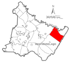 Map of Westmoreland County, Pennsylvania Highlighting Fairfield Township | |
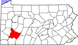 Map of Pennsylvania highlighting Westmoreland County | |
| Country | United States |
| State | Pennsylvania |
| County | Westmoreland |
| Settled | 1769 |
| Incorporated | April 6, 1773 |
| Area[1] | |
| • Total | 61.59 sq mi (159.52 km2) |
| • Land | 61.38 sq mi (158.96 km2) |
| • Water | 0.22 sq mi (0.56 km2) |
| Population (2010) | |
| • Total | 2,424 |
| • Estimate (2016)[2] | 2,382 |
| • Density | 38.81/sq mi (14.98/km2) |
| Time zone | UTC-5 (Eastern (EST)) |
| • Summer (DST) | UTC-4 (EDT) |
| FIPS code | 42-129-24608 |
| Website | http://www.fairfieldtwp.com |
Fairfield Township is a township in Westmoreland County, Pennsylvania, United States. The population was 2,536 at the 2000 census.
History
The Ross Furnace was listed on the National Register of Historic Places in 1991.[3]
Geography
According to the United States Census Bureau, the township has a total area of 60.8 square miles (157 km2), of which, 60.5 square miles (157 km2) of it is land and 0.3 square miles (0.78 km2) of it (0.48%) is water.
Demographics
| Historical population | |||
|---|---|---|---|
| Census | Pop. | %± | |
| 2010 | 2,424 | — | |
| Est. 2016 | 2,382 | [2] | −1.7% |
| U.S. Decennial Census[4] | |||
As of the census[5] of 2000, there were 2,536 people, 950 households, and 737 families residing in the township. The population density was 41.9 people per square mile (16.2/km²). There were 1,141 housing units at an average density of 18.9/sq mi (7.3/km²). The racial makeup of the township was 98.74% White, 0.39% African American, 0.28% Native American, 0.04% Asian, 0.08% from other races, and 0.47% from two or more races. Hispanic or Latino of any race were 0.43% of the population.
There were 950 households out of which 31.2% had children under the age of 18 living with them, 65.9% were married couples living together, 8.3% had a female householder with no husband present, and 22.4% were non-families. 19.5% of all households were made up of individuals and 10.2% had someone living alone who was 65 years of age or older. The average household size was 2.61 and the average family size was 2.97.
In the township the population was spread out with 24.6% under the age of 18, 6.5% from 18 to 24, 29.1% from 25 to 44, 26.1% from 45 to 64, and 13.8% who were 65 years of age or older. The median age was 39 years. For every 100 females, there were 103.9 males. For every 100 females age 18 and over, there were 98.0 males.
The median income for a household in the township was $32,927, and the median income for a family was $37,177. Males had a median income of $37,422 versus $23,750 for females. The per capita income for the township was $18,284. About 12.1% of families and 15.5% of the population were below the poverty line, including 23.5% of those under age 18 and 9.2% of those age 65 or over.
References
- ↑ "2016 U.S. Gazetteer Files". United States Census Bureau. Retrieved Aug 14, 2017.
- 1 2 "Population and Housing Unit Estimates". Retrieved June 9, 2017.
- ↑ National Park Service (2010-07-09). "National Register Information System". National Register of Historic Places. National Park Service.
- ↑ "Census of Population and Housing". Census.gov. Retrieved June 4, 2016.
- ↑ "American FactFinder". United States Census Bureau. Archived from the original on 2013-09-11. Retrieved 2008-01-31.
| Counties |  Map of the Pittsburgh Tri-State with green counties in the metropolitan area and yellow counties in the combined area. | |
|---|---|---|
| Major cities | ||
| Cities and towns 15k-50k (in 2010) | ||
| Airports | ||
| Topics | ||
| ||
Coordinates: 40°23′00″N 79°07′59″W / 40.38333°N 79.13306°W