Donegal Township, Westmoreland County, Pennsylvania
| Donegal Township, Westmoreland County, Pennsylvania | |
|---|---|
| Township | |
 Post office at Jones Mills | |
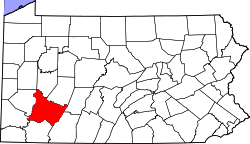
 Map of Westmoreland County, Pennsylvania Highlighting Donegal Township | |
 Map of Pennsylvania highlighting Westmoreland County | |
| Country | United States |
| State | Pennsylvania |
| County | Westmoreland |
| Incorporated | April 6, 1773 |
| Area[1] | |
| • Total | 49.26 sq mi (127.58 km2) |
| • Land | 49.13 sq mi (127.25 km2) |
| • Water | 0.13 sq mi (0.33 km2) |
| Population (2010) | |
| • Total | 2,403 |
| • Estimate (2016)[2] | 2,344 |
| • Density | 47.71/sq mi (18.42/km2) |
| Time zone | UTC-5 (Eastern (EST)) |
| • Summer (DST) | UTC-4 (EDT) |
| FIPS code | 42-129-19480 |
| Website | http://www.donegaltownship.com |
Donegal Township is a township in Westmoreland County, Pennsylvania, United States. The population was 2,442 at the 2000 census.
It was named after the town and county of Donegal in Ireland.[3]
Geography
According to the United States Census Bureau, the township has a total area of 49.2 square miles (127 km2), of which, 49.1 square miles (127 km2) of it is land and 0.1 square miles (0.26 km2) of it (0.28%) is water.
The township includes the following communities: Franklin, Hopewell, Horners Mill, Jones Mills, Kregar, and Myersbrook. Donegal Township surrounds, but does not include, the borough of Donegal, which is a separate municipality.
Demographics
| Historical population | |||
|---|---|---|---|
| Census | Pop. | %± | |
| 2010 | 2,403 | — | |
| Est. 2016 | 2,344 | [2] | −2.5% |
| U.S. Decennial Census[4] | |||
As of the census[5] of 2000, there were 2,442 people, 950 households, and 691 families residing in the township. The population density was 49.7 people per square mile (19.2/km²). There were 1,207 housing units at an average density of 24.6/sq mi (9.5/km²). The racial makeup of the township was 99.26% White, 0.12% African American, 0.04% Asian, 0.20% from other races, and 0.37% from two or more races. Hispanic or Latino of any race were 0.74% of the population.
There were 950 households out of which 29.7% had children under the age of 18 living with them, 61.5% were married couples living together, 6.5% had a female householder with no husband present, and 27.2% were non-families. 24.6% of all households were made up of individuals and 10.9% had someone living alone who was 65 years of age or older. The average household size was 2.47 and the average family size was 2.90.
In the township the population was spread out with 22.5% under the age of 18, 6.3% from 18 to 24, 28.8% from 25 to 44, 26.2% from 45 to 64, and 16.1% who were 65 years of age or older. The median age was 41 years. For every 100 females, there were 105.0 males. For every 100 females age 18 and over, there were 106.9 males.
The median income for a household in the township was $29,741, and the median income for a family was $33,750. Males had a median income of $29,196 versus $25,529 for females. The per capita income for the township was $14,764. About 8.0% of families and 12.1% of the population were below the poverty line, including 12.3% of those under age 18 and 12.1% of those age 65 or over.
References
- ↑ "2016 U.S. Gazetteer Files". United States Census Bureau. Retrieved Aug 14, 2017.
- 1 2 "Population and Housing Unit Estimates". Retrieved June 9, 2017.
- ↑ Gannett, Henry (1905). The Origin of Certain Place Names in the United States. Govt. Print. Off. p. 107.
- ↑ "Census of Population and Housing". Census.gov. Retrieved June 4, 2016.
- ↑ "American FactFinder". United States Census Bureau. Archived from the original on 2013-09-11. Retrieved 2008-01-31.
External links
| Counties |  Map of the Pittsburgh Tri-State with green counties in the metropolitan area and yellow counties in the combined area. | |
|---|---|---|
| Major cities | ||
| Cities and towns 15k-50k (in 2010) | ||
| Airports | ||
| Topics | ||
| ||
Coordinates: 40°05′00″N 79°18′59″W / 40.08333°N 79.31639°W