Cochise County, Arizona
| Cochise County, Arizona | |||
|---|---|---|---|
| County | |||
| County of Cochise | |||
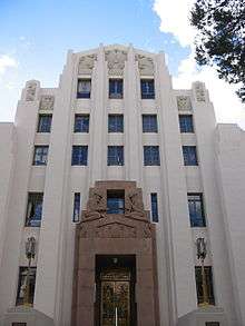 The art deco county courthouse in Bisbee | |||
| |||
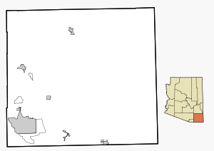
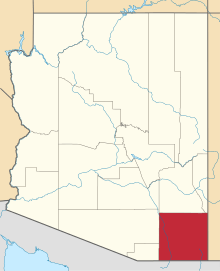 Location in the U.S. state of Arizona | |||
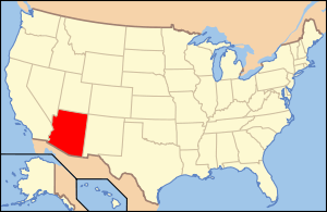 Arizona's location in the U.S. | |||
| Founded | February 1, 1881 | ||
| Named for | Cochise | ||
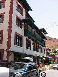
| Seat | Bisbee | ||
| Largest city | Sierra Vista | ||
| Area | |||
| • Total | 6,219 sq mi (16,107 km2) | ||
| • Land | 6,166 sq mi (15,970 km2) | ||
| • Water | 53 sq mi (137 km2), 0.9% | ||
| Population (est.) | |||
| • (2016) | 125,770 | ||
| • Density | 21/sq mi (8/km2) | ||
| Congressional district | 2nd | ||
| Time zone | Mountain: UTC−7 | ||
| Website |
www | ||

Cochise County is located in the southeastern corner of the U.S. state of Arizona. The population was 131,346 at the 2010 census.[1] The county seat is Bisbee.[2]
Cochise County comprises the Sierra Vista-Douglas, AZ Metropolitan Statistical Area. The county borders southwestern New Mexico and northeastern Sonora in Mexico.
History
In 1528 Spanish Explorers: Alvar Nunez Cabeza de Vaca, Estevanico, and Fray Marcos de Niza[3] survived a shipwreck off Texas coast. Captured by Native Americans they spent 8 years finding way back to Mexico City, via the San Pedro Valley. Their journals, maps, and stories lead to the Cibola, seven cities of gold myth. The Expedition of Francisco Vásquez de Coronado in 1539 using it as his route north through what they called the Guachuca Mountains of Pima[4] (Tohono O'odham) lands and later part of the mission routes north, but was actually occupied by the Sobaipuri descendants of the Hohokam. They found a large Pueblo (described as a small city) between Benson and Whetstone, and several smaller satellite villages and smaller pueblos including ones on Fort Huachuca, Huachuca City and North Eastern Fry. About 1657 Father Kino visited the Sobaipuris [5]just before the Apache forced most from the valley, as they were struggling to survive due to increasing Chiricahua Apache attacks as they moved into the area of Texas Canyon in the Dragoon Mountains. In 1776 The Presidio Santa Cruz de Terrante[6] was founded on the West bank of the San Pedro River, to protect the natives as well as the Spanish settlers who supplied the mission stations, but it was chronically short on provisions from raids, and lack of personnel to adequately patrol the eastern route due to wars with France and England, so the main route north shifted west to the Santa Cruz valley, farther from the Chiricahua Apache's ranges who almost exclusively controlled the area by 1821.[5][7]
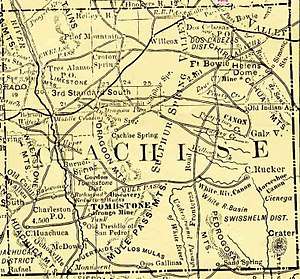
Cochise County was created on February 1, 1881, out of the eastern portion of Pima County.[8] It took its name from the legendary Chiricahua Apache war chief Cochise.[9][10] The county seat was Tombstone until 1929 when it moved to Bisbee. Notable men who once held the position of County Sheriff were Johnny Behan, who served as the first sheriff of the new county, and who was one of the main characters during the events leading to and following the Gunfight at the O.K. Corral. Later, in 1886, Texas John Slaughter became sheriff. Lawman Jeff Milton and lawman/outlaw Burt Alvord both served as deputies under Slaughter.
A syndicated television series which aired from 1956 to 1958, Sheriff of Cochise starring John Bromfield, was filmed in Bisbee. The Jimmy Stewart movie Broken Arrow and subsequent television show of the same name starring John Lupton, which also aired from 1956 to 1958, took place (but was not filmed) in Cochise County.
J.A. Jance's Joanna Brady mystery series takes place in Cochise County, with Brady being the sheriff.
Beginning in the late 1950s, the small community of Miracle Valley was the site of a series of bible colleges and similar religious organizations, founded by television evangelist A. A. Allen. In 1982, Miracle Valley and neighboring Palominas were the site of a series of escalating conflicts between a newly arrived religious community and the county sheriff and deputies that culminated in the Miracle Valley shootout.
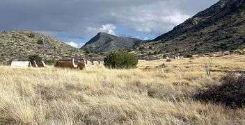
Geography
According to the U.S. Census Bureau, the county has a total area of 6,219 square miles (16,110 km2), of which 6,166 square miles (15,970 km2) is land and 53 square miles (140 km2) (0.9%) is water.[11] Cochise County is close to the size of the States of Rhode Island and Connecticut combined.
Adjacent counties and municipios
- Santa Cruz County – southwest
- Pima County – west
- Graham County – north
- Greenlee County – northeast
- Hidalgo County, New Mexico – east
- Agua Prieta, Sonora, Mexico – south
- Cananea, Sonora, Mexico – south
- Naco, Sonora, Mexico – south
- Santa Cruz, Sonora, Mexico – south
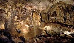
Protected areas
Demographics
| Historical population | |||
|---|---|---|---|
| Census | Pop. | %± | |
| 1890 | 6,938 | — | |
| 1900 | 9,251 | 33.3% | |
| 1910 | 34,591 | 273.9% | |
| 1920 | 46,465 | 34.3% | |
| 1930 | 40,998 | −11.8% | |
| 1940 | 34,627 | −15.5% | |
| 1950 | 31,488 | −9.1% | |
| 1960 | 55,039 | 74.8% | |
| 1970 | 61,910 | 12.5% | |
| 1980 | 85,686 | 38.4% | |
| 1990 | 97,624 | 13.9% | |
| 2000 | 117,755 | 20.6% | |
| 2010 | 131,346 | 11.5% | |
| Est. 2016 | 125,770 | [12] | −4.2% |
| U.S. Decennial Census[13] 1790–1960[14] 1900–1990[15] 1990–2000[16] 2010–2016[1] | |||
2000 census
As of the 2000 census, there were 117,755 people, 43,893 households, and 30,768 families residing in the county. The population density was 19 people per square mile (7/km²). There were 51,126 housing units at an average density of 8 per square mile (3/km²). The racial makeup of the county was 76.66% White, 4.52% Black or African American, 1.15% Native American, 1.65% Asian, 0.26% Pacific Islander, 12.05% from other races, and 3.72% from two or more races. 30.69% of the population were Hispanic or Latino of any race. 25.35% reported speaking Spanish at home, while 1.31% speak German .
There were 43,893 households out of which 32.00% had children under the age of 18 living with them, 55.10% were married couples living together, 11.10% had a female householder with no husband present, and 29.90% were non-families. 25.30% of all households were made up of individuals and 10.10% had someone living alone who was 65 years of age or older. The average household size was 2.55 and the average family size was 3.07.
In the county, the population was spread out with 26.30% under the age of 18, 9.30% from 18 to 24, 26.00% from 25 to 44, 23.70% from 45 to 64, and 14.70% who were 65 years of age or older. The median age was 37 years. For every 100 females there were 101.60 males. For every 100 females age 18 and over, there were 101.20 males.
The median income for a household in the county was $32,105, and the median income for a family was $38,005. Males had a median income of $30,533 versus $22,252 for females. The per capita income for the county was $15,988. About 13.50% of families and 17.70% of the population were below the poverty line, including 25.80% of those under age 18 and 10.40% of those age 65 or over.
In 2000, the largest denominational group was the Catholics (with 25,837 adherents) and Evangelical Protestants (with 12,548 adherents).[17] The largest religious bodies were The Catholic Church (with 25,837 members) and The Southern Baptist Convention (with 5,999 members).[17]
2010 census
As of the 2010 United States Census, there were 131,346 people, 50,865 households, and 33,653 families residing in the county.[18] The population density was 21.3 inhabitants per square mile (8.2/km2). There were 59,041 housing units at an average density of 9.6 per square mile (3.7/km2).[19] The racial makeup of the county was 78.5% white, 4.2% black or African American, 1.9% Asian, 1.2% American Indian, 0.3% Pacific islander, 9.9% from other races, and 4.0% from two or more races. Those of Hispanic or Latino origin made up 32.4% of the population.[18] The largest ancestry groups were:[20]
- 28.3% Mexican
- 16.2% German
- 11.6% Irish
- 9.8% English
- 4.5% American
- 3.7% Italian
- 2.6% French
- 2.1% Scottish
- 2.0% Dutch
- 1.9% Scotch-Irish
- 1.9% Polish
- 1.5% Norwegian
- 1.1% Puerto Rican
- 1.1% Swedish
Of the 50,865 households, 30.4% had children under the age of 18 living with them, 50.0% were married couples living together, 11.5% had a female householder with no husband present, 33.8% were non-families, and 28.2% of all households were made up of individuals. The average household size was 2.46 and the average family size was 3.02. The median age was 39.7 years.[18]
The median income for a household in the county was $44,876 and the median income for a family was $53,077. Males had a median income of $42,164 versus $31,019 for females. The per capita income for the county was $23,010. About 11.8% of families and 15.7% of the population were below the poverty line, including 23.2% of those under age 18 and 10.7% of those age 65 or over.[21]
Politics
Cochise County leans strongly towards the Republican Party in Presidential elections. Although Bill Clinton carried the county narrowly in 1992, it has supported the Republican candidate by large margins in every other election since 1968, except for 1996 and 1976 when Clinton and Jimmy Carter each lost only narrowly. Although the county includes the relatively liberal town of Bisbee, as well as the city of Douglas, which has a large Latino population, this is outweighed by the heavily Republican tilt of the more populous Sierra Vista, which is adjacent to Fort Huachuca and thus has a heavy military presence.
| Year | Republican | Democrat | Others |
|---|---|---|---|
| 2016 | 56.2% 28,092 | 34.9% 17,450 | 9.0% 4,473 |
| 2012 | 60.0% 29,497 | 37.7% 18,546 | 2.4% 1,158 |
| 2008 | 59.1% 29,026 | 38.6% 18,943 | 2.3% 1,112 |
| 2004 | 59.6% 26,556 | 39.3% 17,514 | 1.2% 525 |
| 2000 | 54.7% 18,180 | 40.2% 13,360 | 5.1% 1,701 |
| 1996 | 45.0% 14,365 | 43.2% 13,782 | 11.8% 3,776 |
| 1992 | 36.8% 12,202 | 38.3% 12,701 | 24.9% 8,247 |
| 1988 | 56.4% 15,815 | 42.1% 11,812 | 1.5% 423 |
| 1984 | 62.3% 16,405 | 36.7% 9,671 | 1.1% 279 |
| 1980 | 59.5% 13,351 | 31.3% 7,028 | 9.2% 2,066 |
| 1976 | 49.9% 9,921 | 46.7% 9,281 | 3.4% 681 |
| 1972 | 64.0% 11,706 | 32.9% 6,023 | 3.1% 570 |
| 1968 | 45.6% 7,619 | 39.5% 6,597 | 14.9% 2,495 |
| 1964 | 45.8% 7,644 | 54.2% 9,045 | 0.1% 8 |
| 1960 | 50.5% 7,572 | 49.4% 7,419 | 0.1% 16 |
| 1956 | 56.4% 6,893 | 43.6% 5,328 | 0.1% 9 |
| 1952 | 53.5% 6,495 | 46.5% 5,640 | |
| 1948 | 37.2% 3,854 | 59.8% 6,198 | 3.1% 318 |
| 1944 | 32.7% 3,371 | 67.2% 6,935 | 0.1% 13 |
| 1940 | 26.5% 3,170 | 73.2% 8,748 | 0.3% 32 |
| 1936 | 19.9% 2,092 | 77.4% 8,130 | 2.6% 277 |
| 1932 | 25.3% 2,838 | 69.5% 7,798 | 5.2% 580 |
| 1928 | 57.3% 5,776 | 42.3% 4,262 | 0.5% 45 |
| 1924 | 38.3% 3,712 | 36.0% 3,496 | 25.7% 2,491 |
| 1920 | 54.7% 5,341 | 45.3% 4,430 | |
| 1916 | 31.6% 3,203 | 60.4% 6,115 | 8.0% 814 |
| 1912 | 8.7% 403 | 42.7% 1,973 | 48.6% 2,243[lower-alpha 1] |
In the United States House of Representatives, the county is part of Arizona's 2nd congressional district, which is represented by Republican Martha McSally; the majority of the district’s population is in Tucson and its suburbs, which tend to be more moderate than Cochise County. In the Arizona Legislature, the county is part of the 14th district and is represented by Republican Gail Griffin in the State Senate and Republicans David Gowan and David Stevens in the State House of Representatives. This district also includes the entirety of Graham County and Greenlee County, as well as portions of Pima County.
Transportation
Major highways
Airports
Bisbee Municipal Airport is owned by the City of Bisbee and located five nautical miles (9 km) southeast of its central business district[24]
Sierra Vista Municipal Airport (IATA: FHU, ICAO: KFHU, FAA LID: FHU), a joint-use civil-military airport which shares facilities with Libby Army Airfield, is located on Fort Huachuca in Sierra Vista, a city and U.S. Army installation in Cochise County, Arizona, United States. The airport has three runways and one helipad. It is mostly used for military aviation for the surrounding military base.
There are no commercial flights out of Cochise County; the nearest commercial airport is at Tucson approximately 70 miles from Sierra Vista.
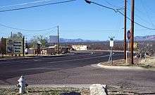
Communities
Cities
Towns
Ghost towns
Census-designated places
Other places
- Ash Creek
- Amber
- Babocomari
- Cascabel
- Charleston
- Cochise
- Contention City
- Courtland
- Dos Cabezas
- Double Adobe
- El Dorado
- Fairbank
- Gleeson
- Hereford
- Hilltop
- Hookers Hot Springs
- Kansas Settlement
- Leslie Canyon National Wildlife refuge
- Nicksville
- Paul Spur
- Pearce
- Pomerene
- Portal
- Paradise
- Rucker
- Stewart District
- Sunnyside
- Sunsites
- Tintown
- Tres Alamos
Military sites
- Fort Huachuca
- Willcox Playa (proving ground)
County population ranking
The population ranking of the following table is based on the 2010 census of Cochise County.[25][26]
† county seat
| Rank | City/Town/etc. | Population (2010 Census) | Municipal type | Incorporated |
|---|---|---|---|---|
| 1 | Sierra Vista | 43,888 | City | 1956 |
| 2 | Douglas | 17,378 | City | 1905 |
| 3 | Sierra Vista Southeast | 14,797 | CDP | |
| 4 | † Bisbee | 5,575 | City | 1902 |
| 5 | Benson | 5,105 | City | 1880 (founded) |
| 6 | Willcox | 3,757 | City | 1915 |
| 7 | Whetstone | 2,617 | CDP | |
| 8 | Huachuca City | 1,853 | Town | 1958 |
| 9 | Mescal | 1,812 | CDP | |
| 10 | Pirtleville | 1,744 | CDP | |
| 11 | St. David | 1,699 | CDP | |
| 12 | Tombstone | 1,380 | City | 1881 |
| 13 | Naco | 1,046 | CDP | |
| 14 | Miracle Valley | 644 | CDP | |
| 15 | Elfrida | 459 | CDP | |
| 16 | Bowie | 449 | CDP | |
| 17 | Sunizona | 281 | CDP | |
| 18 | McNeal | 238 | CDP | |
| 19 | Palominas | 212 | CDP | |
| 20 | Dragoon | 209 | CDP | |
| 21 | San Simon | 165 | CDP |
See also
Notes
- ↑ This comprises 1,396 votes (30.2%) for Progressive Theodore Roosevelt, 819 votes (18.3%) for Socialist Eugene V. Debs, and 28 votes (0.6%) for Prohibition Party candidate Eugene W. Chafin.
References
- 1 2 "State & County QuickFacts". United States Census Bureau. Retrieved May 18, 2014.
- ↑ "Find a County". National Association of Counties. Archived from the original on 2011-05-31. Retrieved 2011-06-07.
- ↑ A pictorial history of Sierra Vista, Arizona : more than a city, a way of life. Tritz, Judith,. [Place of publication not identified]: Pediment Pub. 2006. ISBN 1597250589. OCLC 74175599.
- ↑ Smith, Cornelius C (1981). FORT HUACHUCA: The story of a frontier post. U.S Government Printing Office: Superintendent of Documents, U.S. Government Printing Office, Washington, D.C. 20402.
- 1 2 Jackson., Price, Ethel (2003). Sierra Vista : young city with a past. Charleston, SC: Arcadia. ISBN 0738524344. OCLC 53882709.
- ↑ "Fr. Kino's Visits to the San Pedro". www.saguaro-juniper.com. Retrieved 2018-03-14.
- ↑ "Journey to Cochise County: Explore the lives and Stories of those who have make Cochise County their home". The Cochise County Historical Journal. Cochise County Historical Society along with the Smithsonian Museum to accompany the Main Street traveling exhibit "Journey Stories" February 22-April 5, 2014. Volume 45, Number 1. Spring/Summer 2015. Check date values in:
|date=(help) - ↑ "Arizona Cultural Inventory Project". Retrieved 29 December 2014.
- ↑ "Cochise County Arizona". County Website. Cochise County. 2009. Retrieved 2009-09-25.
- ↑ "Reminiscence of Early Days" (jpg). Tombstone (AZ) Weekly Epitaph. 27 Oct 1912. p. 4. Retrieved 28 Jul 2015 – via Newspapers.com.
I feel a paternal pride in Cochise county, for one Sunday 31 years ago, in the little law office of Will Hunsaker and myself in Tombstone, the committee selected the name, and I was one of the godfathers at the christening. Harry Wood, editor of the Tombstone Nugget, suggested the name in honor of the territorial Apache chief as a fitting companion to the dismal name of its county seat.

- ↑ "2010 Census Gazetteer Files". United States Census Bureau. August 23, 2012. Retrieved August 23, 2015.
- ↑ "Population and Housing Unit Estimates". Retrieved June 9, 2017.
- ↑ "U.S. Decennial Census". United States Census Bureau. Archived from the original on May 12, 2015. Retrieved May 18, 2014.
- ↑ "Historical Census Browser". University of Virginia Library. Retrieved May 18, 2014.
- ↑ "Population of Counties by Decennial Census: 1900 to 1990". United States Census Bureau. Retrieved May 18, 2014.
- ↑ "Census 2000 PHC-T-4. Ranking Tables for Counties: 1990 and 2000" (PDF). United States Census Bureau. Retrieved May 18, 2014.
- 1 2 "County Membership Reports". thearda.com. Archived from the original on 2011-07-12. Retrieved 2011-08-22.
- 1 2 3 "DP-1 Profile of General Population and Housing Characteristics: 2010 Demographic Profile Data". United States Census Bureau. Retrieved 2016-01-20.
- ↑ "Population, Housing Units, Area, and Density: 2010 – County". United States Census Bureau. Retrieved 2016-01-20.
- ↑ "DP02 SELECTED SOCIAL CHARACTERISTICS IN THE UNITED STATES – 2006–2010 American Community Survey 5-Year Estimates". United States Census Bureau. Retrieved 2016-01-20.
- ↑ "DP03 SELECTED ECONOMIC CHARACTERISTICS – 2006–2010 American Community Survey 5-Year Estimates". United States Census Bureau. Retrieved 2016-01-20.
- ↑ "Dave Leip's Atlas of United States Presidential Elections". Retrieved 2011-06-11.
- ↑ Scammon, Richard M. (compiler); America at the Polls: A Handbook of Presidential Election Statistics 1920–1964; pp. 42–44 ISBN 0405077114
- ↑ FAA Airport Master Record for P04 (Form 5010 PDF)
- ↑ Center for New Media and Promotions(C2PO). "2010 Census". Archived from the original on 21 December 2013. Retrieved 29 December 2014.
- ↑ Geographic Products Branch. "2010 Census Block Maps – Geography – U.S. Census Bureau". Retrieved 29 December 2014.
External links
Places adjacent to Cochise County, Arizona | ||||||||||
|---|---|---|---|---|---|---|---|---|---|---|
| ||||||||||
Rural outlaw cowboys and allies vs. business owners, townspeople, and the law | ||||||
| Supporting rural interests |
|  | ||||
| Supporting town interests |
| |||||
| Conflicts and events | ||||||
| Locations | ||||||
Coordinates: 31°52′50″N 109°45′13″W / 31.88056°N 109.75361°W