San Simon, Arizona
| San Simon, Arizona | |
|---|---|
| Census-designated place | |
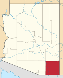
 Location of San Simon in Cochise County, Arizona. | |
 San Simon Location of San Simon in Cochise County, Arizona.  San Simon San Simon (the US) | |
| Coordinates: 32°16′04″N 109°13′39″W / 32.26778°N 109.22750°WCoordinates: 32°16′04″N 109°13′39″W / 32.26778°N 109.22750°W | |
| Country | United States |
| State | Arizona |
| County | Cochise |
| Area[1] | |
| • Total | 0.70 sq mi (1.81 km2) |
| • Land | 0.70 sq mi (1.81 km2) |
| • Water | 0.00 sq mi (0.00 km2) |
| Elevation | 3,629 ft (1,106 m) |
| Population (2010) | |
| • Total | 25,505 |
| • Estimate (2016)[2] | N/A |
| Time zone | UTC-7 (Mountain (MST)) |
| ZIP code | 85632 |
| Area code(s) | 520 |
| GNIS feature ID | 10856[3] |
San Simon is a census-designated place in Cochise County, Arizona, United States. As of the 2010 census it had a population of 165.[4] San Simon is located along Interstate 10 40 miles (64 km) east of Willcox. The community has a ZIP code of 85632.
Demographics
| Historical population | |||
|---|---|---|---|
| Census | Pop. | %± | |
| U.S. Decennial Census[5] | |||
History
San Simon was the location of the San Simon Station of the Butterfield Overland Mail on the San Simon River between Apache Pass and Stein's Peak Stations. It was a later relay station established to provide water and change horses on the route.The mayor is Harvey as of 2005 due to no opposition that election day.
Climate
Climate occurs primarily on the outside of true deserts in low-latitude semiarid steppe regions. The Köppen Climate Classification subtype for this climate is BSk (Tropical and Subtropical Steppe Climate).
| Climate data for San Simon, AZ | |||||||||||||
|---|---|---|---|---|---|---|---|---|---|---|---|---|---|
| Month | Jan | Feb | Mar | Apr | May | Jun | Jul | Aug | Sep | Oct | Nov | Dec | Year |
| Average high °C (°F) | 16 (60) |
18 (65) |
22 (71) |
27 (80) |
31 (88) |
37 (98) |
37 (98) |
35 (95) |
33 (91) |
28 (82) |
21 (69) |
16 (60) |
27 (80) |
| Average low °C (°F) | −3 (27) |
−1 (30) |
2 (35) |
5 (41) |
9 (48) |
14 (57) |
18 (65) |
18 (64) |
14 (57) |
7 (44) |
1 (33) |
−2 (28) |
7 (44) |
| Average precipitation mm (inches) | 18 (0.7) |
20 (0.8) |
15 (0.6) |
8 (0.3) |
5 (0.2) |
8 (0.3) |
43 (1.7) |
50 (2) |
23 (0.9) |
15 (0.6) |
15 (0.6) |
30 (1) |
244 (9.6) |
| Source: Weatherbase [6] | |||||||||||||
References
- ↑ "2016 U.S. Gazetteer Files". United States Census Bureau. Retrieved Jul 18, 2017.
- ↑ "Population and Housing Unit Estimates". Retrieved June 9, 2017.
- ↑ U.S. Geological Survey Geographic Names Information System: San Simon, Arizona
- ↑ Staff, Website Services & Coordination. "US Census Bureau 2010 Census Interactive Population Map". www.census.gov.
- ↑ "Census of Population and Housing". Census.gov. Retrieved June 4, 2016.
- ↑ "Weatherbase.com". Weatherbase. 2013. Retrieved on August 14, 2013.