Ayun Pa
| Ayun Pa Thị xã Ayun Pa | |
|---|---|
| District-level town (Class-4) | |
 Ayun Pa | |
| Coordinates: 13°23′38″N 108°26′27″E / 13.39389°N 108.44083°ECoordinates: 13°23′38″N 108°26′27″E / 13.39389°N 108.44083°E | |
| Country |
|
| Region | Central Highlands |
| Province | Gia Lai |
| Area | |
| • District-level town (Class-4) | 111 sq mi (287 km2) |
| • Urban | 6.670 sq mi (17.275 km2) |
| Population (2007) | |
| • District-level town (Class-4) | 35,058 |
| • Density | 320/sq mi (122/km2) |
| • Urban | 21,613 |
| • Urban density | 3,240/sq mi (1,251/km2) |
| Time zone | UTC+07:00 (Indochina Time) |
Ayun Pa is a district-level town (thị xã) in Gia Lai Province, in the Central Highlands of Vietnam. It used to be known as Cheo Reo after 1975. Ayun Pa covers an area of 287 km², with a population of 35,058 (2007). The town is situated in the south-eastern part of Gia Lai Province. To the east and north-east is Ia Pa District, to the south-east is Krông Pa District, to the south is Ea H'leo District, to the west is Phú Thiện District.
Ayun Pa town has 8 subdivisions, including 4 urban wards (phường): Cheo Reo, Hòa Bình, Đoàn Kết, Sông Bờ, and communes (xã): Ia RTô, Chư Băh, Ia Rbol and Ia Sao.
| Đắk Lắk Province | 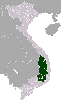 | |
|---|---|---|
| Đắk Nông Province | ||
| Gia Lai Province | ||
| Kon Tum Province | ||
| Lâm Đồng Province | ||
※ denotes provincial seat. | ||
This article is issued from
Wikipedia.
The text is licensed under Creative Commons - Attribution - Sharealike.
Additional terms may apply for the media files.