Cát Tiên District
| Cát Tiên | |
|---|---|
| District | |
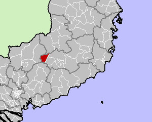 Location in Lâm Đồng Province | |
| Country |
|
| Region | Central Highlands |
| Province | Lâm Đồng |
| Capital | Cát Tiên |
| Area | |
| • Total | 428 km2 (165 sq mi) |
| Population (2003) | |
| • Total | 41,706 |
| Time zone | UTC+7 (UTC + 7) |
Cát Tiên is a district (huyện) of Lâm Đồng Province in the Central Highlands region of Vietnam.
As of 2003 the district had a population of 41,706[1] and includes the historic centre with one of the greatest concentrations of the Mạ people. The district covers an area of 428 km². The district capital lies at Cát Tiên.[1]
The district is in the southwest of the province. The northern edge border Đăk R'Lấp (in Đắk Nông Province), the northwest and west border Bù Đăng in Bình Phước Province, the south borders Tân Phú District, Đồng Nai, the east borderd Đạ Tẻh và Bảo Lâm. The upper sources of the Đồng Nai River are in the district. The Đa Dâng River is the northern, southern and western boundary of the district.
The district consists of small mountains and hills as the Central Highlands dissipates into plains. The average elevation is 400 m. The soil is rich and moist. The area is often flooded during the monsoon.
The northern sector of Cát Tiên National Park, called Cát Loc, is in the district as is the Cat Tien archaeological site.
As of 2018, the district is divided into two townships (Cát Tiên and Phước Cát) and nine communes (Đồng Nai Thượng, Đức Phổ, Gia Viễn, Mỹ Lâm, Nam Ninh, Phước Cát 2, Quảng Ngãi, Tiên Hoàng, and Tư Nghĩa.)[2]
91% of the population works in agriculture. The most important crops are soybeans, strawberries, wheat. Buffaloes can also be seen grazing in the area.
The district was created in 1987 due to the division of Đạ Huoai into the districts of Đạ Huoai, Đạ Tẻh and Cát Tiên.
See also
References
- 1 2 "Districts of Vietnam". Statoids. Retrieved 13 March 2009.
- ↑ "UBTVQH xem xét thành lập một số thị xã, thị trấn mới" (in Vietnamese). 12 April 2018. Retrieved 19 April 2018.
Coordinates: 11°40′01″N 107°19′59″E / 11.667°N 107.333°E
| Đắk Lắk Province | 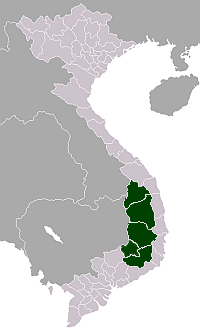 | |
|---|---|---|
| Đắk Nông Province | ||
| Gia Lai Province | ||
| Kon Tum Province | ||
| Lâm Đồng Province | ||
※ denotes provincial seat. | ||