Chanditala
| Chanditala | |
|---|---|
| Village | |
 Chanditala Location in West Bengal, India  Chanditala Chanditala (India) | |
| Coordinates: 22°41′27″N 88°15′58″E / 22.6909°N 88.2662°ECoordinates: 22°41′27″N 88°15′58″E / 22.6909°N 88.2662°E | |
| Country |
|
| State | West Bengal |
| District | Hooghly |
| Nearest City | Serampore |
| Government | |
| • Body | Gram panchayat |
| Population (2011) | |
| • Total | 3,984 |
| Languages | |
| • Official | Bengali, English |
| Time zone | UTC+5:30 (IST) |
| ISO 3166 code | IN-WB |
| Vehicle registration | WB |
| Lok Sabha constituency | Serampore |
| Vidhan Sabha constituency | Chanditala |
| Website |
wb |
Chanditala is a village in Chanditala II community development block of Srirampore subdivision in Hooghly District in the Indian state of West Bengal.[1]
Geography
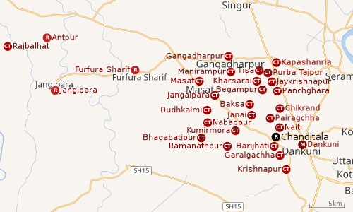 |
| Cities and towns in Chanditala I, Chanditala II and Jangipara CD Blocks in Srirampore subdivision in Hooghly district M: municipal city/ town, CT: census town, R: rural/ urban centre, Owing to space constraints in the small map, the actual locations in a larger map may vary slightly |
Location
Chanditala is located at 22°41′27″N 88°15′58″E / 22.6909°N 88.2662°E.
Police station
Chanditala police station has jurisdiction over the Chanditala I CD Block and a part of Chanditala II CD Block.[2][3]
CD Block HQ
The headquarters of Chanditala II CD Block are located at Chanditala.[4]
Urbanisation
Srirampore subdivision is the most urbanized of the subdivisions in Hooghly district. 73.13% of the population in the subdivision is urban and 26.88% is rural. The subdivision has 6 municipalities and 34 census towns. The municipalities are: Uttarpara Kotrung Municipality, Konnagar Municipality, Serampore Municipality, Baidyabati Municipality, Rishra Municipality and Dankuni Municipality. Amongst the CD Blocks in the subdivision, Uttarapara Serampore (census towns shown in a separate map) had 76% urban population, Chanditala I 42%, Chanditala II 69% and Jangipara 7% (census towns shown in the map above).[5][6]All places marked in the map are linked in the larger full screen map.
Demographics
As per the 2011 Census of India, Chanditala had a total population of 3,984 of which 2,059 (52%) were males and 1,925 (48%) were females. Population below 6 years was 335. The total number of literates in Chanditala was 3,119 (85.48% of the population over 6 years).[6]
Transport
- Railway
The nearest railway station is Gobra on Howrah-Bardhaman chord of Kolkata Suburban Railway network.
- Road
The main road is SH 15-(Ahilyabai Holkar Road). It is the main artery of the town and it is connected to NH 19 (old number NH 2).
- Bus Route
Jangipara
E-13/1 (Rabindra Sadan-Jangipara)
Furfurasharif
E-14 (Victoria House-Furfurasharif)
Arambagh Bus Terminal
E-13 (Esplanade Bus Terminus-Arambagh Bus Terminal)
CTC,[7]
Healthcare
Chanditala Rural Hospital has 30 beds.[8]
References
- ↑ "Mouza Information". Land & Land Reforms Department, Government of West Bengal.
- ↑ "District Statistical Handbook 2014 Hooghly". Tables 2.1, 2.2,. Department of Statistics and Programme Implementation, Government of West Bengal. Retrieved 20 June 2017.
- ↑ "Hooghly District Police". West Bengal Police. Retrieved 20 June 2017.
- ↑ "District Census Handbook: Hugli, Series-20, Part XIIA" (PDF). Map of Hooghly district with CD Block HQs and Police Stations (on the fifth page). Directorate of Census Operations, West Bengal, 2011. Retrieved 20 June 2017.
- ↑ "District Statistical Handbook 2014 Hooghly". Table 2.2, 2.4(a). Department of Statistics and Programme Implementation, Government of West Bengal. Retrieved 3 October 2018.
- 1 2 "C.D. Block Wise Primary Census Abstract Data(PCA)". 2011 census: West Bengal – District-wise CD Blocks. Registrar General and Census Commissioner, India. Retrieved 3 October 2018.
- ↑ "CTC Information". Chanditala, Hooghly Bus Route.
- ↑ "Health & Family Welfare Department". Health Statistics. Government of West Bengal. Retrieved 15 July 2017.