Cappelle-Brouck
| Cappelle-Brouck Kapellebroek | ||
|---|---|---|
| Commune | ||
 | ||
| ||
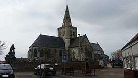
 Cappelle-Brouck Location within Hauts-de-France region  Cappelle-Brouck | ||
| Coordinates: 50°54′09″N 2°13′24″E / 50.9025°N 2.2233°ECoordinates: 50°54′09″N 2°13′24″E / 50.9025°N 2.2233°E | ||
| Country | France | |
| Region | Hauts-de-France | |
| Department | Nord | |
| Arrondissement | Dunkerque | |
| Canton | Grande-Synthe | |
| Intercommunality | CC Hauts de Flandre | |
| Government | ||
| • Mayor (2008–2014) | Michel Decool | |
| Area1 | 17.55 km2 (6.78 sq mi) | |
| Population (2004)2 | 1,122 | |
| • Density | 64/km2 (170/sq mi) | |
| Demonym(s) | Cappellebrouckois (es) | |
| Time zone | UTC+1 (CET) | |
| • Summer (DST) | UTC+2 (CEST) | |
| INSEE/Postal code | 59130 /59630 | |
| Elevation |
0–4 m (0–13 ft) (avg. 2 m or 6.6 ft) | |
|
1 French Land Register data, which excludes lakes, ponds, glaciers > 1 km2 (0.386 sq mi or 247 acres) and river estuaries. 2 Population without double counting: residents of multiple communes (e.g., students and military personnel) only counted once. | ||
Cappelle-Brouck (from Dutch meaning "chapel marsh"; Kapellebroek in modern Dutch spelling) is a commune in the Nord department in northern France.
Politics
Presidential Elections 2nd Round
| Election | Candidate | Party | % | |
|---|---|---|---|---|
| 2017 | Marine Le Pen | FN | 57.94 | |
| 2012 | Nicolas Sarkozy | UMP | 56.15 | |
| 2007 | Nicolas Sarkozy | UMP | 58.06 | |
| 2002 | Jacques Chirac | RPR | 74.33 | |
Heraldry
_Nord-France.svg.png) |
The arms of Cappelle-Brouck are blazoned : Gules, 2 keys addorsed in saltire argent. |
See also
References
| Wikimedia Commons has media related to Cappelle-Brouck. |
This article is issued from
Wikipedia.
The text is licensed under Creative Commons - Attribution - Sharealike.
Additional terms may apply for the media files.