Cabo Frio
| Cabo Frio | |||
|---|---|---|---|
| Municipality | |||
| Município de Cabo Frio | |||
 | |||
| |||
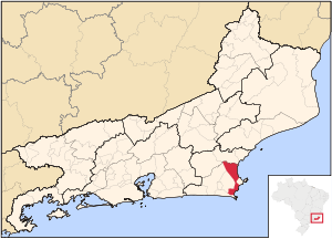 Location of Cabo Frio in the state of Rio de Janeiro | |||
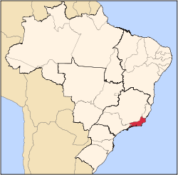
 Cabo Frio Location of Cabo Frio in Brazil | |||
| Coordinates: 22°52′44″S 42°01′08″W / 22.87889°S 42.01889°WCoordinates: 22°52′44″S 42°01′08″W / 22.87889°S 42.01889°W | |||
| Country |
| ||
| Region | Southeast | ||
| State |
| ||
| Government | |||
| • Prefeito | Marcos Mendes (PMDB) | ||
| Area[1] | |||
| • Total | 410.418 km2 (158.463 sq mi) | ||
| Elevation | 4 m (13 ft) | ||
| Population (est. 2017)[1] | |||
| • Total | 216,030 | ||
| • Density | 530/km2 (1,400/sq mi) | ||
| Time zone | UTC-3 (UTC-3) | ||
| Website | Prefeitura de Cabo Frio | ||

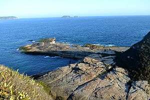
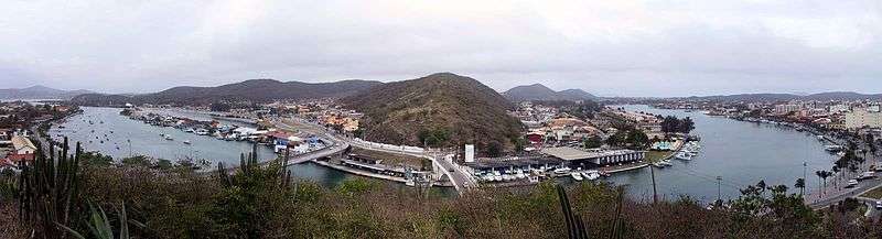
Cabo Frio (Portuguese pronunciation: [ˈkabu ˈfɾi.u], Cold Cape) is a Brazilian municipality in Rio de Janeiro state, founded by the Portuguese on November 13, 1615.[1]
As of 2017, Cabo Frio's estimated population is 216,030 and its area is 410 km².[1]
Cabo Frio is served by Cabo Frio International Airport.
Climate
| Climate data for Cabo Frio, Rio de Janeiro, Brazil | |||||||||||||
|---|---|---|---|---|---|---|---|---|---|---|---|---|---|
| Month | Jan | Feb | Mar | Apr | May | Jun | Jul | Aug | Sep | Oct | Nov | Dec | Year |
| Average high °C (°F) | 28.7 (83.7) |
29.1 (84.4) |
28.8 (83.8) |
27.5 (81.5) |
26.1 (79) |
24.9 (76.8) |
24.7 (76.5) |
24.3 (75.7) |
24.3 (75.7) |
25.2 (77.4) |
26.5 (79.7) |
27.9 (82.2) |
26.5 (79.7) |
| Average low °C (°F) | 22.3 (72.1) |
22.7 (72.9) |
22.7 (72.9) |
21.5 (70.7) |
20.0 (68) |
18.8 (65.8) |
18.6 (65.5) |
18.7 (65.7) |
19.0 (66.2) |
19.7 (67.5) |
20.7 (69.3) |
21.8 (71.2) |
20.5 (69) |
| Average rainfall mm (inches) | 78.1 (3.075) |
44.1 (1.736) |
52.8 (2.079) |
78.3 (3.083) |
69.1 (2.72) |
43.9 (1.728) |
44.7 (1.76) |
36.1 (1.421) |
61.0 (2.402) |
80.7 (3.177) |
81.0 (3.189) |
101.1 (3.98) |
770.9 (30.35) |
| Average relative humidity (%) | 82 | 82 | 82 | 80 | 81 | 81 | 80 | 81 | 81 | 82 | 82 | 82 | 81 |
| Source: Climate-Charts.com[2] | |||||||||||||
References
- 1 2 3 4 "Cabo Frio" (in Portuguese). IBGE - Instituto Brasileiro de Geografia e Estatística - Brazilian Institute of Geography and Statistics.
- ↑ "Cabo Frio, Brazil: Climate, Global Warming, and Daylight Charts and Data". Climate-Charts.com. 2010. Retrieved January 14, 2018.
- Much of the content of this article comes from the corresponding Portuguese-language Wikipedia article (retrieved on January 2, 2006).
External links
Capital: Rio de Janeiro | |||||||||||
| Mesoregion Baixadas |
|  | |||||||||
| Mesoregion Centro Fluminense |
| ||||||||||
| Mesoregion Metropolitana do Rio de Janeiro |
| ||||||||||
| Mesoregion Noroeste Fluminense |
| ||||||||||
| Mesoregion Norte Fluminense |
| ||||||||||
| Mesoregion Sul Fluminense |
| ||||||||||
This article is issued from
Wikipedia.
The text is licensed under Creative Commons - Attribution - Sharealike.
Additional terms may apply for the media files.