Caminho Novo, São Tomé and Príncipe
| Caminho Novo | |
|---|---|
| Village | |
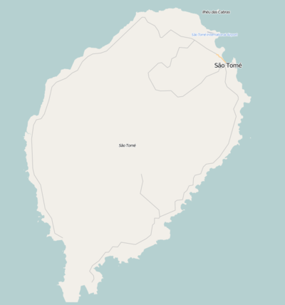 Caminho Novo Location on São Tomé Island | |
| Coordinates: 0°18′27″N 6°43′51″E / 0.3074°N 6.7308°ECoordinates: 0°18′27″N 6°43′51″E / 0.3074°N 6.7308°E | |
| Country |
|
| Province | São Tomé |
| District | Mé-Zóchi |
| Population (2008) | |
| • Total | 2,357 |
| Time zone | UTC+0 (UTC) |
Caminho Novo is a village in the north-eastern part of São Tomé Island in São Tomé and Príncipe. Its 2008 population is 2,357.[1] Its estimate 2015 population is over 2,500. Its etymology being in an area where a road was made and was once new being the National Route 2. The settlement is situated in a narrow stretch of territory that is inbetween the districts of Água Grande and Cantagalo. Nearby places include Pantufo to the northeast, Praia Melão to the southeast, Almas to the southeast and Bombom to the northwest, the first place is in Água Grande district.
The village is located south of the capital São Tomé.
Population history
| Historical population | ||
|---|---|---|
| Year | Pop. | ±% |
| 2001 (census) | 2,068 | — |
| 2008 (estimate) | 2,357 | +14.0% |
Other
A species of frogs known as Phrynobatrachus leveleve (Leveleve African mud frog) are founded in the area of Pete Pete (pronunciation: peh-teh, peh-teh, name possibly of Angolan origin) to the southeast, described in 2007.[2] The species are related to Phrynobatrachus dispar.
References
- ↑ INE, Evolução da população São-Tomense por localidades, 2008
- ↑ Uyeda J.C., Drewes R.C. & Zimkus B.M., 2007, The California Academy Sciences Gulf of Guinea Expeditions (2001, 2006) VI. a new species of Phrynobatrachus from the Gulf of Guinea Islands and a reanalysis of Phrynobatrachus dispar and P. feae (Anura: Phrynobatrachidae). Proc. California Acad. Sci., Ser. 4, 58: 367–385.
| Communities |  | |
|---|---|---|
| University institution | ||
| Sports facilities and complexes |
| |
| Culture | ||