Ototó
| Ototó | |
|---|---|
| Village | |
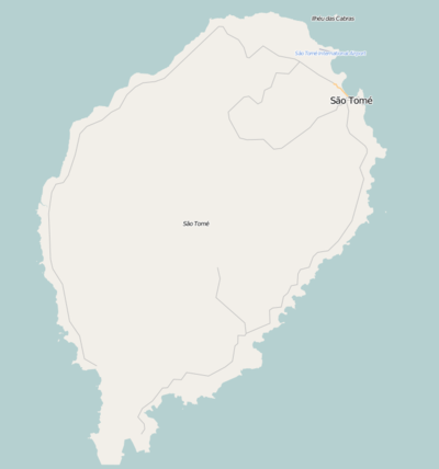 Ototó Location on São Tomé Island | |
| Coordinates: 0°19′07″N 6°40′02″E / 0.3185°N 6.6672°ECoordinates: 0°19′07″N 6°40′02″E / 0.3185°N 6.6672°E | |
| Country |
|
| Province | São Tomé |
| District | Mé-Zóchi |
| Population (2008) | |
| • Total | 491 |
| Time zone | UTC+0 (UTC) |
Ototó is a village in the central part of São Tomé Island in São Tomé and Príncipe. Its 2008 population is 491[1], its approximate 2012 population was at around 500. The settlement are one of several whose etymology is Angolan origin.
Nearby other places include Vista Alegre to the east, Mongo further west, Santa Margarida and Madalena to the north.
Description
Agriculture is the only economy of the village.
Its nearby hospital is located west in Santa Margarida.
Ototó has its own football (soccer) club, member of the Santomean Football Association. Currently it is a Second Division club and also being one of the country's newest clubs.
Population history
| Historical population | ||
|---|---|---|
| Year | Pop. | ±% |
| 2001 (census) | 431 | — |
| 2008 (estimate) | 491 | +13.9% |
References
- ↑ Agostinho Miguel (2013-11-13). "Evolução da população São-Tomense por localidades, 2001/2007-08" (PDF). Retrieved 2018-03-22.
| Communities |  | |
|---|---|---|
| University institution | ||
| Sports facilities and complexes |
| |
| Culture | ||
This article is issued from
Wikipedia.
The text is licensed under Creative Commons - Attribution - Sharealike.
Additional terms may apply for the media files.