Arneys Mount, New Jersey
| Arneys Mount, New Jersey | |
|---|---|
| Unincorporated community | |
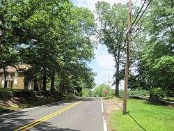 Photo of Arneys Mount at the Friends Meetinghouse | |
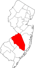
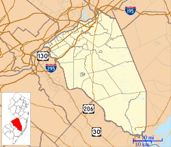 Arneys Mount Location of Arneys Mount in Burlington County Inset: Location of county within the state of New Jersey  Arneys Mount Arneys Mount (New Jersey)  Arneys Mount Arneys Mount (the US) | |
| Coordinates: 40°00′35″N 74°41′48″W / 40.00972°N 74.69667°WCoordinates: 40°00′35″N 74°41′48″W / 40.00972°N 74.69667°W | |
| Country |
|
| State |
|
| County | Burlington |
| Township | Springfield |
| Elevation[1] | 131 ft (40 m) |
| Time zone | UTC-5 (Eastern (EST)) |
| • Summer (DST) | UTC-4 (EDT) |
| GNIS feature ID | 874380[1] |
Arneys Mount is an unincorporated community located within Springfield Township in Burlington County, New Jersey, United States.[2] It shares its name with an adjacent hill, Arneys Mount, the highest point in Burlington County.[3]
References
- 1 2 "Arneys Mount". Geographic Names Information System. United States Geological Survey.
- ↑ Locality Search Archived 2016-07-09 at the Wayback Machine., State of New Jersey. Accessed March 13, 2015.
- ↑ "New Jersey County High Points". Peakbagger.com. Retrieved June 14, 2015.
This article is issued from
Wikipedia.
The text is licensed under Creative Commons - Attribution - Sharealike.
Additional terms may apply for the media files.