Shire of Broadsound
| Shire of Broadsound Queensland | |||||||||||||||
|---|---|---|---|---|---|---|---|---|---|---|---|---|---|---|---|
 Location within Queensland | |||||||||||||||
| Population | 6,843 (2006 census)[1] | ||||||||||||||
| • Density | 0.368974/km2 (0.95564/sq mi) | ||||||||||||||
| Established | 1879 | ||||||||||||||
| Area | 18,546.0 km2 (7,160.7 sq mi) | ||||||||||||||
| Council seat | St Lawrence | ||||||||||||||
| Region | Capricornia | ||||||||||||||
 | |||||||||||||||
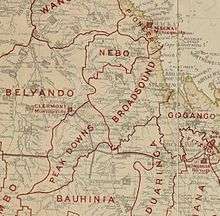
Shire of Broadsound was a local government area in the Capricornia region of Queensland, Australia. The Shire, administered from the town of St Lawrence, covered an area of 18,546.0 square kilometres (7,160.7 sq mi), and existed as a local government entity from 1879 until 2008, when it was amalgamated with the Shires of Belyando and Nebo to form the Isaac Region.
History
On 11 November 1879, the Broadsound Division was established as one of 74 divisions around Queensland under the Divisional Boards Act 1879 with a population of 1146.[2][3]
On 3 March 1892, part of subdivision 2 of the Broadsound Division was transferred to subdivision 3 of the Gogango Division. Another part of subdivision 2 of the Broadsound Division was transferred to the Duaringa Division.[4]
On 7 February 1883, part of subdivisions 2 and 3 of Broadsound Division were separated to create Nebo Division.[5][6][7]
With the passage of the Local Authorities Act 1902, Broadsound Division became the Shire of Broadsound on 31 March 1903.[3][8]
On 15 March 2008, under the Local Government (Reform Implementation) Act 2007 passed by the Parliament of Queensland on 10 August 2007, Broadsound merged with the Shires of Belyando and Nebo to form the Isaac Region.[8][9]
Towns and localities
The Shire of Broadsound included the following settlements:
Population
| Year | Population |
|---|---|
| 1933 | 1,590 |
| 1947 | 1,415 |
| 1954 | 1,537 |
| 1961 | 1,539 |
| 1966 | 1,625 |
| 1971 | 1,589 |
| 1976 | 3,379 |
| 1981 | 6,908 |
| 1986 | 8,419 |
| 1991 | 8,472 |
| 1996 | 7,486 |
| 2001 | 6,601 |
| 2006 | 6,843 |
Chairmen
References
- ↑ Australian Bureau of Statistics (25 October 2007). "Broadsound (S) (Local Government Area)". 2006 Census QuickStats. Retrieved 3 June 2013.
- ↑ "Proclamation [Broadsound Division]". Queensland Government Gazette. 11 November 1879. p. 25:1004.
- 1 2 "Agency ID356, Broadsound Divisional Board". Queensland State Archives. Retrieved 24 September 2013.
- ↑ "Order in Council [Broadsound, Gogango and Duaringa Divisions]". Queensland Government Gazette. 5 March 1892. p. 55:920.
- ↑ "Proclamation [Nebo Division constituted]". Queensland Government Gazette. 10 February 1883. p. 32:354.
- ↑ "Proclamation [Broadsound Division amended]". Queensland Government Gazette. 10 February 1883. p. 32:354.
- ↑ "Agency ID1444, Nebo Divisional Board". Queensland State Archives. Retrieved 4 October 2013.
- 1 2 "Agency ID185, Broadsound Shire Council". Queensland State Archives. Retrieved 24 September 2013.
- ↑ "Agency ID11032, Isaac Regional Council". Queensland State Archives. Retrieved 24 September 2013.
- 1 2 3 Consolidated Index to Queensland Government Gazette 1859-1919. Queensland Family History Society. 2004. ISBN 1 876613 79 3.
- ↑ Pugh, Theophilus Parsons (1927). Pugh's Almanac for 1927. Retrieved 13 June 2014.
External links
| Wikimedia Commons has media related to Shire of Broadsound. |
- "Broadsound Shire". Queensland Places. Centre for the Government of Queensland, University of Queensland.
- Official website at the Wayback Machine (archive index)
Coordinates: 27°20′57.28″S 149°31′18″E / 27.3492444°S 149.52167°E