Shire of Burnett
| Shire of Burnett Queensland | |||||||||||||||
|---|---|---|---|---|---|---|---|---|---|---|---|---|---|---|---|
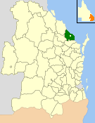 Location within Queensland | |||||||||||||||
| Population | 27,232 (2006 census)[1] | ||||||||||||||
| • Density | 13.6106/km2 (35.2512/sq mi) | ||||||||||||||
| Established | 1994 | ||||||||||||||
| Area | 2,000.8 km2 (772.5 sq mi) | ||||||||||||||
| Council seat | Bargara (160 Hughes Rd) | ||||||||||||||
| Region | Wide Bay–Burnett | ||||||||||||||
 | |||||||||||||||
| Website | Shire of Burnett | ||||||||||||||
| |||||||||||||||
The Shire of Burnett was a local government area located in the Wide Bay–Burnett region of Queensland, Australia. It completely surrounded, but did not include, the regional city of Bundaberg, and covered an area of 2,000.8 square kilometres (772.5 sq mi). It existed as a local government entity from its creation through the amalgamation of the Shire of Gooburrum and the Shire of Woongarra in 1994 until 2008, when it amalgamated with the City of Bundaberg and other councils in the region to form the Bundaberg Region.
History
On 21 November 1991, the Electoral and Administrative Review Commission, created two years earlier, produced its second report, and recommended that local government boundaries in the Bundaberg area be rationalised. The Local Government (Bundaberg and Burnett) Regulation 1993 was gazetted on 17 December 1993, in effect amalgamating the Shires of Gooburrum and Woongarra, and transferring a newer urban area to the City of Bundaberg. On 30 March 1994, the Shire of Burnett came into being.
On 15 March 2008, under the Local Government (Reform Implementation) Act 2007 passed by the Parliament of Queensland on 10 August 2007, the Shire of Burnett merged with the City of Bundaberg and the Shires of Isis and Kolan to form the Bundaberg Region.[2]
Population
| Year | Population (total) |
Population (Gooburrum) |
Population (Woongarra) |
|---|---|---|---|
| 1921 | 5,435 | 2,922 | 2,513 |
| 1933 | 7,202 | 3,915 | 3,287 |
| 1947 | 7,170 | 3,825 | 3,345 |
| 1954 | 7,835 | 4,131 | 3,704 |
| 1961 | 8,521 | 4,372 | 4,149 |
| 1966 | 9,710 | 4,776 | 4,934 |
| 1971 | 9,669 | 4,519 | 5,150 |
| 1976 | 14,018 | 5,227 | 8,791 |
| 1981 | 15,126 | 5,261 | 9,865 |
| 1986 | 17,832 | 5,917 | 11,915 |
| 1991 | 23,608* | 7,117 | 16,491 |
| 1996 | 21,218* | ||
| 2001 | 23,598 | ||
| 2006 | 27,232 |
* Excluding the area transferred to City of Bundaberg in 1994, the population of Burnett was 15,417 in 1991.
Towns and localities
The Shire of Burnett included the following settlements:
|
North Burnett area:
|
South Burnett area:
|
1 - split with Gladstone Region
2 - split with the former City of Bundaberg
External links
- Official website at the Wayback Machine (archived February 18, 2008)
References
- ↑ Australian Bureau of Statistics (25 October 2007). "Burnett (S) (Local Government Area)". 2006 Census QuickStats. Retrieved 2008-03-18.
- ↑ "Agency ID11037, Bundaberg Region Council". Queensland State Archives. Retrieved 25 September 2013.
Coordinates: 24°48′56″S 152°27′44″E / 24.81556°S 152.46222°E