Ackermanville, Pennsylvania
| Ackermanville, Pennsylvania | |
|---|---|
| census-designated place | |
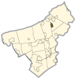 Location within Northampton county | |
 Ackermanville Location within the state of Pennsylvania  Ackermanville Ackermanville (the US) | |
| Coordinates: 40°50′21″N 75°13′10″W / 40.83917°N 75.21944°WCoordinates: 40°50′21″N 75°13′10″W / 40.83917°N 75.21944°W | |
| Country | United States |
| State | Pennsylvania |
| County | Northampton |
| Township | Washington |
| Population (2010) | |
| • Total | 610 |
| Time zone | UTC-5 (Eastern (EST)) |
| • Summer (DST) | UTC-4 (EDT) |
| ZIP codes | 18013, 18072 |
Ackermanville is a census-designated place located in Washington Township, Northampton County, Pennsylvania, on Route 191. It is drained by the Martins Creek southward into the Delaware River and is served by the Bangor Area School District. It is split between the Bangor ZIP code of 18013 and the Pen Argyl ZIP code of 18072. Ackermanville previously had a post office with a ZIP code of 18010; however, this ZIP code was retired in 2016.[1] As of the 2010 census the population was 610 residents.[2]
References
- ↑ Zandi, Karl (February 2016). "Geography Note: U.S. - ZIP Code Update". Moody's Analytics. Retrieved June 6, 2017.
- ↑ https://www.census.gov/#
Places adjacent to Ackermanville, Pennsylvania | ||||||||||
|---|---|---|---|---|---|---|---|---|---|---|
| ||||||||||
Municipalities and communities of Northampton County, Pennsylvania, United States | ||
|---|---|---|
| Cities | 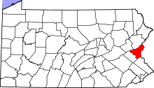 | |
| Boroughs | ||
| Townships | ||
| CDPs | ||
| Unincorporated communities | ||
| Footnotes | ‡This populated place also has portions in an adjacent county or counties | |
This article is issued from
Wikipedia.
The text is licensed under Creative Commons - Attribution - Sharealike.
Additional terms may apply for the media files.