Walnutport, Pennsylvania
| Borough of Walnutport | |
|---|---|
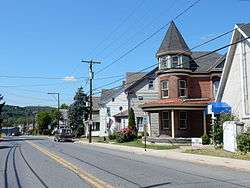 Main Street in Walnutport | |
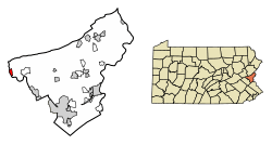 Location of Walnutport in Northampton County, Pennsylvania. | |
 Walnutport Location of Walnutport in Pennsylvania  Walnutport Walnutport (the US) | |
| Coordinates: 40°45′6″N 75°35′44″W / 40.75167°N 75.59556°WCoordinates: 40°45′6″N 75°35′44″W / 40.75167°N 75.59556°W | |
| Country | United States |
| State | Pennsylvania |
| County | Northampton |
| Borough | 1989 |
| Government | |
| • Mayor | Henry Kline |
| Area[1] | |
| • Total | 0.82 sq mi (2.12 km2) |
| • Land | 0.74 sq mi (1.93 km2) |
| • Water | 0.07 sq mi (0.19 km2) |
| Elevation | 814 ft (248 m) |
| Population (2010) | |
| • Total | 2,070 |
| • Estimate (2016)[2] | 2,082 |
| • Density | 2,802.15/sq mi (1,081.24/km2) |
| Time zone | UTC-5 (EST) |
| • Summer (DST) | UTC-4 (EDT) |
| ZIP Code | 18088 |
| Area code(s) | 610 and 484 (610 Exchange: 767) |
| FIPS code | 42-80800 |
Walnutport is a borough in Northampton County, Pennsylvania, United States. Incorporated in 1909, Walnutport is located in the Lehigh Valley region of Pennsylvania along the Lehigh River.
The population of Walnutport was 2,043 at the 2000 census. The Zip Code is 18088.
Geography
Walnutport is located at 40°45′6″N 75°35′44″W / 40.75167°N 75.59556°W (40.751554, -75.595574).[3]
According to the United States Census Bureau, the borough has a total area of 0.8 square miles (2.1 km2), of which, 0.8 square miles (1.9 km2) of it is land and 0.1 square miles (0.2 km2) of it (7.41%) is water.
Walnutport is located 20 miles north of Bethlehem at the intersections of Pennsylvania Route 145 and Mountain View Drive, an extension of State Route 946. It's also located 4 miles south of Palmerton, 1 Mile east of Slatington, and 46 miles (74 km) south of Scranton, in the Wyoming Valley or the Scranton/Wilkes-Barre metropolitan area. Walnutport's elevation is at 814 feet above sea level.
Demographics
As of the census[5] of 2000, there were 2,043 people, 809 households, and 584 families residing in the borough. The population density was 2,727.6 people per square mile (1,051.7/km2). There were 865 housing units at an average density of 1,154.8 per square mile (445.3/km2). The racial makeup of the borough was 97.45% White, 0.39% African American, 0.34% Native American, 1.17% Asian, 0.39% from other races, and 0.24% from two or more races. Hispanic or Latino of any race were 1.52% of the population.
There were 809 households, out of which 28.9% had children under the age of 18 living with them, 58.1% were married couples living together, 9.9% had a female householder with no husband present, and 27.7% were non-families. 23.1% of all households were made up of individuals, and 11.7% had someone living alone who was 65 years of age or older. The average household size was 2.46 and the average family size was 2.88.
In the borough the population was spread out, with 22.0% under the age of 18, 6.4% from 18 to 24, 29.6% from 25 to 44, 24.7% from 45 to 64, and 17.3% who were 65 years of age or older. The median age was 40 years. For every 100 females there were 90.0 males. For every 100 females age 18 and over, there were 89.1 males.
The median income for a household in the borough was $41,743, and the median income for a family was $44,844. Males had a median income of $35,729 versus $21,546 for females. The per capita income for the borough was $18,095. About 8.8% of families and 8.5% of the population were below the poverty line, including 11.5% of those under age 18 and 12.7% of those age 65 or over.
Public education
The borough is served by the Northern Lehigh School District.
Gallery
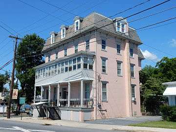 Presbyterian House
 Christ Church UCC
 Lehigh Canal in Walnutport.
References
- ↑ "2016 U.S. Gazetteer Files". United States Census Bureau. Retrieved Aug 14, 2017.
- 1 2 "Population and Housing Unit Estimates". Retrieved June 9, 2017.
- ↑ "US Gazetteer files: 2010, 2000, and 1990". United States Census Bureau. 2011-02-12. Retrieved 2011-04-23.
- ↑ "Census of Population and Housing". U.S. Census Bureau. Retrieved 11 December 2013.
- 1 2 "American FactFinder". United States Census Bureau. Retrieved 2008-01-31.
- ↑ "Incorporated Places and Minor Civil Divisions Datasets: Subcounty Resident Population Estimates: April 1, 2010 to July 1, 2012". Population Estimates. U.S. Census Bureau. Retrieved 11 December 2013.
External links
| Wikimedia Commons has media related to Walnutport, Pennsylvania. |
Places adjacent to Walnutport, Pennsylvania | |
|---|---|
Municipalities and communities of Northampton County, Pennsylvania, United States | ||
|---|---|---|
| Cities | 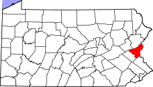 | |
| Boroughs | ||
| Townships | ||
| CDPs | ||
| Unincorporated communities | ||
| Footnotes | ‡This populated place also has portions in an adjacent county or counties | |