Barra do Piraí
| Barra do Piraí | |||
|---|---|---|---|
| Municipality | |||
| Barra do Piraí | |||
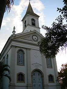 SantAnna's Cathedral | |||
| |||
| Nickname(s): Valley's pearl | |||
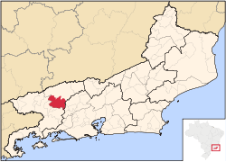 Location of Barra do Piraí in the state of Rio de Janeiro | |||
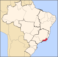
 Barra do Piraí Location of Barra do Piraí in Brazil | |||
| Coordinates: 22°28′12″S 43°49′33″W / 22.47000°S 43.82583°WCoordinates: 22°28′12″S 43°49′33″W / 22.47000°S 43.82583°W | |||
| Country |
| ||
| Region | Southeast | ||
| State |
| ||
| Government | |||
| • Prefeito | Mário Esteves (PRB) | ||
| Area | |||
| • Total | 578.471 km2 (223.349 sq mi) | ||
| Elevation | 363 m (1,191 ft) | ||
| Population (2010) | |||
| • Total | 96,568 | ||
| Time zone | UTC-3 (UTC-3) | ||
| Website | |||
Barra do Piraí (Portuguese pronunciation: [ˈbaʁɐ du piɾɐˈi]) is a municipality of the Brazilian state of Rio de Janeiro. It is located at latitude 22º28'12" South and longitude 43º49'32" East. Its population is 94,778 (2010 census) and its area is 578.471 km².[1] It is 114 km from Rio de Janeiro.
The municipality contains part of the 5,952 hectares (14,710 acres) Serra da Concórdia State Park, created in 2002.[2]
References
- ↑ IBGE - "Archived copy". Archived from the original on 2007-01-09. Retrieved 2014-08-03.
- ↑ Parque Estadual da Serra da Concórdia (in Portuguese), Inea: Instituto Estadual do Ambiente, retrieved 2017-01-18
Capital: Rio de Janeiro | |||||||||||
| Mesoregion Baixadas |
|  | |||||||||
| Mesoregion Centro Fluminense |
| ||||||||||
| Mesoregion Metropolitana do Rio de Janeiro |
| ||||||||||
| Mesoregion Noroeste Fluminense |
| ||||||||||
| Mesoregion Norte Fluminense |
| ||||||||||
| Mesoregion Sul Fluminense |
| ||||||||||
This article is issued from
Wikipedia.
The text is licensed under Creative Commons - Attribution - Sharealike.
Additional terms may apply for the media files.