Buôn Ma Thuột
| City of Buôn Ma Thuột Thành phố Buôn Ma Thuột | ||
|---|---|---|
| Provincial city (Class-1) | ||
 Buôn Ma Thuột city square in June 2006 | ||
| ||
 City of Buôn Ma Thuột Location of in Vietnam | ||
| Coordinates: 12°40′N 108°3′E / 12.667°N 108.050°E | ||
| Country |
| |
| Province | Đắk Lắk | |
| Area | ||
| • Total | 377.18 km2 (145.63 sq mi) | |
| Elevation | 536 m (1,759 ft) | |
| Population (2016) | ||
| • Total | 420,000 | |
| • Density | 1,100/km2 (2,900/sq mi) | |
| Time zone | UTC+7 (ICT) | |
| Website |
buonmathuot | |
Coordinates: 12°40′N 108°3′E / 12.667°N 108.050°E
Buôn Ma Thuột (![]()
Buôn Ma Thuột is served by Buon Ma Thuot Airport.
Geography
The city locates at 12.6667° N, 108.0500° E, right at the heart of the central highland of Vietnam, 1300 km from Ha Noi, 500 km from Da Nang, and 350 km from Ho Chi Minh City. Lying on a fairly flat highland, at an average height of 536m (1608 ft) above the sea, Buon Ma Thuot has a vital role in Vietnam's national security and defense system. Buon Ma Thuot is the capital of Dak Lak Province and also the biggest city in Central Highlands (Tay Nguyen).
History
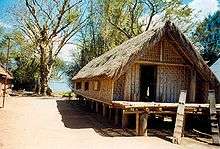
In 1904 Đắk Lắk Province was established by the French and Buôn Ma Thuột was selected as the provincial administrative centre, rather than the trading center of Đôn on the Srepok River. Buôn Ma Thuột was originally settled by the Ê Đê, but due to the incoming Việt settlement after the Vietnam War and the active acculturation policy, less than 15% (around 40,000) are still Montagnards. An important battle took place there at the end of the second Vietnam war.
Institutions
Buôn Ma Thuột is the site of Tay Nguyen University.
Climate
| Climate data for Buôn Ma Thuột | |||||||||||||
|---|---|---|---|---|---|---|---|---|---|---|---|---|---|
| Month | Jan | Feb | Mar | Apr | May | Jun | Jul | Aug | Sep | Oct | Nov | Dec | Year |
| Record high °C (°F) | 34.1 (93.4) |
36.6 (97.9) |
37.6 (99.7) |
39.4 (102.9) |
37.0 (98.6) |
35.1 (95.2) |
32.9 (91.2) |
32.5 (90.5) |
32.7 (90.9) |
33.1 (91.6) |
32.6 (90.7) |
32.4 (90.3) |
39.4 (102.9) |
| Average high °C (°F) | 27.8 (82) |
30.3 (86.5) |
32.8 (91) |
33.6 (92.5) |
32.0 (89.6) |
29.9 (85.8) |
29.4 (84.9) |
29.0 (84.2) |
29.1 (84.4) |
28.6 (83.5) |
27.4 (81.3) |
26.4 (79.5) |
29.7 (85.5) |
| Daily mean °C (°F) | 20.9 (69.6) |
22.4 (72.3) |
24.5 (76.1) |
26.0 (78.8) |
25.6 (78.1) |
24.7 (76.5) |
24.2 (75.6) |
24.0 (75.2) |
23.8 (74.8) |
23.4 (74.1) |
22.3 (72.1) |
21.0 (69.8) |
23.6 (74.5) |
| Average low °C (°F) | 17.6 (63.7) |
18.4 (65.1) |
19.7 (67.5) |
21.5 (70.7) |
22.0 (71.6) |
21.8 (71.2) |
21.3 (70.3) |
21.3 (70.3) |
21.1 (70) |
20.5 (68.9) |
19.4 (66.9) |
18.1 (64.6) |
20.2 (68.4) |
| Record low °C (°F) | 9.1 (48.4) |
12.0 (53.6) |
12.3 (54.1) |
16.7 (62.1) |
14.4 (57.9) |
17.9 (64.2) |
18.4 (65.1) |
14.4 (57.9) |
13.4 (56.1) |
14.9 (58.8) |
10.7 (51.3) |
7.4 (45.3) |
7.4 (45.3) |
| Average precipitation mm (inches) | 5 (0.2) |
5 (0.2) |
19 (0.75) |
86 (3.39) |
237 (9.33) |
248 (9.76) |
255 (10.04) |
310 (12.2) |
288 (11.34) |
222 (8.74) |
96 (3.78) |
25 (0.98) |
1,796 (70.71) |
| Average precipitation days | 1.1 | 1.0 | 3.2 | 8.3 | 19.5 | 22.4 | 24.6 | 25.3 | 24.2 | 17.7 | 11.0 | 5.6 | 163.7 |
| Average relative humidity (%) | 77.5 | 73.8 | 71.1 | 72.4 | 80.3 | 84.9 | 86.6 | 87.7 | 88.5 | 87.0 | 84.6 | 82.0 | 81.4 |
| Mean monthly sunshine hours | 250 | 247 | 273 | 252 | 225 | 183 | 181 | 162 | 155 | 167 | 173 | 194 | 2,460 |
| Source: Vietnam Institute for Building Science and Technology[2] | |||||||||||||
See also
References
- ↑ "Buon Me Thuot" Encyclopædia Britannica (2009 edition) Encyclopædia Britannica Online, accessed 24 September 2009
- ↑ "Vietnam Building Code Natural Physical & Climatic Data for Construction" (PDF). Vietnam Institute for Building Science and Technology. Archived from the original (PDF) on 22 July 2018. Retrieved 23 July 2018.
External links
| Wikivoyage has a travel guide for Buon Ma Thuot. |
- "Establishing Buon Ma Thuot City and Adjusting the Border Between it and the Districts of Cu Jut, Ea Sup and Krong Pac of Darlac Province" Laws of Vietnam, Decree 8-CP, 21 January 1995
- "Buon Ma Thuot, Vietnam" Falling Rain Genomics, Inc.
| Đắk Lắk Province |  | |
|---|---|---|
| Đắk Nông Province | ||
| Gia Lai Province | ||
| Kon Tum Province | ||
| Lâm Đồng Province | ||
※ denotes provincial seat. | ||